Zambrów County
Zambrów County (Polish: powiat zambrowski) is a unit of territorial administration and local government (powiat) in Podlaskie Voivodeship, north-eastern Poland. It came into being on January 1, 1999, as a result of the Polish local government reforms passed in 1998. Its administrative seat and only town is Zambrów, which lies 64 kilometres (40 mi) west of the regional capital Białystok.
Zambrów County
Powiat zambrowski | |
|---|---|
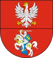
 Flag  Coat of arms | |
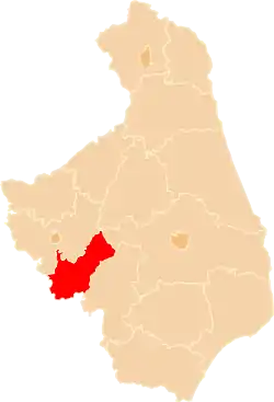 Location within the voivodeship | |
| Coordinates (Zambrów): 52°59′N 22°15′E | |
| Country | |
| Voivodeship | Podlaskie |
| Seat | Zambrów |
| Gminas | Total 5 (incl. 1 urban)
|
| Area | |
| • Total | 733.11 km2 (283.06 sq mi) |
| Population (2019) | |
| • Total | 43,663 |
| • Density | 60/km2 (150/sq mi) |
| • Urban | 22,098 |
| • Rural | 21,565 |
| Car plates | BZA |
| Website | http://www.powiatzambrowski.com/ |
The county covers an area of 733.11 square kilometres (283.1 sq mi). As of 2019 its total population is 43,663, out of which the population of Zambrów is 22,098 and the rural population is 21,565.[1]
Neighbouring counties
Zambrów County is bordered by Łomża County to the north, Białystok County and Wysokie Mazowieckie County to the east, and Ostrów Mazowiecka County to the south-west.
Administrative division
The county is subdivided into five gminas (one urban and four rural). These are listed in the following table, in descending order of population.
| Gmina | Type | Area (km²) |
Population (2019) |
Seat |
| Zambrów | urban | 19.0 | 22,098 | |
| Gmina Zambrów | rural | 299.0 | 8,884 | Zambrów * |
| Gmina Rutki | rural | 200.2 | 5,555 | Rutki-Kossaki |
| Gmina Szumowo | rural | 141.2 | 4,817 | Szumowo |
| Gmina Kołaki Kościelne | rural | 73.8 | 2,309 | Kołaki Kościelne |
| * seat not part of the gmina | ||||
References
- GUS. "Population. Size and structure and vital statistics in Poland by territorial divison in 2019. As of 30th June". stat.gov.pl. Retrieved 2020-09-14.
| Seat |
| |
|---|---|---|
| Rural gminas | ||