Kowie River
The Kowie River is a river in the Eastern Cape, South Africa. It has its source in the hills of the "Grahamstown Heights" from where it flows in a south-easterly direction draining the major part of the Bathurst region, reaching the Indian Ocean through an estuary at Port Alfred.
| Kowie River | |
|---|---|
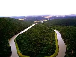 The Kowie River near Bathurst | |
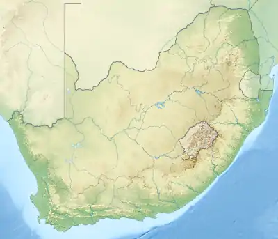 Location of the Kowie River mouth | |
| Location | |
| Country | South Africa |
| Province | Eastern Cape |
| Physical characteristics | |
| Mouth | Indian Ocean |
• location | Port Alfred |
• coordinates | 33°36′06″S 26°53′58″E |
• elevation | 0 m (0 ft) |
| Length | 94 km (58 mi) |
| Basin size | 800 km2 (310 sq mi) |
Its major tributaries are the Bloukrans River, the Bak River and the Lushington River (or Torrens). The Little Kowie River is a smaller tributary which enters the estuarine portion of the river 14 km from the mouth. There are also a number of smaller unnamed streams entering the river along its course. The Kowie river is part of the Fish to Tsitsikama Water Management Area.[1]
Ecology
There is a small population of the endangered Eastern Province rocky (Sandelia bainsii) in the Kowie river.[2]
See also
- List of rivers of South Africa
- List of reservoirs and dams in South Africa
