Krasnoperekopsk
Krasnoperekopsk (Russian: Краснопереко́пск, Ukrainian: Яни Капу, Краснопереко́пськ, Crimean Tatar: Yañı Qapı, Krasnoperekopsk) is a town of regional significance that was, following the 2014 annexation of Crimea, incorporated into Russia's Republic of Crimea, though the territory is recognised by a majority of countries as part of Ukraine within the Autonomous Republic of Crimea. It also serves as the administrative center of Krasnoperekopsk Raion, although it is not a part of the raion (district). Population: 26,268 (2014 Census).[2]
Krasnoperekopsk
Красноперекопск, Яни Капу Yañı Qapı | |
|---|---|
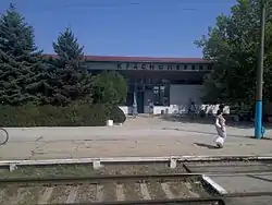 Krasnoperekopsk railway station | |
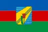 Flag  Coat of arms | |
.jpg.webp) Krasnoperekopsk Location of Krasnoperekopsk within Crimea 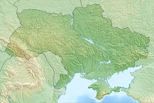 Krasnoperekopsk Krasnoperekopsk (Ukraine) .jpg.webp) Krasnoperekopsk Krasnoperekopsk (European Russia) 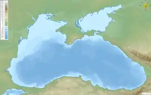 Krasnoperekopsk Krasnoperekopsk (Black Sea) | |
| Coordinates: 45°58′3″N 33°48′1″E | |
| Country | Disputed between Russia and Ukraine[1] |
| Republic | Crimea |
| Area | |
| • Total | 22 km2 (8 sq mi) |
| Elevation | 5 m (16 ft) |
| Population (2014) | |
| • Total | 26 268 |
| • Density | 1,395.45/km2 (3,614.2/sq mi) |
| Time zone | UTC+3 (MSK) |
| Postal code | 96000 — 96005 |
| Area code(s) | +7-36565 |
It is located on the southern part of the Perekop Isthmus, on the shore of the Stare lake, and about 124 kilometres (77 mi) from the Crimean capital, Simferopol. It lies on the Dzhankoy-Kherson railroad line (one of the two railroad lines connecting the Crimea and the rest of the continent).
History
The city of Krasnoperekopsk should not be confused with the historic Crimean city of Perekop, which was destroyed in November 1920 during the Russian Civil War, and which is located in a 25 kilometres (16 mi) range to the north of Krasnoperekopsk. Perekop was depopulated and destroyed as the Crimean Peninsula was invaded by the Soviet Red Army.
The city was founded as Bromzavod (Russian: Бромзавод) in 1932 as an industrial settlement for a bromine factory located near the Staroe Lake (Lake Tuzla). In 1936, the settlement became known as Krasno-Perekopsk (Красно-Перекопск) in honor of the Red Army men who stormed Perekop in 1920. In 1964, the name was changed again to Krasnoperekopsk, and in 1966, it received the status of a city.
On 12 May 2016, Ukrainian authorities[nb 1] rechristened the city Yany Kapu (Ukrainian: Яни Капу; Crimean Tatar: Yañı Qapı)[6] as part of its decommunization efforts, but this decision does not take effect until the return of Crimea to the jurisdiction of Ukraine.
Economy and Industry
- Soda Plant , soda alkaline and other different chemicals
- Bromine Plant , halogens halide and other different chemicals
Demographics
| Nationality | #Inhabitants |
|---|---|
| Russians | 16,561 |
| Ukrainians | 13,602 |
| Crimean Tatars | 1,121 |
| Total: | 31,284 |
Climate
Krasnoperekopsk's climate is mostly dry and hot in the summer, and mild in the winter. The average temperature ranges from −2.4 °C (27.7 °F) in January, to 23.3 °C (73.9 °F) in July. The average precipitation is 336 mm (13.2 in) per year.
International relations
Notes
- Since the 2014 Crimean crisis, the status of the Crimea and of the city of Sevastopol is under dispute between Russia and Ukraine; Ukraine and the majority of the international community considers the Crimea and Sevastopol an integral part of Ukraine, while Russia, on the other hand, considers the Crimea and Sevastopol an integral part of Russia, with Sevastopol functioning as a federal city within the Crimean Federal District.[3][4][5]
References
- This place is located on the Crimean peninsula, most of which is the subject of a territorial dispute between Russia and Ukraine. According to the political division of Russia, there are federal subjects of the Russian Federation (the Republic of Crimea and the federal city of Sevastopol) located on the peninsula. According to the administrative-territorial division of Ukraine, there are the Ukrainian divisions (the Autonomous Republic of Crimea and the city with special status of Sevastopol) located on the peninsula.
- Russian Federal State Statistics Service (2014). "Таблица 1.3. Численность населения Крымского федерального округа, городских округов, муниципальных районов, городских и сельских поселений" [Table 1.3. Population of Crimean Federal District, Its Urban Okrugs, Municipal Districts, Urban and Rural Settlements]. Федеральное статистическое наблюдение «Перепись населения в Крымском федеральном округе». ("Population Census in Crimean Federal District" Federal Statistical Examination) (in Russian). Federal State Statistics Service. Retrieved January 4, 2016.
- Gutterman, Steve. "Putin signs Crimea treaty, will not seize other Ukraine regions". Reuters.com. Retrieved 26 March 2014.
- "Ukraine crisis timeline". BBC News.
- UN General Assembly adopts resolution affirming Ukraine's territorial integrity Archived 2018-03-04 at the Wayback Machine, China Central Television (28 March 2014)
- Верховна Рада України; Постанова від 12.05.2016 № 1352-VIII Про перейменування окремих населених пунктів та районів Автономної Республіки Крим та міста Севастополя (in Ukrainian)
- "Дзержинский О городе" (in Russian). Archived from the original on 2018-10-09. Retrieved 2019-06-04.
External links
| Wikimedia Commons has media related to Krasnoperekopsk. |
- Official website (in Russian)
- Registration card at Verkhovna Rada
- Krasnoperekopsk travel Guide in Russian
| Raions | |||||
|---|---|---|---|---|---|
| Municipalities | |||||
| Cities |
| ||||
| |||||