Krasyliv Raion
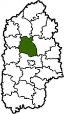
Krasyliv Raion (Ukrainian: Красилівський район, Krasylivs'kyi raion) was one of the 20 administrative raions (a district) of Khmelnytskyi Oblast in western Ukraine. The raion's administrative center was located in the city of Krasyliv. Its population was 61,331 in the 2001 Ukrainian Census.[2] The raion was abolished on 18 July 2020 as part of the administrative reform of Ukraine, which reduced the number of raions of Khmelnytskyi Oblast to three.[3][4] The last estimate of the raion population was 49,345 (2020 est.)[5]
Krasyliv Raion
Красилівський район | |
|---|---|
 Flag  Coat of arms | |
 | |
| Coordinates: 49°43′34″N 26°52′18″E | |
| Country | |
| Region | Khmelnytskyi Oblast |
| Established | 7 March 1923 |
| Disestablished | 18 July 2020 |
| Admin. center | Krasyliv |
| Subdivisions | List
|
| Government | |
| • Governor | Petro Arseniuk[1] (PR) |
| Area | |
| • Total | 1,180 km2 (460 sq mi) |
| Population (2020) | |
| • Total | |
| Time zone | UTC+02:00 (EET) |
| • Summer (DST) | UTC+03:00 (EEST) |
| Postal index | 31000—31075 |
| Area code | +380 3855 |
| Website | www.krasilov-rda.km.ua |
Geography
Krasyliv Raion was located in the central part of the Khmelnytskyi Oblast, corresponding to the modern-day boundaries of the Volhynia and Podolia historical regions. One of the main rivers that ran through the raion was the Sluch River, a tributary of the Pripyat.[6] The raion could be accessed nationally via the ![]() H03 national highway and the Southwestern Railways.[6]
H03 national highway and the Southwestern Railways.[6]
History
Krasyliv Raion was first established on March 7, 1923 as a raion of the Shepetivka Okruha during a full-scale administrative reorganization of the Ukrainian Soviet Socialist Republic.[2] From February 3, 1931 to February 26, 1935, Krasyliv Raion did not exist and its territory was instead part of Antoniny Raion, although it was again re-established on February 26, 1935.[6]
Administrative divisions
Krasyliv Raion was divided in a way that followed the general administrative scheme in Ukraine. Local government was also organized along a similar scheme nationwide. Consequently, raions were subdivided into councils, which were the prime level of administrative division in the country.
Each of the raion's urban localities administered their own councils, often containing a few other villages within its jurisdiction. However, only a handful of rural localities were organized into councils, which also might contain a few villages within its jurisdiction.
Accordingly, the Krasyliv Raion was divided into:[2]
- 1 city council—made of the city of Krasyliv (administrative center);
- 1 settlement council—made up of the urban-type settlement of Antoniny
- 35 village councils
Overall, the raion had a total of 95 populated localities, consisting of one city, one urban-type settlement, and 93 villages.[2]
References
- "Chief of the Administration". Krasyliv Raion State Administration of the Khmelnytskyi Oblast (in Ukrainian). Archived from the original on 15 June 2012. Retrieved 5 January 2013.
- "Krasyliv Raion, Khmelnytskyi Oblast". Regions of Ukraine and their Structure (in Ukrainian). Verkhovna Rada of Ukraine. Archived from the original on 4 March 2016. Retrieved 6 January 2013.
- "Про утворення та ліквідацію районів. Постанова Верховної Ради України № 807-ІХ". Голос України (in Ukrainian). 2020-07-18. Retrieved 2020-10-03.
- "Нові райони: карти + склад" (in Ukrainian). Міністерство розвитку громад та територій України.
- "Чисельність наявного населення України (Actual population of Ukraine)" (PDF) (in Ukrainian). State Statistics Service of Ukraine. Retrieved 30 September 2020.
- "Records". Krasyliv Raion State Administration (in Ukrainian). Archived from the original on 14 May 2008. Retrieved 6 January 2013.
External links
| Wikimedia Commons has media related to Krasyliv Raion. |
- "Main Page". Krasyliv Raion State Administration of the Khmelnytskyi Oblast (in Ukrainian). Archived from the original on 20 May 2013. Retrieved 6 January 2013.
Administrative geographic location | |
|---|---|
| Raions | |||||
|---|---|---|---|---|---|
| Hromadas | |||||
| Cities |
| ||||
| |||||
| Authority control |
|---|