Kushtia
Kushtia (Bengali: কুষ্টিয়া) is a city in the Khulna Division of southwestern Bangladesh.[6] It serves as the headquarters of Kushtia Sadar Upazila and Kushtia District.[3]
Kushtia
কুষ্টিয়া | |
|---|---|
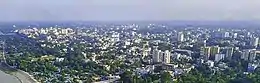 .jpg.webp) 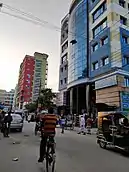 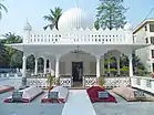 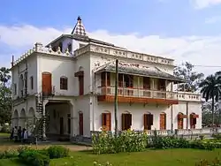 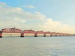 from top: Kushtia city skyline, Porimol Tower, Lovely Tower, Tomb of Lalon, Tagore kuthibari, Hardinge Bridge | |
 Kushtia Location in Bangladesh | |
| Coordinates: 23.910125°N 89.123115°E | |
| Country | |
| Division | Khulna Division |
| District | Kushtia District |
| Subdistrict | Kushtia Sadar Upazila |
| Municipality | 1 April 1869 [1] |
| Government | |
| • Type | Mayor–Council |
| • Body | Kushtia Municipality |
| • Paura Mayor | Md. Anwar Ali [2] |
| Area | |
| • Urban | 42.79 km2 (16.52 sq mi) |
| • Metro | 96.23 km2 (37.15 sq mi) |
| Population (2018 [4]) | |
| • Urban | 418,312 |
| • Urban density | 9,800/km2 (25,000/sq mi) |
| • Metro | 550,000 |
| • Metro density | 5,700/km2 (15,000/sq mi) |
| • Rank | 13th |
| Time zone | UTC+6 (Bangladesh Time) |
| Postal code | 7000[5] |
| National Dialing Code | +880 |
Education
According to Banglapedia, Dinmani Secondary School, founded in 1930, Kushtia Zilla School (1960), and Mohini Mohan High School (1944) are notable secondary schools.[3]
References
- "History of Kushtia municipality". Retrieved 2019-10-07.
- "Mayor of Kushtia city's civic body". News24.com. Retrieved 2019-10-07.
- Bhuiyan, Md Abu Taher (2012). "Kushtia Sadar Upazila". In Islam, Sirajul; Jamal, Ahmed A. (eds.). Banglapedia: National Encyclopedia of Bangladesh (Second ed.). Asiatic Society of Bangladesh.
- "কুষ্টিয়া পৌরসভা". municipality.kushtia.gov.bd.
- Staff. "ZIP Code database of Bangladesh". Geopostcodes.com. Retrieved 11 June 2008.
- "NGA GeoNames Database". National Geospatial-Intelligence Agency. Retrieved 2 January 2015.
This article is issued from Wikipedia. The text is licensed under Creative Commons - Attribution - Sharealike. Additional terms may apply for the media files.
