Kyd Island
Kyd Island is an island of the Andaman Islands. It belongs to the South Andaman administrative district, part of the Indian union territory of Andaman and Nicobar Islands.[6] the island lies 30 km (19 mi) north from Port Blair.
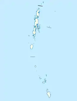 Kyd Island Location of Kyd Island | |
| Geography | |
|---|---|
| Location | Bay of Bengal |
| Coordinates | 11.95°N 92.75°E |
| Archipelago | Andaman Islands |
| Adjacent bodies of water | Indian Ocean |
| Total islands | 1 |
| Major islands |
|
| Area | 5.42 km2 (2.09 sq mi)[1] |
| Length | 3.29 km (2.044 mi) |
| Width | 2.24 km (1.392 mi) |
| Coastline | 10.37 km (6.444 mi) |
| Highest elevation | 237 m (778 ft)[2] |
| Administration | |
| District | South Andaman |
| Island group | Andaman Islands |
| Island sub-group | Napier Bay Islands |
| Tehsil | Ferrargunj Tehsil |
| Demographics | |
| Population | 0 (2016) |
| Pop. density | 0.00/km2 (0/sq mi) |
| Ethnic groups | Hindu, Andamanese |
| Additional information | |
| Time zone |
|
| PIN | 744206[3] |
| Telephone code | 031927 [4] |
| ISO code | IN-AN-00[5] |
| Official website | www |
| Literacy | 84.4% |
| Avg. summer temperature | 30.2 °C (86.4 °F) |
| Avg. winter temperature | 23.0 °C (73.4 °F) |
| Sex ratio | 1.2♂/♀ |
| Census Code | 35.639.0004 |
| Official Languages | Hindi, English |
Geography
The island belongs to the Napier Bay Islands and lies north of Shoal Bay.
Administration
Politically, Kyd Island, along with the neighbouring Napier Bay Islands, is part of Ferrargunj Taluk.[7]
Demographics
The island was formerly inhabited. [8] An Andamani group of inhabitants 'Aca-Bea' used to live on Kyd Island.
References
- "Islandwise Area and Population - 2011 Census" (PDF). Government of Andaman.
- Sailing Directions (Enroute), Pub. 173: India and the Bay of Bengal (PDF). Sailing Directions. United States National Geospatial-Intelligence Agency. 2017. p. 285.
- "A&N Islands - Pincodes". 22 September 2016. Archived from the original on 23 March 2014. Retrieved 22 September 2016.CS1 maint: bot: original URL status unknown (link)
- "STD Codes of Andaman and Nicobar". allcodesindia.in. Retrieved 23 September 2016.
- Registration Plate Numbers added to ISO Code
- "Village Code Directory: Andaman & Nicobar Islands" (PDF). Census of India. Retrieved 16 January 2011.
- "DEMOGRAPHIC – A&N ISLANDS" (PDF). andssw1.and.nic.in. Retrieved 23 September 2016.
 Andaman and Nicobar Islands travel guide from Wikivoyage
This article is issued from Wikipedia. The text is licensed under Creative Commons - Attribution - Sharealike. Additional terms may apply for the media files.