Lèze
The Lèze (French: la Lèze) is a 70.2 km (43.6 mi) long river in the Ariège and Haute-Garonne départements, southwestern France.[1] Its source is in La Bastide-de-Sérou. It flows generally north. It is a left tributary of the Ariège into which it flows between Labarthe-sur-Lèze and Clermont-le-Fort.
| Lèze | |
|---|---|
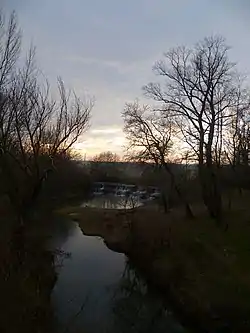 The Lèze in Beaumont-sur-Lèze | |
| Location | |
| Country | France |
| Region | Occitanie |
| Physical characteristics | |
| Source | |
| • location | La Bastide-de-Sérou |
| • coordinates | 43°02′02″N 01°29′03″E |
| • elevation | 570 m (1,870 ft) |
| Mouth | |
• location | Ariège |
• coordinates | 43°27′48″N 01°25′07″E |
• elevation | 155 m (509 ft) |
| Length | 70.2 km (43.6 mi) |
| Basin size | 351 km2 (136 sq mi) |
| Discharge | |
| • average | 2.01 m3/s (71 cu ft/s) |
| Basin features | |
| Progression | Ariège→ Garonne→ Gironde estuary→ Atlantic Ocean |
Départements and communes along its course
This list is ordered from source to mouth:
- Ariège: La Bastide-de-Sérou, Aigues-Juntes, Gabre, Montégut-Plantaurel, Monesple, Pailhès, Artigat, Le Fossat, Sainte-Suzanne, Saint-Ybars
- Haute-Garonne: Massabrac, Castagnac
- Ariège: Lézat-sur-Lèze
- Haute-Garonne: Saint-Sulpice-sur-Lèze, Montaut, Beaumont-sur-Lèze, Lagardelle-sur-Lèze, Vernet, Labarthe-sur-Lèze, Clermont-le-Fort
Notes
- This article is based on the equivalent article from the French Wikipedia, consulted on March 27th 2009.
References
This article is issued from Wikipedia. The text is licensed under Creative Commons - Attribution - Sharealike. Additional terms may apply for the media files.