Artigat
Artigat is a commune in the Ariège department in the Occitanie region of south-western France.
Artigat | |
|---|---|
Location of Artigat 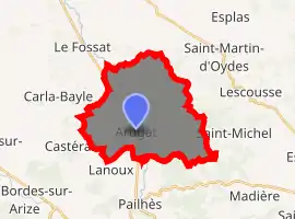
| |
 Artigat  Artigat | |
| Coordinates: 43°08′12″N 1°26′26″E | |
| Country | France |
| Region | Occitanie |
| Department | Ariège |
| Arrondissement | Saint-Girons |
| Canton | Arize-Lèze |
| Intercommunality | CC Arize Lèze |
| Government | |
| • Mayor (2014-2020) | François Vanderstraeten |
| Area 1 | 23.9 km2 (9.2 sq mi) |
| Population (2017-01-01)[1] | 564 |
| • Density | 24/km2 (61/sq mi) |
| Time zone | UTC+01:00 (CET) |
| • Summer (DST) | UTC+02:00 (CEST) |
| INSEE/Postal code | 09019 /09130 |
| Elevation | 242–434 m (794–1,424 ft) (avg. 265 m or 869 ft) |
| 1 French Land Register data, which excludes lakes, ponds, glaciers > 1 km2 (0.386 sq mi or 247 acres) and river estuaries. | |
The inhabitants of the commune are known as Artigatois or Artigatoises[2]
Geography
Artigat is located some 10 km west by north-west of Pamiers and 14 km south-west of Saverdun. Access to the commune is by the D919 road from Le Fossat in the north passing through the heart of the commune and the village and continuing south to Pailhès. The D278 road comes from the D26 on the western border of the commune and goes east through the village to join the D36 south-west of Saint-Michel. The D27A also branches from the D919 in the north of the commune and goes east to Saint-Martin-d'Oydes. Apart from the village there are also the hamlets of Bajou in the north, and Les Lanes east of the village. The commune has extensive forests covering about 40% of the land area with the rest farmland.[3]
The Lèze River flows through the commune from south to north gathering several tributaries including the Ruisseau de Laurens with its many tributaries.[3]
Neighbouring communes and villages
Places adjacent to Artigat | |
|---|---|
History
Until the French Revolution, the Parish of Artigat (with Bajou), as with those of Pailhès, Lanoux, Castéras, Gabre, Aigues-Juntes, Montégut-Plantaurel, Cazeaux, Artix, Saint-Bauzeil, Benagues, Saint-Victor-Rouzaud, Madière, Saint-Michel, Lescousse, Saint-Martin-d'Oydes, and Esplas formed an enclave of Languedoc. They all depended on the Episcopal Diocese of Rieux and the civil diocese of Toulouse while neighbouring communes were part of the County of Foix. See the Cassini Map.[4]
The Parish of Artigat (shown as Arugat on the Cassini Map) was certainly the most important parish of this Languedoc enclave. The famous case of Martin Guerre took place in Artigat.
There was a flood in the autumn of 2006 in Artigat whereupon moat were built in the village.
Administration
List of Successive Mayors[5]
| From | To | Name | Party | Position |
|---|---|---|---|---|
| 1995 | 2014 | Patrick Cauhope | ||
| 2014 | 2020 | François Vanderstraeten |
(Not all data is known)
Demography
In 2017 the commune had 564 inhabitants.
|
| ||||||||||||||||||||||||||||||||||||||||||||||||||||||||||||||||||||||||||||||||||||||||||||||||||||||||||||||||||
| Source: EHESS[6] and INSEE[7] | |||||||||||||||||||||||||||||||||||||||||||||||||||||||||||||||||||||||||||||||||||||||||||||||||||||||||||||||||||
Notable people linked to the commune
- Martin Guerre (famous affair of the 16th century which took place in Artigat).
- Claude Bergeaud (1960-), French basketball trainer was born in Artigat.
See also
References
- "Populations légales 2017". INSEE. Retrieved 6 January 2020.
- Inhabitants of Ariège (in French)
- Google Maps
- Cassini Map - Arugat (in French)
- List of Mayors of France (in French)
- Des villages de Cassini aux communes d'aujourd'hui: Commune data sheet Artigat, EHESS. (in French)
- Population en historique depuis 1968, INSEE
| Wikimedia Commons has media related to Artigat. |