La Harpe Township, Hancock County, Illinois
La Harpe Township is one of twenty-four townships in Hancock County, Illinois, USA. As of the 2010 census, its population was 1,473 and it contained 714 housing units.[2]
La Harpe Township | |
|---|---|
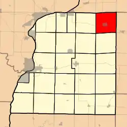 Location in Hancock County | |
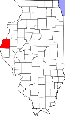 Hancock County's location in Illinois | |
| Coordinates: 40°35′34″N 90°57′50″W | |
| Country | |
| State | |
| County | Hancock |
| Established | November 6, 1849 |
| Area | |
| • Total | 37.31 sq mi (96.6 km2) |
| • Land | 37.31 sq mi (96.6 km2) |
| • Water | 0 sq mi (0 km2) 0% |
| Elevation | 679 ft (207 m) |
| Population (2010) | |
| • Estimate (2016)[1] | 1,428 |
| • Density | 39.5/sq mi (15.3/km2) |
| Time zone | UTC-6 (CST) |
| • Summer (DST) | UTC-5 (CDT) |
| ZIP codes | 61420, 61450, 62330 |
| FIPS code | 17-067-40845 |
La Harpe Township was named for Jean-Baptiste Bénard de la Harpe, a French explorer.[3]
Geography
According to the 2010 census, the township has a total area of 37.31 square miles (96.6 km2), all land.[2]
Cities, towns, villages
Unincorporated towns
(This list is based on USGS data and may include former settlements.)
Cemeteries
The township contains LaHarpe City Cemetery.
Major highways
Airports and landing strips
- Housewright Airport
Landmarks
- Mayor Memorial Park
School districts
LaHarpe Community School District 347, grades K-8, & Illini West High School District 307
Political districts
- Illinois's 18th congressional district
- State House District 94
- State Senate District 47
References
- United States Census Bureau 2008 TIGER/Line Shapefiles
- "La Harpe Township". Geographic Names Information System. United States Geological Survey. Retrieved 2009-09-20.
- United States National Atlas
- "Population and Housing Unit Estimates". Retrieved June 9, 2017.
- "Population, Housing Units, Area, and Density: 2010 - County -- County Subdivision and Place -- 2010 Census Summary File 1". United States Census. Archived from the original on 2020-02-12. Retrieved 2013-05-28.
- Gannett, Henry (1905). The Origin of Certain Place Names in the United States. Government Printing Office. pp. 179.
- "Census of Population and Housing". Census.gov. Retrieved June 4, 2016.
External links
Places adjacent to La Harpe Township, Hancock County, Illinois | |
|---|---|
Municipalities and communities of Hancock County, Illinois, United States | ||
|---|---|---|
| Cities | Map of Illinois highlighting Hancock County | |
| Town | ||
| Villages | ||
| Townships | ||
| Unincorporated communities | ||
| Footnotes | ‡This populated place also has portions in an adjacent county or counties | |
| ||
This article is issued from Wikipedia. The text is licensed under Creative Commons - Attribution - Sharealike. Additional terms may apply for the media files.