La Paz, Agusan del Sur
La Paz, officially the Municipality of La Paz (Cebuano: Lungsod sa La Paz; Tagalog: Bayan ng La Paz), is a municipality in the province of Agusan del Sur in the Caraga (Region XIII) of the Philippines. The population was 28,217 at the 2015 census. [3]
La Paz | |
|---|---|
| Municipality of La Paz | |
 Municipal hall | |
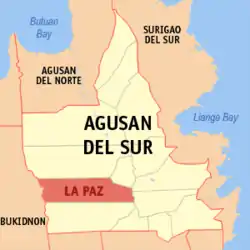 Map of Agusan del Sur with La Paz highlighted | |
OpenStreetMap 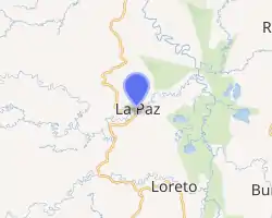
| |
.svg.png.webp) La Paz Location within the Philippines | |
| Coordinates: 8°17′N 125°49′E | |
| Country | |
| Region | Caraga (Region XIII) |
| Province | Agusan del Sur |
| District | 2nd District |
| Barangays | 15 (see Barangays) |
| Government | |
| • Type | Sangguniang Bayan |
| • Mayor | Michael D. Lim |
| • Vice Mayor | Albert A. Justo |
| • Representative | Adolph Edward G. Plaza |
| • Electorate | 19,748 voters (2019) |
| Area | |
| • Total | 1,481.12 km2 (571.86 sq mi) |
| Elevation | 327 m (1,073 ft) |
| Population | |
| • Total | 28,217 |
| • Density | 19/km2 (49/sq mi) |
| • Households | 5,246 |
| Economy | |
| • Income class | 1st municipal income class |
| • Poverty incidence | 58.44% (2015)[4] |
| • Revenue | ₱249,315,958.72 (2016) |
| Time zone | UTC+8 (PST) |
| ZIP code | 8508 |
| PSGC | |
| IDD : area code | +63 (0)85 |
| Climate type | tropical rainforest climate |
| Native languages | Agusan Butuanon Cebuano Higaonon Tagalog |
Geography
La Paz is located at 8.28°N 125.81°E.
According to the Philippine Statistics Authority, the municipality has a land area of 1,481.12 square kilometres (571.86 sq mi) [2] constituting 14.83% of the 9,989.52-square-kilometre- (3,856.98 sq mi) total area of Agusan del Sur.
Climate
| Climate data for La Paz, Agusan del Sur | |||||||||||||
|---|---|---|---|---|---|---|---|---|---|---|---|---|---|
| Month | Jan | Feb | Mar | Apr | May | Jun | Jul | Aug | Sep | Oct | Nov | Dec | Year |
| Average high °C (°F) | 27 (81) |
27 (81) |
28 (82) |
30 (86) |
30 (86) |
30 (86) |
30 (86) |
30 (86) |
30 (86) |
30 (86) |
29 (84) |
28 (82) |
29 (84) |
| Average low °C (°F) | 23 (73) |
23 (73) |
22 (72) |
23 (73) |
24 (75) |
24 (75) |
24 (75) |
24 (75) |
24 (75) |
24 (75) |
23 (73) |
23 (73) |
23 (74) |
| Average precipitation mm (inches) | 105 (4.1) |
72 (2.8) |
55 (2.2) |
40 (1.6) |
69 (2.7) |
94 (3.7) |
100 (3.9) |
103 (4.1) |
99 (3.9) |
106 (4.2) |
85 (3.3) |
63 (2.5) |
991 (39) |
| Average rainy days | 17.6 | 16.0 | 14.9 | 14.0 | 20.9 | 24.3 | 25.3 | 25.5 | 24.5 | 24.7 | 19.7 | 16.7 | 244.1 |
| Source: Meteoblue [5] | |||||||||||||
Barangays
La Paz is politically subdivided into 15 barangays.[6]
| PSGC | Barangay | Population | ±% p.a. | |||
|---|---|---|---|---|---|---|
| 2015 [3] | 2010 [7] | |||||
| 160304009 | Angeles | 2.9% | 823 | 1,039 | −4.34% | |
| 160304001 | Bataan | 6.7% | 1,893 | 1,685 | 2.24% | |
| 160304002 | Comota | 5.8% | 1,641 | 2,046 | −4.11% | |
| 160304003 | Halapitan | 1.8% | 508 | 639 | −4.27% | |
| 160304010 | Kasapa II | 5.0% | 1,398 | 1,391 | 0.10% | |
| 160304004 | Langasian | 4.4% | 1,233 | 1,083 | 2.50% | |
| 160304011 | Lydia | 5.2% | 1,465 | 1,579 | −1.42% | |
| 160304005 | Osmeña, Sr. | 6.5% | 1,827 | 1,553 | 3.14% | |
| 160304012 | Panagangan | 12.6% | 3,549 | 3,319 | 1.28% | |
| 160304006 | Poblacion | 19.7% | 5,563 | 4,977 | 2.14% | |
| 160304013 | Sabang Adgawan | 5.3% | 1,505 | 1,667 | −1.93% | |
| 160304007 | Sagunto | 5.9% | 1,677 | 1,847 | −1.82% | |
| 160304014 | San Patricio | 5.2% | 1,476 | 1,358 | 1.60% | |
| 160304015 | Valentina | 6.9% | 1,942 | 2,560 | −5.12% | |
| 160304008 | Villa Paz | 6.1% | 1,717 | 1,819 | −1.09% | |
| Total | 28,217 | 28,562 | −0.23% | |||
Demographics
| Year | Pop. | ±% p.a. |
|---|---|---|
| 1918 | 908 | — |
| 1939 | 2,418 | +4.77% |
| 1948 | 2,701 | +1.24% |
| 1960 | 5,746 | +6.49% |
| 1970 | 7,971 | +3.32% |
| 1975 | 12,634 | +9.68% |
| 1980 | 14,389 | +2.63% |
| 1990 | 16,144 | +1.16% |
| 1995 | 23,044 | +6.90% |
| 2000 | 20,880 | −2.09% |
| 2007 | 25,214 | +2.64% |
| 2010 | 28,562 | +4.64% |
| 2015 | 28,217 | −0.23% |
| Source: Philippine Statistics Authority [3] [7] [8][9] | ||
In the 2015 census, La Paz had a population of 28,217. [3] The population density was 19 inhabitants per square kilometre (49/sq mi).
References
- Municipality of La Paz | (DILG)
- "Province: Agusan del Sur". PSGC Interactive. Quezon City, Philippines: Philippine Statistics Authority. Retrieved 12 November 2016.
- Census of Population (2015). "Caraga". Total Population by Province, City, Municipality and Barangay. PSA. Retrieved 20 June 2016.
- "PSA releases the 2015 Municipal and City Level Poverty Estimates". Quezon City, Philippines. Retrieved 12 October 2019.
- "La Paz: Average Temperatures and Rainfall". Meteoblue. Retrieved 29 April 2020.
- "Municipal: La Paz, Agusan del Sur". PSGC Interactive. Quezon City, Philippines: Philippine Statistics Authority. Retrieved 8 January 2016.
- Census of Population and Housing (2010). "Caraga". Total Population by Province, City, Municipality and Barangay. NSO. Retrieved 29 June 2016.
- Censuses of Population (1903–2007). "Caraga". Table 1. Population Enumerated in Various Censuses by Province/Highly Urbanized City: 1903 to 2007. NSO.
- "Province of Agusan del Sur". Municipality Population Data. Local Water Utilities Administration Research Division. Retrieved 17 December 2016.
External links
Places adjacent to La Paz, Agusan del Sur | |
|---|---|
Prosperidad (capital) | |
| Component city | |
| Municipalities | |
This article is issued from Wikipedia. The text is licensed under Creative Commons - Attribution - Sharealike. Additional terms may apply for the media files.