Lac La Ronge Provincial Park
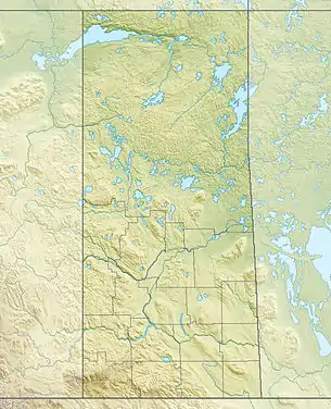
Lac La Ronge Provincial Park is located in the boreal forest of north central Saskatchewan within the Canadian Shield. The park boundary begins on the western shore of Lac la Ronge at La Ronge and extends north to the Churchill River. Highway 102 forms this western boundary with one exception. 13 km (8 miles} north of the town of La Ronge the park goes further west to include a section of Nemeiben Lake.[1]
| Lac La Ronge Provincial Park | |
|---|---|
IUCN category Ib (wilderness area) | |
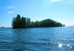 Island on Lac la Ronge | |
 | |
| Location | |
| Nearest city | La Ronge, Saskatchewan |
| Coordinates | 55°16′17″N 104°43′56″W |
| Governing body | Saskatchewan Parks |
The northern section of the park follows the Churchill River until it goes south to include the eastern shore of Lac la Ronge. Just north of Wapawekka Lake on the eastern shore the park ends.[1]
Access
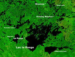
The town of La Ronge, 243 km (150 miles) north of Prince Albert[2] on the west side of Lac la Ronge, is reached by Highway 2. Highway 2 becomes Highway 102 within the community.
The following places in the park are reached from La Ronge on Highway 102 (distances are all from La Ronge).[3]
- 18 km north is the Nemeiben Lake access road.
- 27 km north is Wadin Bay.
- 32 km north is a settlement of the Lac La Ronge First Nation.
- 44 km north is the junction of Highway 915 that leads to Stanley Mission. Across the Churchill River at Stanley Mission is Holy Trinity Anglican Church . Located in the Park it was designated a National Historic Site in 1970.[4]
- 79 km north is Missinipe.
Campgrounds in the park are located at Nemeiben Lake, Wadin Bay, Missinipe and Nut Point.[5]
Highway 912 ends in a dead end in the eastern side of the park.
See also
References
- "Natural Resources Canada-Canadian Geographical Names (Lac la Ronge)". Retrieved 2014-08-29.
- Google maps
- Google maps
- Holy Trinity Church National Historic Site of Canada. Canadian Register of Historic Places. Retrieved 17 August 2012.
- "Lac La Ronge Provincial Park". Retrieved 2012-10-14.