Ladysmith Airport
Ladysmith Airport (IATA: LAY, ICAO: FALY) is an airport serving Ladysmith,[1] a town in the KwaZulu-Natal province in South Africa.
Ladysmith Airport | |||||||||||
|---|---|---|---|---|---|---|---|---|---|---|---|
 Ladysmith Airport seen from Platrand | |||||||||||
| Summary | |||||||||||
| Airport type | Public | ||||||||||
| Owner | JetVision Holdings Pty Ltd | ||||||||||
| Operator | JetVision Airports Pty Ltd | ||||||||||
| Location | Ladysmith, KwaZulu-Natal, South Africa | ||||||||||
| Elevation AMSL | 3,548 ft / 1,081 m | ||||||||||
| Coordinates | 28°34.8′S 029°45.2′E | ||||||||||
| Website | www.jetvisionairways.com | ||||||||||
| Map | |||||||||||
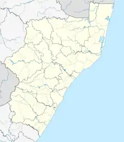 LAY Location in KwaZulu-Natal | |||||||||||
| Runways | |||||||||||
| |||||||||||
Facilities
The airport is located on the outskirts of town just below Platrand at 28°34′48″S 29°45′10″E at an elevation of 3,548 feet (1,081 m) above mean sea level. It has one runway designated 11/29 with an asphalt surface measuring 1,200 by 15 metres (3,937 ft × 49 ft).[1] NDB is LY397.5 and VOR is LYV116.5. The airport is now managed by JetVision Airports Pty Ltd,
References
- "Aerodrome chart for FALY – LADYSMITH" (PDF). South African Civil Aviation Authority. 8 July 2004. Archived from the original (PDF) on 19 July 2011.
- Airport information for FALY from DAFIF (effective October 2006)
- Airport information for LAY at Great Circle Mapper. Source: DAFIF (effective October 2006).
External links
This article is issued from Wikipedia. The text is licensed under Creative Commons - Attribution - Sharealike. Additional terms may apply for the media files.