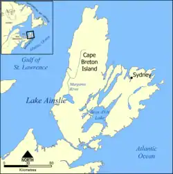
Lake Ainslie
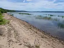
Lake Ainslie on Cape Breton Island is the largest natural freshwater lake in Nova Scotia. The Southwest Margaree River starts at the lake and empties into the Gulf of Saint Lawrence. The lake is approximately 20 km long and averages 5 km in width.[1]
| Lake Ainslie | |
|---|---|
 | |
 Lake Ainslie | |
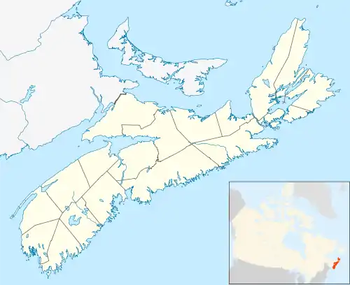
| Location | Inverness County, Nova Scotia |
| Coordinates | 46°7′36″N 61°10′34″W |
| Type | Glacial Lake |
| Primary inflows | Trout Brook |
| Primary outflows | Margaree River |
| Basin countries | Canada |
| Max. length | 20 km (12 mi) |
| Max. width | 7 km (4.3 mi) |
| Surface area | 57.4 km2 (22.2 sq mi) |
| Average depth | 5.75 m (18.9 ft) |
| Max. depth | 18 m (59 ft) |
| Water volume | 0.33 km3 (270,000 acre⋅ft) |
| Surface elevation | 57 m (187 ft) |
| Islands | none |
| Settlements | Scotsville, MacCormick's Corner |
Geography
Lake Ainslie was formed during the Pleistocene Epoch, about two million years ago, when glacial outwash blocked the drainage of the valley of Loch Ban. It is underlain primarily by sedimentary deposits of the Horton and Windsor Formations, dating back about 350 million years.[2]
Fauna and Flora
A number of bald eagles nest around the lake.
Naming
The lake was named after George Robert Ainslie, the Lieutenant Governor of Cape Breton Island from 1816 to 1820, when Cape Breton became part of Nova Scotia.
References
- "Lake Ainslie - Home". Retrieved December 8, 2014.
- "Lake Ainslie Water Quality Report" (PDF). May 1991 – September 1993. Retrieved December 8, 2014.
Home of Aidan MacLellan.
