Lassul Baining Rural LLG
Lassul Baining Rural LLG is a local-level government (LLG) of East New Britain Province, Papua New Guinea.[1][2]
Lassul Baining Rural LLG | |
|---|---|
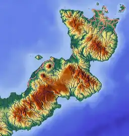 Lassul Baining Rural LLG Location within Papua New Guinea | |
| Coordinates: 4.227408°S 151.691376°E | |
| Country | Papua New Guinea |
| Province | East New Britain Province |
| Time zone | UTC+10 (AEST) |
Wards
- 01. Poniar/Kanako
- 02. Mobilum
- 03. Takis
- 04. Nangasn
- 05. Traiwara
- 06. Lassul
- 07. Puktas
- 08. Karo
- 09. Matanakunai
- 10. Mandrambit (Simbali language speakers)[3][4]
- 11. Wilambemki/Poiniara
- 12. Panarupkap
- 13. Laan
- 14. Yalom
- 15. Komgi
- 16. Naviu/Mamapit
- 17. Open Bay Timbers
- 18. Walmetki (Qaqet speakers)[5]
- 19. Kolopom Settlement
- 20. Warakindam
- 21. Morokindam
- 22. Mobisberg Plantation
References
- "Census Figures by Wards - Islands Region". www.nso.gov.pg. 2011 National Population and Housing Census: Ward Population Profile. Port Moresby: National Statistical Office, Papua New Guinea. 2014.
- "Final Figures". www.nso.gov.pg. 2011 National Population and Housing Census: Ward Population Profile. Port Moresby: National Statistical Office, Papua New Guinea. 2014.
- Eberhard, David M.; Simons, Gary F.; Fennig, Charles D., eds. (2019). "Papua New Guinea languages". Ethnologue: Languages of the World (22nd ed.). Dallas: SIL International.
- United Nations in Papua New Guinea (2018). "Papua New Guinea Village Coordinates Lookup". Humanitarian Data Exchange. 1.31.9.
- Marley, Alexandra. 2013. Language Use amongst the Qaqet Baining: A sociolinguistic study of language choices in an ethnolinguistic minority in Papua New Guinea. MA thesis, LaTrobe University.
- OCHA FISS (2018). "Papua New Guinea administrative level 0, 1, 2, and 3 population statistics and gazetteer". Humanitarian Data Exchange. 1.31.9.
- United Nations in Papua New Guinea (2018). "Papua New Guinea Village Coordinates Lookup". Humanitarian Data Exchange. 1.31.9.
This article is issued from Wikipedia. The text is licensed under Creative Commons - Attribution - Sharealike. Additional terms may apply for the media files.