Lawton–Fort Sill Regional Airport
Lawton–Fort Sill Regional Airport (IATA: LAW[2], ICAO: KLAW, FAA LID: LAW) is two miles south of Lawton, in Comanche County, Oklahoma.[1] It is used for military aviation from nearby Fort Sill and Sheppard Air Force Base and is served by American Eagle. Allegiant Air runs occasional charters.
Lawton–Fort Sill Regional Airport | |||||||||||
|---|---|---|---|---|---|---|---|---|---|---|---|
| Summary | |||||||||||
| Airport type | Public | ||||||||||
| Owner | City of Lawton | ||||||||||
| Serves | Lawton, Oklahoma | ||||||||||
| Elevation AMSL | 1,110 ft / 338 m | ||||||||||
| Coordinates | 34°34′04″N 098°24′59″W | ||||||||||
| Website | www.FlyLawton.org | ||||||||||
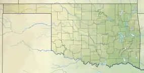
| Map | |||||||||||
 LAW  LAW | |||||||||||
| Runways | |||||||||||
| |||||||||||
| Statistics (2012) | |||||||||||
| |||||||||||
The National Plan of Integrated Airport Systems for 2011–2015 categorized it as a primary commercial service airport.[3] Federal Aviation Administration records say the airport had 77,533 passenger boardings (enplanements) in calendar year 2008,[4] 71,389 in 2009 and 68,054 in 2010.[5]
Facilities
The airport covers 1,300 acres (526 ha) at an elevation of 1,110 feet (338 m). Its single runway, 17/35, is 8,599 by 150 feet (2,621 x 46 m) concrete.[1]
In the year ending May 30, 2012 the airport had 33,983 aircraft operations, average 93 per day: 73% military, 18% general aviation, 8% air taxi, and 1% airline. 46 aircraft were then based at this airport: 93.5% single-engine and 6.5% multi-engine.[1]
Airline and destination
Scheduled passenger service:
| Airlines | Destinations |
|---|---|
| American Eagle | Dallas/Fort Worth |
Continental Airlines flew to Lawton from 1948 until 1975, with DC-9s starting in 1967. Central Airlines served the city starting in 1953-54;[8][9] successor Frontier Airlines served it until 1981.
Aircraft
Embraer ERJ-140s and Canadair CRJ-700s on American Eagle and general aviation.
References
- FAA Airport Form 5010 for LAW PDF. Federal Aviation Administration. Effective November 15, 2012.
- "IATA Airport Code Search (LAW: Lawton Municipal)". International Air Transport Association. Retrieved December 16, 2012.
- "2011–2015 NPIAS Report, Appendix A" (PDF). National Plan of Integrated Airport Systems. Federal Aviation Administration. October 4, 2010. Archived from the original (PDF, 2.03 MB) on September 27, 2012.
- "Enplanements for CY 2008" (PDF, 1.0 MB). CY 2008 Passenger Boarding and All-Cargo Data. Federal Aviation Administration. December 18, 2009.
- "Enplanements for CY 2010" (PDF, 189 KB). CY 2010 Passenger Boarding and All-Cargo Data. Federal Aviation Administration. October 4, 2011.
- "FAA Contract Tower Closure List". American Association of Airport Executives. March 22, 2013. Archived from the original on April 19, 2015. Retrieved March 23, 2013.
- "FAA: 149 control towers to close at small airports". USA Today. March 22, 2013.
- "Central Airlines, Effective December 1, 1953". Timetableimages.com. Retrieved October 1, 2020.
- "Central Airlines, Effective July 1, 1967". Timetableimages.com. Retrieved October 1, 2020.
External links
- Lawton–Fort Sill Regional Airport
- Lawton–Fort Sill Regional Airport (LAW) at Oklahoma Aeronautics Commission
- Aerial image as of February 1995 from USGS The National Map
- FAA Airport Diagram (PDF), effective January 28, 2021
- FAA Terminal Procedures for LAW, effective January 28, 2021
- Resources for this airport:
- AirNav airport information for KLAW
- ASN accident history for LAW
- FlightAware airport information and live flight tracker
- NOAA/NWS weather observations: current, past three days
- SkyVector aeronautical chart for KLAW
- FAA current LAW delay information
