Le Thuit-Signol
Le Thuit-Signol is a former commune in the Eure department in Normandy in northern France. On 1 January 2016, it was merged into the new commune of Le Thuit-de-l'Oison.[2]
Le Thuit-Signol | |
|---|---|
Part of Le Thuit-de-l'Oison | |
.svg.png.webp) Coat of arms | |
Location of Le Thuit-Signol 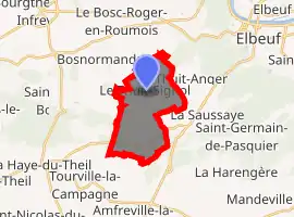
| |
 Le Thuit-Signol  Le Thuit-Signol | |
| Coordinates: 49°15′57″N 0°56′27″E | |
| Country | France |
| Region | Normandy |
| Department | Eure |
| Arrondissement | Bernay |
| Canton | Bourgtheroulde-Infreville |
| Commune | Le Thuit-de-l'Oison |
| Area 1 | 9.81 km2 (3.79 sq mi) |
| Population (2017)[1] | 2,429 |
| • Density | 250/km2 (640/sq mi) |
| Time zone | UTC+01:00 (CET) |
| • Summer (DST) | UTC+02:00 (CEST) |
| Postal code | 27370 |
| Elevation | 103–179 m (338–587 ft) (avg. 174 m or 571 ft) |
| 1 French Land Register data, which excludes lakes, ponds, glaciers > 1 km2 (0.386 sq mi or 247 acres) and river estuaries. | |
Population
| Year | Pop. | ±% |
|---|---|---|
| 1962 | 532 | — |
| 1968 | 602 | +13.2% |
| 1975 | 1,175 | +95.2% |
| 1982 | 1,574 | +34.0% |
| 1990 | 1,649 | +4.8% |
| 1999 | 1,766 | +7.1% |
| 2008 | 2,126 | +20.4% |
See also
References
- Téléchargement du fichier d'ensemble des populations légales en 2017, INSEE
- Arrêté préfectoral 14 October 2015 (in French)
| Wikimedia Commons has media related to Le Thuit-Signol. |
| Authority control |
|---|
This article is issued from Wikipedia. The text is licensed under Creative Commons - Attribution - Sharealike. Additional terms may apply for the media files.
