Lepar Island
Lepar (Indonesian: Pulau Lepar) is an island in Indonesia, located off the southeastern coast of Bangka. Administratively part of South Bangka in Bangka Belitung province, it is the third-largest island in the province with an area of 169 square km after its much larger namesakes Bangka and Belitung. Lepar sits in the Gaspar Strait which separates the two islands. It stretches about 22 km east-west and 17 km north-south, with the towns of Tanjunglabu, Tanjungsangkar and Penutuk being the main population centers. It is governed as its own subdistrict of Lepar Pongok, which used to include a nearby, medium-sized island of Pongok until 2012 when it separated as its own subdistrict of Pongok Islands.[1]
| Native name: Pulau Lepar | |
|---|---|
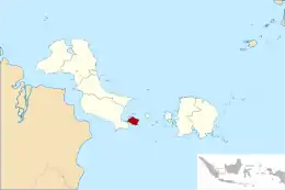 Location of Lepar in Bangka-Belitung | |
| Geography | |
| Coordinates | 2°57′S 106°49′E |
| Area | 169.3 km2 (65.4 sq mi) |
| Administration | |
| Province | Bangka Belitung Islands |
| Regency | South Bangka |
| Subdistrict | Lepar Pongok |
| Demographics | |
| Population | 6,603 |
| Pop. density | 39/km2 (101/sq mi) |
Geography
The island is largely flat with no prominent elevations, with the southeastern side having the steepest slopes.[2] It is separated by Bangka by a strait known as the Lepar Strait. The island is surrounded by about a dozen tiny islands, some of which are uninhabited.[3] Four small rivers flow in the island, named Pangku, Elang, Bunut and Bayan.[2][3]
Administrative divisions
Lepar is divided into 4 villages (desa), which also includes the smaller islands surrounding Lepar:[3]
| Village | Area (km2) | Population |
|---|---|---|
| Penutuk | 44.14 | 2,776 |
| Tanjung Labu | 47.46 | 2,115 |
| Tanjung Sangkar | 51.61 | 2,403 |
| Kumbung | 29.10 | 663 |
These villages are further subdivided into multiple orchards (dusun), totaling 12 throughout the subdistrict including settlements of Lepar.[3]
Economy and facilities
Agriculture and fisheries dominate the subdistrict's economy, employing about 2,650 and 1,150 people respectively in 2016. Agricultural commodities include palm oil, rubber and pepper. A palm oil plantation company holds usage rights to just over half the island, with a concession of 8,500 hectares.[4] Unconventional tin mining also employs 200.[3]
Public schools are present, with 5 elementary schools (SD), 3 junior high schools (SMP) and a senior high school (SMA) alongside a private Islamic school.
References
- "Pemekaran Lepar Pongok. Pulau Celagen Masuk Kecamatan Baru". Radar Bangka (in Indonesian). 10 March 2012. Retrieved 2 October 2017.
- "Pulau Lepar". Direktori Pulau-Pulau Kecil Indonesia (in Indonesian). Ministry of Fishery and Seas. Retrieved 2 October 2017.
- "Kecamatan Lepar Pongok dalam Angka 2017" (PDF) (in Indonesian). Statistics Indonesia. Retrieved 2 October 2017.
- Satriawan, Iwan (5 June 2013). "Kebun Sawit Terhampar di Pulau Lepar". Bangka Pos (in Indonesian). Retrieved 2 October 2017.