Lewes Brooks
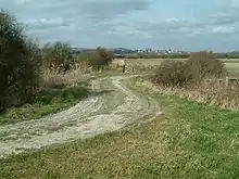
Lewes Brooks is a 339.1-hectare (838-acre) biological Site of Special Scientific Interest south of Lewes in East Sussex.[1][2] The Falmer-Glynde and the Ouse valleys meet in Lewes Brooks and the Upper and Lower Rises are the remains of the chalk uplands eroded by the Ouse.[3]
| Site of Special Scientific Interest | |
 | |
| Area of Search | East Sussex |
|---|---|
| Grid reference | TQ 421 076[1] |
| Interest | Biological |
| Area | 339.1 hectares (838 acres)[1] |
| Notification | 1988[1] |
| Location map | Magic Map |
This site on the flood plain of the River Ouse has fields separated by ditches. Variations in salinity from brackish to spring-fed, together with periodic clearing of ditches, produce a variety of habitats. There is a diverse invertebrate fauna, especially water beetles and there are also rare snails, flies and moths.[4]
References
- "Designated Sites View: Lewes Brooks". Sites of Special Scientific Interest. Natural England. Retrieved 16 January 2019.
- "Map of Lewes Brooks". Sites of Special Scientific Interest. Natural England. Retrieved 16 January 2019.
- Sussex Downs Landscape Assessment, Brooks Pastures Archived 2007-03-03 at the Wayback Machine, Sussex Downs Conservation Board
- "Lewes Brooks citation" (PDF). Sites of Special Scientific Interest. Natural England. Retrieved 16 January 2019.
| Wikimedia Commons has media related to Lewes Brooks. |
This article is issued from Wikipedia. The text is licensed under Creative Commons - Attribution - Sharealike. Additional terms may apply for the media files.
