List of Sites of Special Scientific Interest in East Sussex
In England, Sites of Special Scientific Interest (SSSIs) are designated by Natural England, which is responsible for protecting England's natural environment. Designation as an SSSI gives legal protection to the most important wildlife and geological sites.[1] As of March 2019, there are 65 sites designated in East Sussex, 45 of which have been designated for their biological interest, 15 for their geological interest, and 5 for both biological and geological interest.[2]
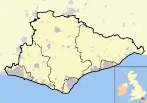
Six sites are Special Areas of Conservation, two are Special Protection Areas, two are Ramsar sites, twenty are Geological Conservation Review sites, ten are Nature Conservation Review sites, five are National Nature Reserves, ten are Local Nature Reserves, six are in Areas of Outstanding Natural Beauty, two are on the Register of Historic Parks and Gardens and three contain Scheduled Monuments. Nine sites are managed by the Sussex Wildlife Trust and one by the Royal Society for the Protection of Birds.
East Sussex is a county in South East England. It is bordered by Kent to the north-east, West Sussex to the west, Surrey to the north and the English Channel to the south.[3] It has an estimated population of 757,600 within an area of 1,795 km2 (443,554.2 acres), therefore making it the 28th largest ceremonial county in the United Kingdom.[4]
Interest
Public access
|
Other classifications
|
Sites
| Site name | Photograph | B | G | Area[lower-alpha 1] | Public access | Location[lower-alpha 1] | Other classifications | Map[lower-alpha 2] | Citation[lower-alpha 3] | Description |
|---|---|---|---|---|---|---|---|---|---|---|
| Arlington Reservoir | 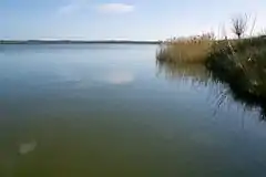 |
100.4 hectares (248 acres)[5] |
YES | Polegate 50.845°N 0.179°E TQ 535 073[5] |
LNR[6] | Map | Citation | More than 10,000 birds winter on this site, including over 1% of the UK population of wigeon. In addition, more than 170 species of birds on passage have been recorded. the River Cuckmere runs through the reservoir and there are areas of tall fen and exposed shingle.[7] | ||
| Asham Quarry | 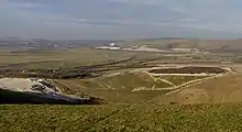 |
2.6 hectares (6.4 acres)[8] |
NO | Lewes 50.834°N 0.045°E TQ 441 058[8] |
AONB[8] GCR[9] | Map | Citation | This site provides important biostratigraphical and lithostratigraphical evidence about environmental conditions during the last 100,000 years, the Last Glacial Period and the Holocene. It is notable for its extensive early and mid Holocene deposits and for having yielded a series of radiocarbon dates.[10] | ||
| Ashburnham Park | 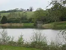 |
109.9 hectares (272 acres)[11] |
FP | Battle 50.907°N 0.412°E TQ 697 147[11] |
NCR[12] RHPG[13] | Map | Citation | This former medieval deer park has many ancient trees which support more than 160 species of lichens. The habitats are parkland and woodland together with three ornamental lakes. The woods have a diverse selection of breeding bird species.[14] | ||
| Ashdown Forest | 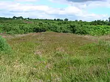 |
3,213.1 hectares (7,940 acres)[15] |
YES | Uckfield 51.058°N 0.066°E TQ 449 308[15] |
LNR[16] NCR[17] SAC[18] SPA[19] SWT[20] | Map | Citation | This is one of the largest areas of heath, semi-natural woodland and valley bog in south-east England. It is important for its heath and woodland bird species, its rich invertebrate fauna and its uncommon plants. There are several streams, some of which have been dammed to form large ponds and they have a diverse aquatic fauna.[21] | ||
| Bingletts Wood | 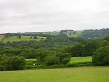 |
16.0 hectares (40 acres)[22] |
NO | Heathfield 50.967°N 0.307°E TQ 621 211[22] |
Map | Citation | Part of this ancient wood is a steep sided valley which has a warm and moist microclimate and it is rich in mosses and liverworts. A woodland glade has two ponds which support white water lily and several species of pondweed.[23] | |||
| Blackhorse Quarry |  |
0.2 hectares (0.49 acres)[24] |
NO | Battle 50.900°N 0.513°E TQ 768 142[24] |
GCR[25][26] | Map | Citation | This is the Type locality for the Wadhurst Clay Formation Telham Bond Bed, which dates to the Early Cretaceous and is part of the Wealden Group. It has yielded many fossils, including turtles, crocodiles, pterosaurs and dinosaurs.[27] | ||
| Bream Wood | .jpg.webp) |
7.8 hectares (19 acres)[28] |
NO | Crowborough 51.074°N 0.173°E TQ 523 328[28] |
Map | Citation | This steep sided valley wood has several locally rare ferns and mosses. There are a number of small ponds and acid springs and flora include the rare moss Dicranodontium denudatum at one of only two known locations in south-east England. The dry upper slopes have ancient woodland.[29] | |||
| Brede Pit and Cutting | .jpg.webp) |
0.6 hectares (1.5 acres)[30] |
NO | Rye 50.936°N 0.605°E TQ 831 184[30] |
GCR[31][32] | Map | Citation | This site shows the junction between two formations in the Wealden Group, dating to the Early Cretaceous. It exposes the top 2 metres of the Ashdown Formation and the bottom 1.5 metres of the Wadhurst Clay Formation. The environments change from shallow fluvial to deeper lakes and lagoons and there are fossils of plants, fishes and reptiles.[33] | ||
| Brighton to Newhaven Cliffs | 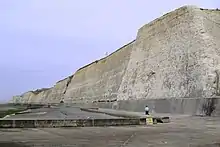 |
165.4 hectares (409 acres)[34] |
YES | Brighton 50.796°N 0.029°W TQ 390 014[34] |
GCR[35] LNR[36] | Map | Citation | The main interest of this site is geological and it has many fossil fauna dating to the late Santonian and early Campanian in the Upper Cretaceous. It is also important for Quaternary stratigraphy. The cliff face and top have some rare plants.[37] | ||
| Burgh Hill Farm Meadow |  |
0.9 hectares (2.2 acres)[38] |
NO | Lewes 50.894°N 0.184°E TQ 537 128[38] |
Map | Citation | This meadow is managed to encourage wildlife and 67 species of flowering plants have been recorded, such as yellow rattle, pepper saxifrage and green winged orchid. The site also has a ditch, two small ponds and mature hedgerows.[39] | |||
| Buxted Park | 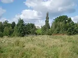 |
84.7 hectares (209 acres)[40] |
FP | Uckfield 50.984°N 0.120°E TQ 489 227[40] |
Map | Citation | This old deer park is important for its invertebrates, especially those associated with mature trees and dead wood. Over fifty nationally scarce beetles have been recorded and four which are nationally rare, Ptenidium gressneri, Aderus brevicornis, Prionocyphon serricornis and Aleochara sanguinea.[41] | |||
| Castle Hill | 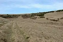 |
114.6 hectares (283 acres)[42] |
YES | Brighton 50.841°N 0.053°W TQ 372 064[42] |
NCR[43] NNR[44] SAC[45] | Map | Citation | This is chalk grassland, which is a nationally uncommon habitat. It is rich in flowering plants and there are areas of scrub which are valuable for breeding birds. The diverse orthopteran insect species include the nationally rare wart-biter grasshopper.[46] | ||
| Chailey Common |  |
170.9 hectares (422 acres)[47] |
YES | Lewes 50.973°N 0.030°W TQ 384 211[47] |
LNR[48] | Map | Citation | This common on Ashdown Sands has areas of acidic grassland, marshy grassland, bracken, wet heath, dry heath, a stream, ditches and ponds. Butterfly species include the silver-studded blue, grayling, pearl-bordered fritillary, high brown fritillary, green hairstreak and small pearl-bordered fritillary.[49] | ||
| Clayton to Offham Escarpment | 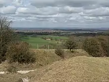 |
422.5 hectares (1,044 acres)[50] |
PP | Lewes 50.897°N 0.075°W TQ 355 126[50] |
SWT[51] | Map[lower-alpha 4] | Citation | Much of this site is steeply sloping chalk grassland, which has many flowering plants such as glaucous sedge, autumn gentian, marjoram, squinancywort and several species of orchid. There are also areas of woodland and scrub and the site has a rich community of breeding birds.[52] | ||
| Combe Haven |  |
153.0 hectares (378 acres)[53] |
PP | Hastings 50.863°N 0.512°E TQ 769 101[53] |
LNR[54] SWT[55] | Map | Citation | This site has diverse habitats. Most of it is poorly drained alluvial meadows which are divided by drainage ditches. There is also ancient woodland and Filsham Reed Beds is the largest area of reed beds in the county. There are diverse breeding and wintering birds and many species of butterflies.[56] | ||
| Dallington Forest | 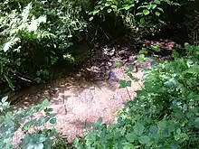 |
16.1 hectares (40 acres)[57] |
YES | Robertsbridge 50.961°N 0.351°E TQ 652 206[57] |
Map | Citation | The Willingford Stream has cut through forest, creating a steep sided valley with a warm and moist microclimate and the woodland in the valley is the main feature of the site. In the north, beech and oak are dominant, whereas in the south the main trees are oak, birch and hazel. In the bottom of the valley there are stands of alder.[58] | |||
| Darwell Wood |  |
37.5 hectares (93 acres)[59] |
YES | Robertsbridge 50.955°N 0.433°E TQ 710 201[59] |
Map | Citation | Several streams run through this area of broadleaved woodland. Most of it is mature hornbeam coppice with oak standards and a sparse ground layer mainly of mosses. The streams have produced steep sided valleys and there are many breeding birds.[60] | |||
| Ditchling Common |  |
66.5 hectares (164 acres)[61] |
YES | Burgess Hill 50.951°N 0.102°W TQ 334 185[61] |
Map | Citation | The common has several different types of acidic heath grassland, together with areas of bracken, scrub, woodland, streams and a pond. The rich butterfly and moth fauna includes several uncommon species such as the small pearl-bordered fritillary and green hairstreak butterflies.[62] | |||
| Dungeness, Romney Marsh and Rye Bay |  |
10,172.9 hectares (25,138 acres)[63] |
PP | Romney Marsh 50.946°N 0.857°E TR 008 202[63] |
AONB[64] GCR[65] LNR[66] NNR[67] Ramsar[68] RSPB[69] SAC[70] SPA[71] SWT[72] | Map[lower-alpha 5] | Citation | Nationally important habitats in this site are saltmarsh, sand dunes, vegetated shingle, saline lagoons, standing waters, lowland ditch systems, and basin fens, and it has many rare and endangered species of fauna and flora. It is geologically important as its deposits display the chronology of coastal evolution.[73] | ||
| Eridge Green |  |
8.4 hectares (21 acres)[74] |
YES | Tunbridge Wells 51.100°N 0.218°E TQ 554 357[74] |
SWT[75] | Map | Citation | This is ancient woodland on clay with outcrops of sandstone which form cliffs up to ten metres high. Flora on the rocks include Tunbridge filmy fern, the mosses Dicranum scottianum and Orthodontium gracile and the liverworts Scapania umbrosa, Scapania gracilis and Harpanthus scutatus.[76] | ||
| Eridge Park |  |
396.8 hectares (981 acres)[77] |
YES | Tunbridge Wells 51.088°N 0.248°E TQ 575 345[77] |
NCR[78] RHPG[79] | Map | Citation | The site has parkland and ancient woodland. It is of national importance for its lichens, with 167 recorded species in one of the richest epiphytic lichen floras of any park in Britain. It is also nationally important for dragonflies with 22 species and there are 60 species of breeding birds.[80] | ||
| Firle Escarpment | 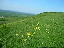 |
302.1 hectares (747 acres)[81] |
PP | Lewes 50.832°N 0.089°E TQ 472 057[81] |
Map | Citation | This is a long stretch of chalk grassland on north facing slopes of the South Downs. Flora include the very rare early spider orchid and other unusual flowering plants such as pyramidal orchid, felwort, common spotted orchid, round headed rampion, clove pink and bee orchid.[82] | |||
| Folkington Reservoir | 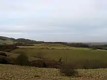 |
5.8 hectares (14 acres)[83] |
FP | Polegate 50.810°N 0.219°E TQ 564 035[83] |
Map | Citation | The banks of the reservoir support a rich chalk grassland flora including kidney vetch, horseshoe vetch, pyramidal orchid, fragrant orchid and the rare and protected hairy mallow. The reservoir itself is covered and the bare chalk on top supports ruderal species such as scarlet pimpernel and parsley piert.[84] | |||
| Fore Wood |  |
20.9 hectares (52 acres)[85] |
YES | Battle 50.888°N 0.491°E TQ 753 128[85] |
Map | Citation | The woodland in this steep valley is variable and it has been considerably modified in some areas. Flora include hay-scented buckler-fern, greater wood-rush and hard fern, as well as three rare mosses. There is also a rich community of breeding birds.[86] | |||
| Hastingford Cutting | .jpg.webp) |
0.04 hectares (0.099 acres)[87] |
YES | Uckfield 51.012°N 0.170°E TQ 523 259[87] |
GCR[88] | Map | Citation | This site exposes rocks dating to the Hastings Beds of the Early Cretaceous. It has coarse sandstone with pebbles and fossil charcoal in a channel which is interpreted as part of a braided system. It underlies a layer which is thought to be part of the shore of a lake.[89] | ||
| Hastings Cliffs to Pett Beach |  |
312.2 hectares (771 acres)[90] |
YES | Hastings 50.873°N 0.651°E TQ 866 115[90] |
GCR[91][92][93][94][95][96][97] LNR[98] NCR[99] SAC[100] | Map | Citation | The crumbling cliffs in this site expose many formations and fossils dating to the Cretaceous period and it is described by Natural England as "of national and international importance for reference". Steep sided wooded valleys have lichens associated with ancient woodland and uncommon and rare beetles. Near the coast there are stunted trees affected by salt spray and important bryophyte flora, including the liverwort Lophocolea fragans at its only locality in south-east England.[101] | ||
| Heathfield Park | .jpg.webp) |
41.0 hectares (101 acres)[102] |
NO | Heathfield 50.965°N 0.269°E TQ 594 209[102] |
Map | Citation | This is a steep valley carved by a stream. The sheltered wooded habitat has a warm and moist microclimate and it has a number of plant species usually restricted to western Britain, such as Cornish moneywort, hay-scented buckler-fern and the liverwort Frullania tamarisci. The site is also important for lichens and 76 species have been recorded.[103] | |||
| Hemingfold Meadow | 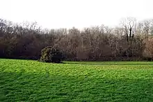 |
4.9 hectares (12 acres)[104] |
NO | Battle 50.905°N 0.526°E TQ 777 148[104] |
Map | Citation | This site consists of two adjacent meadows which have been managed with a grazing and mowing regime which maintains the flora. More than sixty species of flowering plant have been recorded, including common spotted orchid, ox-eye daisy, cuckoo flower, pignut, yellow rattle and primrose.[105] | |||
| Herstmonceux Park | .jpg.webp) |
4.3 hectares (11 acres)[106] |
FP | Hailsham 50.873°N 0.344°E TQ 650 108[106] |
Map | Citation | This narrow stream valley has seven examples of wetland habitats on Tunbridge Wells sandstone and it is notable for its fen vegetation. The site is the location of two plants which are rare in south-east England, milk-parsley and Cornish moneywort. There are several artificial ponds which have a variety of aquatic plant species.[107] | |||
| High Rocks |  |
3.3 hectares (8.2 acres)[108] |
PP | Tunbridge Wells 51.123°N 0.226°E TQ 559 383[108] |
GCR[109][110] | Map[lower-alpha 5] | Citation | This Pleistocene site is described by Natural England as "a key geomorphological site for sandstone weathering features developed on the highest cliffs in the Weald". The Ardingly Sandstone has micro-cracking of unknown origin.[111] | ||
| High Woods |  |
33.7 hectares (83 acres)[112] |
YES | Bexhill-on-Sea 50.862°N 0.433°E TQ 713 098[112] |
Map | Citation | This site has several different habitats, including the only area of sessile oak coppice in the county. There are also areas of pedunculate oak and birch woodland, acidic grassland on wet heath, ponds and streams. Moss species include Sphagnum squarrosum and Hookeria lucens.[113] | |||
| Houghton Green Cliff | .jpg.webp) |
0.1 hectares (0.25 acres)[114] |
YES | Rye 50.969°N 0.747°E TQ 930 224[114] |
GCR[115] | Map | Citation | This site exposes the Cliff End Sandstone Member of the Wadhurst Clay Formation, part of the Wealden Group, which dates to the Lower Cretaceous between 140 and 100 million years ago. It is a key site for studies of sandstone bodies in the clay formation.[116] | ||
| Kingston Escarpment and Iford Hill |  |
63.4 hectares (157 acres)[117] |
YES | Lewes 50.846°N 0.024°W TQ 392 070[117] |
AONB[117] | Map | Citation | These two areas of steeply sloping chalk grassland have a rich invertebrate fauna, including Adonis blue and small blue butterflies and the nationally rare and specially protected wart-biter grasshopper. The flora is also diverse with plants such as squinancywort, horseshoe vetch and eyebright.[118] | ||
| Leasam Heronry Wood |  |
2.1 hectares (5.2 acres)[119] |
NO | Rye 50.962°N 0.714°E TQ 907 216[119] |
Map | Citation | This wood is not long established but it contains a nationally important heronry. The birds began to use the site in 1935 and have bred there since 1940. There are over fifty breeding pairs, around 1% of the British population.[120] | |||
| Lewes Brooks | 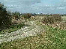 |
339.1 hectares (838 acres)[121] |
PP | Lewes 50.850°N 0.017°E TQ 421 076[121] |
AONB[121] NCR[121] | Map | Citation | This site on the flood plain of the River Ouse has fields separated by ditches. Variations in salinity from brackish to spring-fed, together with periodic clearing of ditches, produce a variety of habitats. There is a diverse invertebrate fauna, especially water beetles and there are also rare snails, flies and moths.[122] | ||
| Lewes Downs | 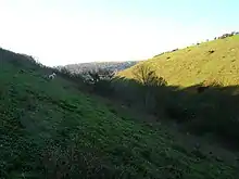 |
165.0 hectares (408 acres)[123] |
PP | Lewes 50.871°N 0.041°E TQ 437 099[123] |
NCR[124] NNR[125] SAC[126] SM[127] SWT[128] | Map | Citation | This south-facing slope on the South Downs is ecologically rich chalk grassland and scrub. Flora include the nationally rare early-spider orchid and it also has a diverse invertebrate fauna and an important breeding community of downland birds.[129] | ||
| Lower Dicker | .jpg.webp) |
0.1 hectares (0.25 acres)[130] |
NO | Hailsham 50.878°N 0.210°E TQ 556 111[130] |
GCR[131] | Map | Citation | This small disused quarry exhibits sandstone river deposits of the Weald Clay dating to the Lower Cretaceous around 130 million years ago. The mineralogy of the sandstones is important for understanding the palaeogeography of the Weald.[132] | ||
| Lullington Heath |  |
72.7 hectares (180 acres)[133] |
YES | Seaford 50.794°N 0.188°E TQ 543 017[133] |
NCR[134] NNR[135] | Map | Citation | This site has two nationally uncommon habitats, chalk heath and chalk grassland. Chalk heath formerly covered most of the site but scrub took over much of it after myxomatosis almost wiped out the rabbit population in the 1950s. The grassland is rich in flowering plants and the scrub and rough grassland provide valuable habitats for invertebrates and birds.[136] | ||
| Maplehurst Wood |  |
31.6 hectares (78 acres)[137] |
YES | Hastings 50.892°N 0.569°E TQ 808 134[137] |
Map | Citation | This wood has probably existed since the Middle Ages and a large part of it is still semi-natural. It has a variety of woodland types and a network of rides and streams. The wood is locally important for its breeding birds such as greater spotted woodpecker, tawny owl and nuthatch.[138] | |||
| Marline Valley Woods |  |
55.1 hectares (136 acres)[139] |
YES | St Leonards-on-Sea 50.881°N 0.528°E TQ 779 121[139] |
LNR[140] SWT[141] | Map | Citation | This site has ancient woodland and species rich unimproved grassland. The wood has standards of pedunculate oak and coppice of hornbeam, hazel and sweet chestnut. A stream runs along a steep sided valley which has 61 species of mosses and liverworts, including some uncommon species.[142] | ||
| Milton Gate Marsh | 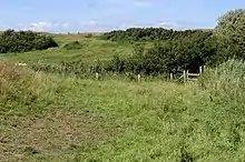 |
17.7 hectares (44 acres)[143] |
FP | Eastbourne 50.831°N 0.181°E TQ 537 058[143] |
Map | Citation | This site consists of two areas of alluvial wetland in the valleys of the River Cuckmere and one of its tributaries. There is a rich variety of invertebrates, including seventeen nationally scarce species such as the sallow clearwing moth and the beetles Ochthebius exaratus and Stenolphus skrimshiranus.[144] | |||
| Northiam | .jpg.webp) |
0.3 hectares (0.74 acres)[145] |
NO | Rye 50.998°N 0.605°E TQ 829 253[145] |
GCR[146] | Map | Citation | This partly flooded former quarry is the type locality for the Northiam Sandstone Member of the Wadhurst Clay Formation, part of the Wealden Group which dates to the Early Cretaceous. It is important for the study of the paleogeography and paleoenvironments of the Wadhurst Clay Formation.[147] | ||
| Offham Marshes | 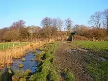 |
39.1 hectares (97 acres)[148] |
FP | Lewes 50.888°N 0.005°W TQ 404 117[148] |
Map | Citation | Ditches in these alluvial marshes have large breeding populations of amphibian species such as common toads, smooth newts, palmate newts and common frogs. The ditches also support the hairy dragonfly and many beetles, including Britain's largest species, the rare great silver beetle.[149] | |||
| Paines Cross Meadow | .jpg.webp) |
3.7 hectares (9.1 acres)[150] |
NO | Heathfield 50.991°N 0.301°E TQ 616 238[150] |
Map | Citation | This site is damp meadow on heavy clay with some areas of peat around springs. There are diverse invertebrates, including great green and dark bush-crickets and common blue and gatekeeper butterflies.[151] | |||
| Park Corner Heath | 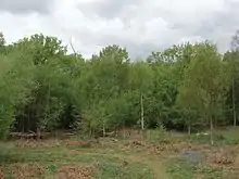 |
2.9 hectares (7.2 acres)[152] |
YES | Lewes 50.913°N 0.147°E TQ 510 148[152] |
Map | Citation | This site has grassy heath, woodland, scrub and a pond on sand over clay. It has a diverse butterfly fauna and an outstanding variety of moths, including the sloe carpet, white-banded carpet, dotted fan-foot, straw belle and the nationally rare silky wave.[153] | |||
| Penn's Rocks | .jpg.webp) |
10.4 hectares (26 acres)[154] |
PP | Tunbridge Wells 51.092°N 0.171°E TQ 521 348[154] |
Map | Citation | This site is a steep sided valley on sandstone with many mosses and liverworts, which is a nationally rare habitat. Uncommon species include Orthodontium gracile, Bazzania trilobata, Saccogyna viticulosa and Harpanthus scutatus.[155] | |||
| Pevensey Levels |  |
3,603.2 hectares (8,904 acres)[156] |
PP | Hailsham 50.844°N 0.338°E TQ 647 076[156] |
NCR[157] NNR[158] Ramsar[159] SAC[160] SWT[161] | Map | Citation | This is a large area of wetland grazing meadows intersected by a network of ditches. It has many nationally rare invertebrates. It may be the best site in Britain for freshwater mollusc fauna, including the endangered shining ram's-horn snail. It also has one nationally rare and several nationally scarce aquatic plants and it is of national importance for lapwing, with more than 1% of the British population.[162] | ||
| Plashett Park Wood |  |
157.6 hectares (389 acres)[163] |
NO | Uckfield 50.921°N 0.077°E TQ 461 156[163] |
Map | Citation | This ancient wood has an extensive area of rides. There are several rare plants, such as the spiked rampion and 25 species of butterfly, including the pearl bordered fritillary, purple hairstreak and silver-washed fritillary. There are also 67 species of breeding birds.[164] | |||
| River Line | .jpg.webp) |
2.2 hectares (5.4 acres)[165] |
NO | Battle 50.946°N 0.441°E TQ 716 191[165] |
GCR[166] | Map | Citation | This site exposes a sequence of sections in the Purbeck Beds, which date to the Upper Jurassic and Lower Cretaceous periods. The sections throw light on the environment of the period and some are marine, with fossil ostracods and crustaceans.[167] | ||
| Rock Wood | 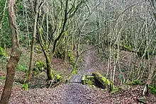 |
10.4 hectares (26 acres)[168] |
YES | Uckfield 51.014°N 0.094°E TQ 470 259[168] |
Map | Citation | This ancient wood has several different types of broadleaved woodland, a stream which cuts through a steep sided valley and a small waterfall. The valley has a moist and mild climate which provides a suitable habitat for mosses and liverworts which are uncommon in south-east England.[169] | |||
| Rye Harbour | .jpg.webp) |
5.6 hectares (14 acres)[170] |
YES | Rye 50.941°N 0.754°E TQ 936 193[170] |
GCR[171] | Map | Citation | No details are available for this site as its location is uncertain. The Natural England citation is for the 761 hectares (1,880 acres) Rye Harbour nature reserve, but the details page and map are for a small 5.6 hectares (14 acres) site north of the nature reserve.[170][172] | ||
| Sapperton Meadows | .jpg.webp) |
14.7 hectares (36 acres)[173] |
YES | Heathfield 50.950°N 0.261°E TQ 589 192[173] |
Map | Citation | These poorly drained hay meadows and rich pastures are managed by traditional techniques. The flora is diverse, with species such as dyer’s greenweed, lesser spearwort and fleabane. There is an extensive network of hedges which are probably old as they have many native trees and shrubs.[174] | |||
| Scaynes Hill | 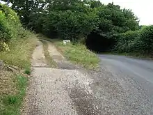 |
0.04 hectares (0.099 acres)[175] |
YES | Lewes 50.987°N 0.020°W TQ 391 227[175] |
GCR[176] | Map | Citation | This disused quarry and road section exposes yellow sandstone of the Grinstead Clay, dating to the Valanginian stage around 135 million years ago. The sandstone was deposited by a meandering river.[177] | ||
| Seaford to Beachy Head |  |
1,108.7 hectares (2,740 acres)[178] |
PP | Eastbourne 50.758°N 0.183°E TV 541 976[178] |
GCR[179][180][181][182] LNR[183] NCR[184] SWT[185] | Map | Citation | This site is of national importance for both its biological and geological features. Its habitats include chalk grassland, maritime grassland, chalk heath, foreshore, chalk cliffs, river meanders and greensand reef. It has nationally rare plants, invertebrates and birds. The site also exposes extensive chalk sections dating to the Late Cretaceous epoch around 80 million years ago.[186] | ||
| Southerham Grey Pit | 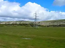 |
8.5 hectares (21 acres)[187] |
NO | Lewes 50.862°N 0.028°E TQ 428 089[187] |
GCR[188][189] | Map | Citation | This site exposes rocks dating to the Cenomanian stage of the Late Cretaceous, around 100 million years ago. It has preserved many fossils of inoceramid bivalves which are not found elsewhere in Britain and are important for regional correlation. It is also the last remaining source for fossil fish in the area.[190] | ||
| Southerham Machine Bottom Pit | .jpg.webp) |
1.8 hectares (4.4 acres)[191] |
NO | Lewes 50.863°N 0.033°E TQ 432 090[191] |
GCR[192] | Map | Citation | This site is historically significant for the number and quality of fossils of Cretaceous fish found there by nineteenth century scholars such as Gideon Mantell. These fossils are particularly important for helping to understand the early evolution of fish groups such as the teleosts.[193] | ||
| Southerham Works Pit | .jpg.webp) |
1.0 hectare (2.5 acres)[194] |
PP | Lewes 50.868°N 0.025°E TQ 426 096[194] |
GCR[195][196] | Map | Citation | This site exposes layers of the Chalk Group dating to the Upper Cretaceous between 90 and 87 million years ago. It is a key site for understanding the lithostratigraphy of the period and the environments of its chalk sea as well as the evolution and taxonomy of Upper Cretaceous fish.[197] | ||
| St Dunstan's Farm Meadows | .jpg.webp) |
10.2 hectares (25 acres)[198] |
FP | Heathfield 50.951°N 0.286°E TQ 607 193[198] |
AONB[198] | Map | Citation | This site has three unimproved meadows which are traditionally managed. They are dominated by red fescue and common bent grass and other flora include sweet vernal-grass, pignut, sheep's sorrel and field woodrush.[199] | ||
| Stockland Farm Meadows | .jpg.webp) |
5.8 hectares (14 acres)[200] |
NO | Uckfield 51.004°N 0.175°E TQ 527 250[200] |
Map | Citation | These two species rich meadows are traditionally managed. Over 80 species of flora have been recorded, including pepper-saxifrage, betony and cowslip. A small pond has five out of the six British species of amphibian.[201] | |||
| Waldron Cutting | .jpg.webp) |
0.2 hectares (0.49 acres)[202] |
YES | Heathfield 50.947°N 0.207°E TQ 551 187[202] |
GCR[203] | Map | Citation | This site exposes siltstones and fine sandstone of the Ashdown Formation, dating to the Early Cretaceous between 140 and 100 million years ago. It has one metre long fossils of Lycopodites plants in life position.[204] | ||
| Weir Wood Reservoir | 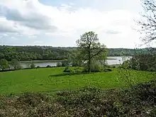 |
153.5 hectares (379 acres)[205] |
YES | East Grinstead 51.096°N 0.011°W TQ 394 348[205] |
AONB[205] LNR[206] | Map | Citation | This is one of the largest bodies of open water in the county and it has rich and diverse communities of breeding, wintering and passage birds. Breeding birds include great crested grebe, teal, mute swan, tufted duck, little grebe, reed warbler, sedge warbler, coot and moorhen.[207] | ||
| Willingdon Down | 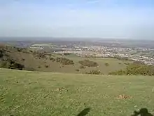 |
67.5 hectares (167 acres)[208] |
YES | Eastbourne 50.798°N 0.236°E TQ 577 022[208] |
SM[209] | Map | Citation | This steeply sloping site on the South Downs is species-rich chalk grassland, a nationally uncommon type of habitat. The dominant grasses are sheep’s fescue and upright brome and uncommon plants include field fleawort, bee orchid, round headed rampion, green winged orchid and burnt orchid.[210] | ||
| Willingford Meadows | .jpg.webp) |
10.5 hectares (26 acres)[211] |
FP | Etchingham 50.976°N 0.357°E TQ 656 223[211] |
Map | Citation | These species-rich meadows are traditionally managed by grazing and mowing. Grassland types range from calcareous to acid and they are the only unimproved pastures on Jurassic limestone in the county. There is also a stream, a marsh, an area of overgrown hornbeam coppice and a mature hazel and hawthorn hedge.[212] | |||
| Wilmington Downs | .jpg.webp) |
209.8 hectares (518 acres)[213] |
PP | Polegate 50.806°N 0.190°E TQ 544 030[213] |
SM[214] | Map | Citation | This site is mainly chalk grassland on the steep slope of the South Downs. It is important for invertebrates, including two protected under Schedule 5 of the Wildlife and Countryside Act, 1981, the wart-biter grasshopper and the snail Monacha cartusiana. There are also several unusual species of lichens and mosses.[215] | ||
| Winchelsea Cutting | .jpg.webp) |
0.1 hectares (0.25 acres)[216] |
YES | Winchelsea 50.920°N 0.705°E TQ 902 169[216] |
GCR[217] | Map | Citation | This site exposes the top two metres of the Ashdown Sand Formation and the bottom four metres of the Wadhurst Clay Formation, dating to the Wealden Group of the Lower Cretaceous around 140 million years ago.[218] |
See also
| Wikimedia Commons has media related to Sites of Special Scientific Interest in East Sussex. |
- List of Local Nature Reserves in East Sussex
- Sussex Wildlife Trust
Notes
- The area and grid reference are taken from the "Details" page for each site on the Natural England database.
- The maps are provided by Natural England on the Magic Map website.
- Citations are provided for each site by Natural England.
- Clayton to Offham Escarpment is partly in West Sussex
- Dungeness, Romney Marsh and Rye Bay and High Rocks are partly in Kent
References
- "Sites of Special Scientific Interest: Designation". Natural England. Archived from the original on 6 March 2016. Retrieved 19 April 2016.
- "Search results for East Sussex". Sites of Special Scientific Interest. Natural England. Archived from the original on 27 March 2019. Retrieved 26 March 2019.
- "Map of East Sussex" (PDF). East Sussex County Council. Archived from the original (PDF) on 12 October 2007. Retrieved 6 April 2008.
- "T 08: Selected age groups for local authorities in the United Kingdom; estimated resident population; Mid-2006 Population Estimates". Office for National Statistics. 22 August 2007. Archived from the original on 2 July 2008. Retrieved 24 May 2008.
- "Designated Sites View: Arlington Reservoir". Sites of Special Scientific Interest. Natural England. Retrieved 12 December 2018.
- "Arlington Reservoir". Local Nature Reserves. Natural England. Archived from the original on 30 June 2015. Retrieved 9 January 2019.
- "Arlington Reservoir citation" (PDF). Sites of Special Scientific Interest. Natural England. Archived (PDF) from the original on 20 December 2018. Retrieved 4 January 2019.
- "Designated Sites View: Asham Quarry". Sites of Special Scientific Interest. Natural England. Retrieved 12 December 2018.
- "Asham Quarry (Quaternary of South-East England)". Geological Conservation Review. Joint Nature Conservation Committee. Archived from the original on 10 January 2019. Retrieved 9 January 2019.
- "Asham Quarry citation" (PDF). Sites of Special Scientific Interest. Natural England. Archived (PDF) from the original on 19 December 2018. Retrieved 10 January 2019.
- "Designated Sites View: Ashburnham Park". Sites of Special Scientific Interest. Natural England. Retrieved 12 December 2018.
- Ratcliffe, p. 50
- "Ashburnham Place". Register of Historic Parks and Gardens of Special Historic Interest in England. Historic England. Archived from the original on 11 January 2019. Retrieved 10 January 2019.
- "Ashburnham Park citation" (PDF). Sites of Special Scientific Interest. Natural England. Archived (PDF) from the original on 19 December 2018. Retrieved 10 January 2019.
- "Designated Sites View: Ashdown Forest". Sites of Special Scientific Interest. Natural England. Retrieved 12 December 2018.
- "Designated Sites View: Old Lodge, Nutley". Local Nature Reserves. Natural England. Archived from the original on 21 December 2018. Retrieved 10 January 2019.
- Ratcliffe, p. 115
- "Designated Sites View: Ashdown Forest". Special Areas of Conservation. Natural England. Archived from the original on 14 February 2019. Retrieved 10 January 2019.
- "Designated Sites View: Ashdown Forest". Special Protection Areas. Natural England. Archived from the original on 14 February 2019. Retrieved 10 January 2019.
- "Old Lodge". Sussex Wildlife Trust. Archived from the original on 21 December 2018. Retrieved 10 January 2019.
- "Ashdown Forest citation" (PDF). Sites of Special Scientific Interest. Natural England. Archived (PDF) from the original on 10 January 2019. Retrieved 11 January 2019.
- "Designated Sites View: Bingletts Wood". Sites of Special Scientific Interest. Natural England. Retrieved 12 December 2018.
- "Bingletts Wood citation" (PDF). Sites of Special Scientific Interest. Natural England. Archived (PDF) from the original on 19 December 2018. Retrieved 11 January 2019.
- "Designated Sites View: Blackhorse Quarry". Sites of Special Scientific Interest. Natural England. Retrieved 12 December 2018.
- "Battle (Wealden)". Geological Conservation Review. Joint Nature Conservation Committee. Archived from the original on 10 January 2019. Retrieved 9 January 2019.
- "Black Horse Quarry, Telham (Jurassic – Cretaceous Reptilia)". Geological Conservation Review. Joint Nature Conservation Committee. Archived from the original on 10 January 2019. Retrieved 9 January 2019.
- "Blackhorse Quarry citation" (PDF). Sites of Special Scientific Interest. Natural England. Archived (PDF) from the original on 19 December 2018. Retrieved 25 March 2019.
- "Designated Sites View: Bream Wood". Sites of Special Scientific Interest. Natural England. Retrieved 12 December 2018.
- "Bream Wood citation" (PDF). Sites of Special Scientific Interest. Natural England. Archived (PDF) from the original on 20 December 2018. Retrieved 11 January 2019.
- "Designated Sites View: Brede Pit and Cutting". Sites of Special Scientific Interest. Natural England. Retrieved 12 December 2018.
- "Brede (Wealden)". Geological Conservation Review. Joint Nature Conservation Committee. Archived from the original on 10 January 2019. Retrieved 9 January 2019.
- "Hare Farm Lane, Brede (Jurassic – Cretaceous Reptilia)". Geological Conservation Review. Joint Nature Conservation Committee. Archived from the original on 10 January 2019. Retrieved 9 January 2019.
- "Brede Pit and Cutting citation" (PDF). Sites of Special Scientific Interest. Natural England. Archived (PDF) from the original on 19 December 2018. Retrieved 25 March 2019.
- "Designated Sites View: Brighton to Newhaven Cliffs". Sites of Special Scientific Interest. Natural England. Retrieved 12 December 2018.
- "Newhaven to Brighton (Cenomanian, Turonian, Senonian, Maastrichtian)". Geological Conservation Review. Joint Nature Conservation Committee. Archived from the original on 27 February 2019. Retrieved 26 February 2019.
- "Designated Sites View: Castle Hill, Newhaven". Local Nature Reserves. Natural England. Archived from the original on 20 December 2018. Retrieved 10 January 2019.
- "Brighton to Newhaven Cliffs citation" (PDF). Sites of Special Scientific Interest. Natural England. Archived (PDF) from the original on 19 December 2018. Retrieved 11 January 2019.
- "Designated Sites View: Burgh Hill Farm Meadow". Sites of Special Scientific Interest. Natural England. Retrieved 12 December 2018.
- "Burgh Hill Farm Meadow citation" (PDF). Sites of Special Scientific Interest. Natural England. Archived (PDF) from the original on 19 December 2018. Retrieved 8 January 2019.
- "Designated Sites View: Buxted Park". Sites of Special Scientific Interest. Natural England. Retrieved 12 December 2018.
- "Buxted Park citation" (PDF). Sites of Special Scientific Interest. Natural England. Archived (PDF) from the original on 20 December 2018. Retrieved 11 January 2019.
- "Designated Sites View: Castle Hill". Sites of Special Scientific Interest. Natural England. Retrieved 12 December 2018.
- Ratcliffe, p. 116
- "Designated Sites View: Castle Hill". National Nature Reserves. Natural England. Retrieved 10 January 2019.
- "Designated Sites View: Castle Hill". Special Areas of Conservation. Natural England. Retrieved 10 January 2019.
- "Castle Hill citation" (PDF). Sites of Special Scientific Interest. Natural England. Archived (PDF) from the original on 19 December 2018. Retrieved 11 January 2019.
- "Designated Sites View: Chailey Common". Sites of Special Scientific Interest. Natural England. Retrieved 12 December 2018.
- "Designated Sites View: Chailey Common". Local Nature Reserves. Natural England. Retrieved 10 January 2019.
- "Chailey Common citation" (PDF). Sites of Special Scientific Interest. Natural England. Archived (PDF) from the original on 20 December 2018. Retrieved 11 January 2019.
- "Designated Sites View: Clayton to Offham Escarpment". Sites of Special Scientific Interest. Natural England. Retrieved 12 December 2018.
- "Ditchling Beacon". Sussex Wildlife Trust. Archived from the original on 21 December 2018. Retrieved 11 January 2019.
- "Clayton to Offham Escarpment citation" (PDF). Sites of Special Scientific Interest. Natural England. Archived (PDF) from the original on 19 December 2018. Retrieved 11 January 2019.
- "Designated Sites View: Combe Haven". Sites of Special Scientific Interest. Natural England. Archived from the original on 12 February 2019. Retrieved 12 December 2018.
- "Designated Sites View: Filsham Reed Beds". Local Nature Reserves. Natural England. Retrieved 10 January 2019.
- "Filsham Reedbed". Sussex Wildlife Trust. Archived from the original on 21 December 2018. Retrieved 10 January 2019.
- "Combe Haven citation" (PDF). Sites of Special Scientific Interest. Natural England. Archived (PDF) from the original on 19 December 2018. Retrieved 11 January 2019.
- "Designated Sites View". Sites of Special Scientific Interest. Natural England. Retrieved 12 December 2018.
- "Dallington Forest citation" (PDF). Sites of Special Scientific Interest. Natural England. Archived (PDF) from the original on 19 December 2018. Retrieved 12 January 2019.
- "Designated Sites View: Darwell Wood". Sites of Special Scientific Interest. Natural England. Retrieved 12 December 2018.
- "Darwell Wood citation" (PDF). Sites of Special Scientific Interest. Natural England. Archived (PDF) from the original on 19 December 2018. Retrieved 12 January 2019.
- "Designated Sites View: Ditchling Common". Sites of Special Scientific Interest. Natural England. Retrieved 12 December 2018.
- "Ditchling Common citation" (PDF). Sites of Special Scientific Interest. Natural England. Archived (PDF) from the original on 20 December 2018. Retrieved 12 January 2019.
- "Designated Sites View: Dungeness, Romney Marsh and Rye Bay". Sites of Special Scientific Interest. Natural England. Retrieved 12 December 2018.
- "Designated Sites View: Dungeness, Romney Marsh and Rye Bay". Sites of Special Scientific Interest. Natural England. Archived from the original on 11 January 2017. Retrieved 16 January 2018.
- "Dungeness (Coastal Geomorphology of England)". Geological Conservation Review. Joint Nature Conservation Committee. Archived from the original on 12 January 2018. Retrieved 11 January 2018.
- "Designated Sites View: Rye Harbour". Local Nature Reserves. Natural England. Archived from the original on 20 December 2018. Retrieved 10 January 2019.
- "Designated Sites View: Dungeness". National Nature Reserves. Natural England. Retrieved 16 January 2018.
- "Designated Sites View: Dungeness, Romney Marsh and Rye Bay". Ramsar Site. Natural England. Archived from the original on 16 July 2018. Retrieved 16 January 2018.
- "Dungeness". Royal Society for the Protection of Birds. Archived from the original on 28 September 2018. Retrieved 16 January 2018.
- "Designated Sites View: Dungeness". Special Area of Conservation. Natural England. Archived from the original on 18 February 2019. Retrieved 16 January 2018.
- "Designated Sites View: Dungeness, Romney Marsh and Rye Bay". Special Protection Area. Natural England. Archived from the original on 18 February 2019. Retrieved 16 January 2018.
- "Rye Harbour". Sussex Wildlife Trust. Archived from the original on 21 December 2018. Retrieved 10 January 2019.
- "Dungeness, Romney Marsh and Rye Bay citation" (PDF). Sites of Special Scientific Interest. Natural England. Retrieved 2 February 2018.
- "Designated Sites View: Eridge Green". Sites of Special Scientific Interest. Natural England. Retrieved 12 December 2018.
- "Eridge Rocks". Sussex Wildlife Trust. Archived from the original on 21 December 2018. Retrieved 10 January 2019.
- "Eridge Green citation" (PDF). Sites of Special Scientific Interest. Natural England. Retrieved 13 January 2019.
- "Designated Sites View: Eridge Park". Sites of Special Scientific Interest. Natural England. Retrieved 12 December 2018.
- Ratcliffe, p. 47
- "Eridge Park". Register of Historic Parks and Gardens of Special Historic Interest in England. Historic England. Archived from the original on 14 January 2019. Retrieved 13 January 2019.
- "Eridge Park citation" (PDF). Sites of Special Scientific Interest. Natural England. Archived (PDF) from the original on 20 December 2018. Retrieved 13 January 2019.
- "Designated Sites View: Firle Escarpment". Sites of Special Scientific Interest. Natural England. Retrieved 12 December 2018.
- "Firle Escarpment citation" (PDF). Sites of Special Scientific Interest. Natural England. Archived (PDF) from the original on 19 December 2018. Retrieved 13 January 2019.
- "Designated Sites View: Folkington Reservoir". Sites of Special Scientific Interest. Natural England. Retrieved 12 December 2018.
- "Folkington Reservoi citation" (PDF). Sites of Special Scientific Interest. Natural England. Archived (PDF) from the original on 19 December 2018. Retrieved 13 January 2019.
- "Designated Sites View: Fore Wood". Sites of Special Scientific Interest. Natural England. Retrieved 12 December 2018.
- "Fore Wood citation" (PDF). Sites of Special Scientific Interest. Natural England. Archived (PDF) from the original on 19 December 2018. Retrieved 14 January 2019.
- "Designated Sites View: Hastingford Cutting". Sites of Special Scientific Interest. Natural England. Retrieved 12 December 2018.
- "Hadlow Down (Wealden)". Geological Conservation Review. Joint Nature Conservation Committee. Archived from the original on 10 January 2019. Retrieved 10 January 2019.
- "Hastingford Cutting citation" (PDF). Sites of Special Scientific Interest. Natural England. Archived (PDF) from the original on 19 December 2018. Retrieved 23 January 2019.
- "Designated Sites View: Hastings Cliffs to Pett Beach". Sites of Special Scientific Interest. Natural England. Retrieved 12 December 2018.
- "Cliff End (Mesozoic Palaeobotany)". Geological Conservation Review. Joint Nature Conservation Committee. Archived from the original on 10 January 2019. Retrieved 9 January 2019.
- "Cliff End (Mesozoic Mammalia)". Geological Conservation Review. Joint Nature Conservation Committee. Archived from the original on 10 January 2019. Retrieved 9 January 2019.
- "Covehurst (Mesozoic Palaeobotany)". Geological Conservation Review. Joint Nature Conservation Committee. Archived from the original on 10 January 2019. Retrieved 9 January 2019.
- "Fairlight (Wealden)". Geological Conservation Review. Joint Nature Conservation Committee. Archived from the original on 10 January 2019. Retrieved 9 January 2019.
- "Fairlight Cove & Haddocks (Alpine Structures of Southern England)". Geological Conservation Review. Joint Nature Conservation Committee. Archived from the original on 10 January 2019. Retrieved 9 January 2019.
- "Hastings (Jurassic – Cretaceous Reptilia)". Geological Conservation Review. Joint Nature Conservation Committee. Archived from the original on 10 January 2019. Retrieved 9 January 2019.
- "Hastings – Pett Level (Wealden)". Geological Conservation Review. Joint Nature Conservation Committee. Archived from the original on 10 January 2019. Retrieved 9 January 2019.
- "Designated Sites View: Hastings Country Park & Fairlight Place Farm". Local Nature Reserves. Natural England. Archived from the original on 20 December 2018. Retrieved 10 January 2019.
- Ratcliffe, p. 49
- "Designated Sites View: Hastings Cliffs". Special Areas of Conservation. Natural England. Retrieved 10 January 2019.
- "Hastings Cliffs to Pett Beach citation" (PDF). Sites of Special Scientific Interest. Natural England. Archived (PDF) from the original on 20 December 2018. Retrieved 15 January 2019.
- "Designated Sites View: Heathfield Park". Sites of Special Scientific Interest. Natural England. Archived from the original on 25 February 2019. Retrieved 12 December 2018.
- "Heathfield Park citation" (PDF). Sites of Special Scientific Interest. Natural England. Archived (PDF) from the original on 19 December 2018. Retrieved 24 February 2019.
- "Designated Sites View: Hemingfold Meadow". Sites of Special Scientific Interest. Natural England. Retrieved 12 December 2018.
- "Hemingfold Meadow citation" (PDF). Sites of Special Scientific Interest. Natural England. Archived (PDF) from the original on 19 December 2018. Retrieved 15 January 2019.
- "Designated Sites View: Herstmonceux Park". Sites of Special Scientific Interest. Natural England. Retrieved 12 December 2018.
- "Herstmonceux Park citation" (PDF). Sites of Special Scientific Interest. Natural England. Archived (PDF) from the original on 20 December 2018. Retrieved 8 January 2019.
- "Designated Sites View: High Rocks". Sites of Special Scientific Interest. Natural England. Retrieved 12 December 2018.
- "High Rocks (Quaternary of South-East England)". Geological Conservation Review. Joint Nature Conservation Committee. Archived from the original on 12 January 2018. Retrieved 11 January 2018.
- "Tunbridge Wells (Wealden)". Geological Conservation Review. Joint Nature Conservation Committee. Archived from the original on 10 January 2019. Retrieved 9 January 2019.
- "High Rockscitation" (PDF). Sites of Special Scientific Interest. Natural England. Archived (PDF) from the original on 2 January 2018. Retrieved 8 February 2018.
- "Designated Sites View: High Woods". Sites of Special Scientific Interest. Natural England. Retrieved 12 December 2018.
- "High Woods citation" (PDF). Sites of Special Scientific Interest. Natural England. Archived (PDF) from the original on 19 December 2018. Retrieved 15 January 2019.
- "Designated Sites View: Houghton Green Cliff". Sites of Special Scientific Interest. Natural England. Retrieved 12 December 2018.
- "Iden (Wealden)". Geological Conservation Review. Joint Nature Conservation Committee. Archived from the original on 10 January 2019. Retrieved 9 January 2019.
- "Houghton Green Cliff citation" (PDF). Sites of Special Scientific Interest. Natural England. Archived (PDF) from the original on 19 December 2018. Retrieved 19 March 2019.
- "Designated Sites View: Kingston Escarpment and Iford Hill". Sites of Special Scientific Interest. Natural England. Retrieved 12 December 2018.
- "Kingston Escarpment citation" (PDF). Sites of Special Scientific Interest. Natural England. Archived (PDF) from the original on 20 December 2018. Retrieved 16 January 2019.
- "Designated Sites View: Leasam Heronry Wood". Sites of Special Scientific Interest. Natural England. Retrieved 12 December 2018.
- "Leasam Heronry Wood citation" (PDF). Sites of Special Scientific Interest. Natural England. Archived (PDF) from the original on 19 December 2018. Retrieved 16 January 2019.
- "Designated Sites View: Lewes Brooks". Sites of Special Scientific Interest. Natural England. Retrieved 12 December 2018.
- "Lewes Brooks citation" (PDF). Sites of Special Scientific Interest. Natural England. Archived (PDF) from the original on 19 December 2018. Retrieved 16 January 2019.
- "Designated Sites View: Lewes Downs". Sites of Special Scientific Interest. Natural England. Retrieved 12 December 2018.
- Ratcliffe, pp. 116–17
- "Designated Sites View: Lewes Downs (Mount Caburn)". National Nature Reserves. Natural England. Retrieved 10 January 2019.
- "Designated Sites View: Lewes Downs". Special Areas of Conservation. Natural England. Retrieved 10 January 2019.
- "Hillfort, bowl barrow and associated remains on The Caburn". Historic England. Archived from the original on 17 January 2019. Retrieved 16 January 2019.
- "Malling Down". Sussex Wildlife Trust. Archived from the original on 21 December 2018. Retrieved 20 December 2018.
- "Lewes Downs citation" (PDF). Sites of Special Scientific Interest. Natural England. Archived (PDF) from the original on 20 December 2018. Retrieved 16 January 2019.
- "Designated Sites View: Lower Dicker". Sites of Special Scientific Interest. Natural England. Retrieved 12 December 2018.
- "Lower Dicker (Wealden)". Geological Conservation Review. Joint Nature Conservation Committee. Archived from the original on 9 January 2019. Retrieved 8 January 2019.
- "Lower Dicker citation" (PDF). Sites of Special Scientific Interest. Natural England. Archived (PDF) from the original on 19 December 2018. Retrieved 8 January 2019.
- "Designated Sites View: Lullington Heath". Sites of Special Scientific Interest. Natural England. Retrieved 12 December 2018.
- Ratcliffe, p. 117
- "Designated Sites View: Lullington Heath". National Nature Reserves. Natural England. Retrieved 10 January 2019.
- "Lullington Heath citation" (PDF). Sites of Special Scientific Interest. Natural England. Archived (PDF) from the original on 19 December 2018. Retrieved 16 January 2019.
- "Designated Sites View: Maplehurst Wood". Sites of Special Scientific Interest. Natural England. Retrieved 12 December 2018.
- "Maplehurst Wood citation" (PDF). Sites of Special Scientific Interest. Natural England. Archived (PDF) from the original on 19 December 2018. Retrieved 17 January 2019.
- "Designated Sites View: Marline Valley Woods". Sites of Special Scientific Interest. Natural England. Retrieved 12 December 2018.
- "Designated Sites View: Marline Wood". Local Nature Reserves. Natural England. Archived from the original on 20 December 2018. Retrieved 10 January 2019.
- "Marline Valley". Sussex Wildlife Trust. Archived from the original on 21 December 2018. Retrieved 10 January 2019.
- "Marline Valley Woods citation" (PDF). Sites of Special Scientific Interest. Natural England. Archived (PDF) from the original on 19 December 2018. Retrieved 17 January 2019.
- "Designated Sites View: Milton Gate Marsh". Sites of Special Scientific Interest. Natural England. Retrieved 12 December 2018.
- "Milton Gate Marsh citation" (PDF). Sites of Special Scientific Interest. Natural England. Archived (PDF) from the original on 19 December 2018. Retrieved 17 January 2019.
- "Designated Sites View: Northiam". Sites of Special Scientific Interest. Natural England. Retrieved 12 December 2018.
- "Northiam (Wealden)". Geological Conservation Review. Joint Nature Conservation Committee. Archived from the original on 10 January 2019. Retrieved 9 January 2019.
- "Northiam citation" (PDF). Sites of Special Scientific Interest. Natural England. Archived (PDF) from the original on 20 December 2018. Retrieved 19 March 2019.
- "Designated Sites View: Offham Marshes". Sites of Special Scientific Interest. Natural England. Retrieved 12 December 2018.
- "Offham Marshes citation" (PDF). Sites of Special Scientific Interest. Natural England. Archived (PDF) from the original on 19 December 2018. Retrieved 17 January 2019.
- "Designated Sites View: Paines Cross Meadow". Sites of Special Scientific Interest. Natural England. Retrieved 12 December 2018.
- "Paines Cross Meadow citation" (PDF). Sites of Special Scientific Interest. Natural England. Archived (PDF) from the original on 20 December 2018. Retrieved 12 March 2019.
- "Designated Sites View: Park Corner Heath". Sites of Special Scientific Interest. Natural England. Retrieved 12 December 2018.
- "Park Corner Heath citation" (PDF). Sites of Special Scientific Interest. Natural England. Archived (PDF) from the original on 20 December 2018. Retrieved 18 January 2019.
- "Designated Sites View: Penn's Rocks". Sites of Special Scientific Interest. Natural England. Retrieved 12 December 2018.
- "Penn's Rocks citation" (PDF). Sites of Special Scientific Interest. Natural England. Archived (PDF) from the original on 20 December 2018. Retrieved 23 January 2019.
- "Designated Sites View: Pevensey Levels". Sites of Special Scientific Interest. Natural England. Retrieved 12 December 2018.
- Ratcliffe, p. 166
- "Designated Sites View: Pevensey Levels". National Nature Reserves. Natural England. Retrieved 10 January 2019.
- "Designated Sites View: Pevensey Levels". Ramsar Site. Natural England. Retrieved 10 January 2019.
- "Designated Sites View: Pevensey Levels". Special Areas of Conservation. Natural England. Retrieved 10 January 2019.
- "Pevensey Marshes". Sussex Wildlife Trust. Archived from the original on 21 December 2018. Retrieved 10 January 2019.
- "Pevensey Levels citation" (PDF). Sites of Special Scientific Interest. Natural England. Archived (PDF) from the original on 19 December 2018. Retrieved 19 January 2019.
- "Designated Sites View: Plashett Park Wood". Sites of Special Scientific Interest. Natural England. Retrieved 12 December 2018.
- "Plashett Park Wood citation" (PDF). Sites of Special Scientific Interest. Natural England. Archived (PDF) from the original on 20 December 2018. Retrieved 19 January 2019.
- "Designated Sites View: River Line". Sites of Special Scientific Interest. Natural England. Retrieved 12 December 2018.
- "River Line (Portlandian – Berriasian)". Geological Conservation Review. Joint Nature Conservation Committee. Archived from the original on 10 January 2019. Retrieved 9 January 2019.
- "River Line citation" (PDF). Sites of Special Scientific Interest. Natural England. Archived (PDF) from the original on 19 December 2018. Retrieved 12 March 2019.
- "Designated Sites View: Rock Wood". Sites of Special Scientific Interest. Natural England. Retrieved 12 December 2018.
- "Rock Wood citation" (PDF). Sites of Special Scientific Interest. Natural England. Archived (PDF) from the original on 19 December 2018. Retrieved 19 January 2019.
- "Designated Sites View: Rye Harbour". Sites of Special Scientific Interest. Natural England. Retrieved 12 December 2018.
- "Rye Harbour (Coastal Geomorphology of England)". Geological Conservation Review. Joint Nature Conservation Committee. Archived from the original on 10 January 2019. Retrieved 9 January 2019.
- "Rye Harbour citation" (PDF). Sites of Special Scientific Interest. Natural England. Archived (PDF) from the original on 19 December 2018. Retrieved 25 March 2019.
- "Designated Sites View: Sapperton Meadows". Sites of Special Scientific Interest. Natural England. Retrieved 12 December 2018.
- "Sapperton Meadows citation" (PDF). Sites of Special Scientific Interest. Natural England. Archived (PDF) from the original on 19 December 2018. Retrieved 25 February 2019.
- "Designated Sites View: Scaynes Hill". Sites of Special Scientific Interest. Natural England. Archived from the original on 20 January 2019. Retrieved 12 December 2018.
- "Scaynes Hill (Wealden)". Geological Conservation Review. Joint Nature Conservation Committee. Archived from the original on 20 January 2019. Retrieved 19 January 2019.
- "Scaynes Hill citation" (PDF). Sites of Special Scientific Interest. Natural England. Archived (PDF) from the original on 19 December 2018. Retrieved 19 January 2019.
- "Designated Sites View: Seaford to Beachy Head". Sites of Special Scientific Interest. Natural England. Archived from the original on 20 February 2019. Retrieved 12 December 2018.
- "Beachy Head to Seaford Head (Coastal Geomorphology of England)". Geological Conservation Review. Joint Nature Conservation Committee. Archived from the original on 10 January 2019. Retrieved 9 January 2019.
- "Birling Gap (Quaternary of South-East England)". Geological Conservation Review. Joint Nature Conservation Committee. Archived from the original on 10 January 2019. Retrieved 9 January 2019.
- "Cow Gap (Quaternary of South-East England)". Geological Conservation Review. Joint Nature Conservation Committee. Archived from the original on 10 January 2019. Retrieved 9 January 2019.
- "Cuckmere to Seaford (Cenomanian, Turonian, Senonian, Maastrichtian)". Geological Conservation Review. Joint Nature Conservation Committee. Archived from the original on 10 January 2019. Retrieved 9 January 2019.
- "Designated Sites View: Seaford Head". Local Nature Reserves. Natural England. Archived from the original on 21 December 2018. Retrieved 10 January 2019.
- Ratcliffe, p. 1
- "Seaford Head". Sussex Wildlife Trust. Archived from the original on 21 December 2018. Retrieved 10 January 2019.
- "Seaford to Beachy Head citation" (PDF). Sites of Special Scientific Interest. Natural England. Archived (PDF) from the original on 20 December 2018. Retrieved 23 January 2019.
- "Designated Sites View: Southerham Grey Pit". Sites of Special Scientific Interest. Natural England. Retrieved 12 December 2018.
- "Southerham Grey Pit (Cenomanian, Turonian, Senonian, Maastrichtian)". Geological Conservation Review. Joint Nature Conservation Committee. Archived from the original on 10 January 2019. Retrieved 9 January 2019.
- "Southerham Grey Pit (Mesozoic – Tertiary Fish/Amphibia)". Geological Conservation Review. Joint Nature Conservation Committee. Archived from the original on 10 January 2019. Retrieved 9 January 2019.
- "Southerham Grey Pit citation" (PDF). Sites of Special Scientific Interest. Natural England. Archived (PDF) from the original on 20 December 2018. Retrieved 24 January 2019.
- "Designated Sites View: Southerham Machine Bottom Pit". Sites of Special Scientific Interest. Natural England. Retrieved 12 December 2018.
- "Southerham (Machine Bottom Pit)" (PDF). Geological Conservation Review. Joint Nature Conservation Committee. Archived (PDF) from the original on 9 January 2019. Retrieved 8 January 2019.
- "Southerham Machine Bottom Pit citation" (PDF). Sites of Special Scientific Interest. Natural England. Archived (PDF) from the original on 19 December 2018. Retrieved 9 January 2019.
- "Designated Sites View: Southerham Works Pit". Sites of Special Scientific Interest. Natural England. Retrieved 12 December 2018.
- "Southerham (Lime Kiln Quarries) (Mesozoic – Tertiary Fish/Amphibia)". Geological Conservation Review. Joint Nature Conservation Committee. Archived from the original on 9 January 2019. Retrieved 8 January 2019.
- "Southerham Pit (Cenomanian, Turonian, Senonian, Maastrichtian)". Geological Conservation Review. Joint Nature Conservation Committee. Archived from the original on 9 January 2019. Retrieved 8 January 2019.
- "Southerham Works Pit citation" (PDF). Sites of Special Scientific Interest. Natural England. Archived (PDF) from the original on 20 December 2018. Retrieved 9 January 2019.
- "Designated Sites View: St. Dunstan's Farm Meadows". Sites of Special Scientific Interest. Natural England. Retrieved 12 December 2018.
- "St Dunstan's Farm Meadows citation" (PDF). Sites of Special Scientific Interest. Natural England. Archived (PDF) from the original on 19 December 2018. Retrieved 25 February 2019.
- "Designated Sites View: Stockland Farm Meadows". Sites of Special Scientific Interest. Natural England. Retrieved 12 December 2018.
- "Stockland Farm Meadows citation" (PDF). Sites of Special Scientific Interest. Natural England. Archived (PDF) from the original on 19 December 2018. Retrieved 23 January 2019.
- "Designated Sites View: Waldron Cutting". Sites of Special Scientific Interest. Natural England. Retrieved 12 December 2018.
- "Waldron (Wealden)". Geological Conservation Review. Joint Nature Conservation Committee. Archived from the original on 10 January 2019. Retrieved 9 January 2019.
- "Waldron Cutting citation" (PDF). Sites of Special Scientific Interest. Natural England. Archived (PDF) from the original on 19 December 2018. Retrieved 25 February 2019.
- "Designated Sites View: Weir Wood Reservoir". Sites of Special Scientific Interest. Natural England. Retrieved 12 December 2018.
- "Designated Sites View: Weirwood Reservoir". Local Nature Reserves. Natural England. Archived from the original on 20 December 2018. Retrieved 10 January 2019.
- "Weir Wood Reservoir citation" (PDF). Sites of Special Scientific Interest. Natural England. Archived (PDF) from the original on 19 December 2018. Retrieved 25 January 2019.
- "Designated Sites View: Willingdon Down". Sites of Special Scientific Interest. Natural England. Retrieved 12 December 2018.
- "Neolithic causewayed enclosure on Combe Hill". Historic England. Archived from the original on 28 January 2019. Retrieved 27 January 2019.
- "Willingdon Down citation" (PDF). Sites of Special Scientific Interest. Natural England. Archived (PDF) from the original on 20 December 2018. Retrieved 27 January 2019.
- "Designated Sites View: Willingford Meadows". Sites of Special Scientific Interest. Natural England. Retrieved 12 December 2018.
- "Willingford Meadows citation" (PDF). Sites of Special Scientific Interest. Natural England. Archived (PDF) from the original on 19 December 2018. Retrieved 13 March 2019.
- "Designated Sites View: Wilmington Downs". Sites of Special Scientific Interest. Natural England. Retrieved 12 December 2018.
- "A turf-cut hill figure known as The Long Man of Wilmington, 914m south-east of Acorn Barn". Historic England. Archived from the original on 28 January 2019. Retrieved 27 January 2019.
- "Wilmington Downs citation" (PDF). Sites of Special Scientific Interest. Natural England. Archived (PDF) from the original on 20 December 2018. Retrieved 27 January 2019.
- "Designated Sites View: Winchelsea Cutting". Sites of Special Scientific Interest. Natural England. Retrieved 12 December 2018.
- "Winchelsea (Wealden)". Geological Conservation Review. Joint Nature Conservation Committee. Archived from the original on 10 January 2019. Retrieved 9 January 2019.
- "Winchelsea Cutting citation" (PDF). Sites of Special Scientific Interest. Natural England. Archived (PDF) from the original on 20 December 2018. Retrieved 25 March 2019.
Sources
- Ratcliffe, Derek, ed. (1977). A Nature Conservation Review. 2. Cambridge, UK: Cambridge University Press. ISBN 978-0-521-21403-2.