Lewis and Harris
Lewis and Harris (Scottish Gaelic: Leòdhas agus na Hearadh, Scots: Lewis an Harris) is a Scottish island in the Outer Hebrides.[8] It is the largest island in Scotland and the third largest in the British Isles, after Great Britain and the island of Ireland, with an area of 841 square miles (2,178 km2), which equates to slightly under 1% of the area of Great Britain. The northern two-thirds is called Lewis and the southern third Harris; both are frequently referred to as if they were separate.
| Scottish Gaelic name | Leòdhas is na Hearadh |
|---|---|
| Scots name | Lewis an Harris[1] |
| Old Norse name | Ljóðhús ok Hérað |
| Meaning of name | Old Norse: "Poet's House" + Hérað = "a type of administrative district" |
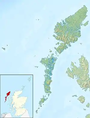
 Satellite photograph of Lewis and Harris | |
| Location | |
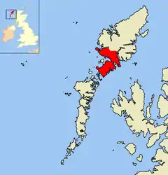
 Lewis and Harris Lewis and Harris shown within the Outer Hebrides | |
| OS grid reference | NB240256 |
| Coordinates | 58.25°N 6.667°W |
| Physical geography | |
| Island group | Outer Hebrides |
| Area | 217,898 hectares (841 sq mi)[2] |
| Area rank | 1 [3] |
| Highest elevation | Clisham 799 metres (2,621 ft) |
| Administration | |
| Sovereign state | United Kingdom |
| Country | Scotland |
| Council area | Comhairle nan Eilean Siar |
| Demographics | |
| Population | 21,031[4] |
| Population rank | 1 [3] |
| Population density | 9.65/km2 (25.0/sq mi)[2][4] |
| Largest settlement | Stornoway |
| References | [5][6][7] |
Geography
Name
The island does not have a one-word name in either English or Scottish Gaelic, and is referred to as 'Lewis and Harris', 'Lewis with Harris', 'Harris with Lewis' etc.[9] Rarely used is the collective name of "the Long Island" (Scottish Gaelic: an t-Eilean Fada),[10] although that epithet is sometimes applied to the entire Outer Hebrides, including the Uists and Barra.[11]
Lewis–Harris boundary

The boundary between Lewis and Harris runs for about 6 miles (10 km) where the island narrows between Loch Resort (Loch Reasort, opposite Scarp) on the west and Loch Seaforth (Loch Shìophoirt) on the east[10][12] This is north of the more obvious isthmus at Tarbert, which separates North Harris from South Harris.[12] Until 1975, Lewis belonged to the county of Ross and Cromarty and Harris to Inverness-shire.[10] The entire island group is now administered by Comhairle nan Eilean Siar, the Western Isles Council. The boundary was originally between the lands of Clan MacLeod of Harris and Clan MacLeod of Lewis, the latter selling to Colin Mackenzie, 1st Earl of Seaforth. A dispute over 3,000 hectares (7,400 acres) between Alexander Hume Macleod and Francis, Lord Seaforth (respective proprietors of Harris and Lewis) led to Court of Session inquiries in 1805 and 1850 and ended with Lord Chief Justice Campbell traversing the boundary on foot.[13][14] As thus determined, it runs southeast from Loch Resort up Clàr Beag to Loch Chleistir, then east along Bealach na h-Uamha to the River Langdale, then northeast through the peaks of Tom Ruisg, Mullach a' Ruisg, and Mullach Bhìogadail, east to Amhuinn a Mhuil, and downstream to where it enters Loch Seaforth at Ath Linne under the A859, the only road connecting Lewis and Harris.[13][15] Seaforth Island was considered part of both Harris and Lewis; for statistical purposes half its area was assigned to each.[16]
Harris
Most of Harris is very hilly, with more than thirty peaks above 1,000 ft (305 m);[10] the highest peak, Clisham, is a Corbett.[17] It is 24 miles (39 km) from the nearest point of the mainland, from which it is separated by the Minch.
Lewis
Lewis is comparatively flat, save in the south-east, where Ben More reaches 1,874 ft (571 m), and in the south-west, where Mealasbhal 1,885 ft (575 m) is the highest point.[10] Lewis contains the deepest lake on any offshore island in the British Isles, Loch Suaineabhal, which has a maximum depth of 66.7 m (219 ft) and an overall mean depth of 32 m (105 ft).
Nearby smaller islands
Other nearby inhabited islands in the Lewis and Harris group are Beàrnaraigh (Great Bernera) and Sgalpaigh (Scalpay). Tarasaigh (Taransay) and An Sgarp (Scarp), now uninhabited, are islands close to the shore of Harris. The Western Isles (or Outer Hebrides) also include the islands of North Uist, Benbecula and South Uist (they are three distinct islands but connected by a causeway) and Barra, just to the south of South Uist.
Population
Lewis/Harris is the most populous of the Scottish islands, and had just over 21,000 residents in 2011,[4] a rise of 5.6% from the 2001 census total of 19,918.[18] Stornoway is the main town of the island, and the civil parish of Stornoway, including the town and various nearby villages, has a population of about 12,000.[19]
Transport links
Stornoway (Steòrnabhagh) has ferry links to Ullapool and air services to Benbecula, Inverness, Aberdeen, Glasgow and Edinburgh. An Tairbeart (Tarbert) is the ferry terminal in Harris with connections to Skye and North Uist. However the main ferry to North Uist uses the terminal at Leverburgh (An t-Òb).
History
The island is the ancestral homeland of the Highland Clan MacLeod, with those individuals on Harris being referred to as from the Clan MacLeod of Harris or MacLeod of MacLeod, and those on Lewis being referred to as from the Clan MacLeod of Lewis.
Lewis is also the ancestral home of Clan Morrison.
The Lewis chessmen is a famous collection of 12th-century chess pieces, carved from walrus ivory and mostly in the form of human figures, which were discovered in Uig in 1831.
Economy

A major industry on the island is the production of Harris tweed fabric, which is handmade on the island; by law only fabric produced in the Outer Hebrides can be called Harris tweed.[20] It is the only commercially produced hand woven tweed in the world and the tweed is popular with celebrities and Royals.[21]
In literature
The Lewis Trilogy of novels (The Blackhouse, The Lewis Man and The Chessmen) by Peter May is set on Lewis and Harris.
See also
Footnotes
- "Map of Scotland in Scots - Guide and gazetteer" (PDF).
- Haswell-Smith (2004) p. 262
- Area and population ranks: there are c. 300 islands over 20 ha in extent and 93 permanently inhabited islands were listed in the 2011 census.
- National Records of Scotland (15 August 2013). "Appendix 2: Population and households on Scotland's Inhabited Islands" (PDF). Statistical Bulletin: 2011 Census: First Results on Population and Household Estimates for Scotland Release 1C (Part Two) (PDF) (Report). SG/2013/126. Retrieved 14 August 2020.
- Haswell-Smith, Hamish (2004). The Scottish Islands. Edinburgh: Canongate. ISBN 978-1-84195-454-7.
- Ordnance Survey
- Jón A. Hjaltalín; Goudie, G.; Anderson, J. (Ed.) (1893). The Orkneyinga saga (1981 ed.). Edinburgh: Mercat Press. ISBN 978-0-901824-25-7.CS1 maint: extra text: authors list (link)
- "A journey through Lewis and Harris, the wild heart of Scotland's Outer Hebrides". National Geographic. Retrieved 10 December 2020.
- Thompson, Francis (1968). Harris and Lewis, Outer Hebrides. Newton Abbot: David & Charles. ISBN 978-0-7153-4260-2.
- Chisholm, Hugh, ed. (1911). . Encyclopædia Britannica. 16 (11th ed.). Cambridge University Press. pp. 525–526.
- Murray, W.H. (1966). The Hebrides. London: Heinemann. p. 2. OCLC 4998389.
- "The Western Isles; Harris (na Hearadh)". The Rough Guide to Scottish Highlands & Islands. Rough Guides UK. 2017. ISBN 978-0-241-31483-8. Retrieved 7 July 2020.
- Angus, Stewart (1997). The Outer Hebrides: the shaping of the islands. White Horse Press. pp. 215–216. ISBN 978-1-874267-33-1.
- "On the Lewis-Harris Boundary". Uig Historical Society. 10 April 2010. Retrieved 7 July 2020.
- "Ordnance Survey 1920s–1940s 1-inch map". Map images. National Library of Scotland. Retrieved 7 July 2020.
- Haswell-Smith, Hamish (2004). The Scottish Islands. Edinburgh: Canongate. pp. 283–84. ISBN 978-1-84195-454-7.; Cooke, A. C. (1879). "Parish of Harris, Hebrides". Ordnance Survey of Scotland; Books of reference to the 25 inch parish maps of Scotland. 55. London: HMSO. p. 12. Retrieved 19 July 2020.
- Johnstone et al (1990) pp. 240–43
- General Register Office for Scotland (28 November 2003) Scotland's Census 2001 – Occasional Paper No 10: Statistics for Inhabited Islands. Retrieved 26 February 2012.
- "Scrol". Archived from the original on 2013-12-02. Retrieved 2013-08-17.
- "Harris Tweed". Archived from the original on 2013-03-08.
- "'It is a sad reflection on the market reality': Harris Tweed forced to make redundancies". Press and Journal. Retrieved 10 December 2020.
References
- Johnstone, Scott; Brown, Hamish; and Bennet, Donald (1990) The Corbetts and Other Scottish Hills. Edinburgh. Scottish Mountaineering Trust.
ISBN 0-907521-29-0
External links
| Wikisource has the text of a 1911 Encyclopædia Britannica article about Lewis and Harris. |
- Google map
- hebrides.ca/ Home of the Quebec–Hebridean Scots who were cleared from Lewis to Quebec, 1838–1920s
| Inhabited islands | ||
|---|---|---|
| Other islands | ||
| Settlements |
| |
| Districts | ||
| Geographical features | ||
| Historical sites | ||
|  | ||||||||||||||||
|
| |||||||||||||||||
| |||||||||||||||||
| |||||||||||||||||
| |||||||||||||||||
| |||||||||||||||||
| |||||||||||||||||
| |||||||||||||||||