Liebenscheid
Liebenscheid is an Ortsgemeinde – a community belonging to a Verbandsgemeinde – in the Westerwaldkreis in Rhineland-Palatinate, Germany.
Liebenscheid | |
|---|---|
 Coat of arms | |
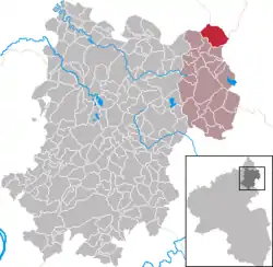
Location of Liebenscheid within Westerwaldkreis district  | |
 Liebenscheid  Liebenscheid | |
| Coordinates: 50°41′50″N 8°5′54″E | |
| Country | Germany |
| State | Rhineland-Palatinate |
| District | Westerwaldkreis |
| Municipal assoc. | Rennerod |
| Government | |
| • Mayor | Hans-Dieter Widerstein |
| Area | |
| • Total | 10.56 km2 (4.08 sq mi) |
| Elevation | 535 m (1,755 ft) |
| Population (2019-12-31)[1] | |
| • Total | 834 |
| • Density | 79/km2 (200/sq mi) |
| Time zone | UTC+01:00 (CET) |
| • Summer (DST) | UTC+02:00 (CEST) |
| Postal codes | 56479 |
| Dialling codes | 02667 |
| Vehicle registration | WW |
| Website | www.rennerod.de |
Geography
Location
The community lies in the Westerwald between Siegen and Limburg on the boundaries with North Rhine-Westphalia and Hesse. Liebenscheid belongs to the Verbandsgemeinde of Rennerod, a kind of collective municipality.
Constituent communities
Liebenscheid has two outlying centres named Weißenberg and Löhnfeld.
History
In 1341, Liebenscheid had its first documentary mention in a partition treaty between the sons of Count Johann I of Nassau-Dillenburg. At this time there also stood Schloss Liebenscheid, a residential castle, which was later taken down.
In 1360, Liebenscheid, together with the neighbouring village of Weißenberg, was granted town rights by Emperor Karl IV, whereby the Emperor bestowed upon the two places the same rights that the Imperial town of Wetzlar held.
In the prison at Schloss Liebenscheid, Peter Paul Rubens’s father, Jan Rubens, was once held for having a close relationship with Anna, William the Silent’s wife.
Politics
Community council
The council is made up of 12 council members who were elected in a majority vote in a municipal election on 13 June 2004.
Economy and infrastructure
Transport
West of the community runs Bundesstraße 54, leading from Limburg an der Lahn to Siegen. The nearest Autobahn interchange is Haiger/Burbach on the A 45 (Dortmund–Aschaffenburg), some 11 km away. The nearest InterCityExpress stop is the railway station at Montabaur on the Cologne-Frankfurt high-speed rail line. The nearest air travel connection is offered by the Siegerland Airport lying a few kilometres west of the community.
References
- "Bevölkerungsstand 2019, Kreise, Gemeinden, Verbandsgemeinden". Statistisches Landesamt Rheinland-Pfalz (in German). 2020.