Lincoln Park, Colorado
Lincoln Park is an unincorporated community and a census-designated place (CDP) located in Fremont County, Colorado, United States. The population of the Lincoln Park CDP was 3,546 at the United States Census 2010.[4] Fremont County governs the unincorporated community. The Cañon City post office (Zip Code 81212) serves the area.[3]
Lincoln Park, Colorado | |
|---|---|
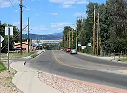 Looking north along South 9th Street (Colorado State Highway 115) in Lincoln Park. | |
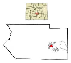 Location of the Lincoln Park CDP in Fremont County, Colorado.Colorado | |
 Lincoln Park Location of the Lincoln Park CDP in the United States. | |
| Coordinates: 38°25′32″N 105°12′47″W[1] | |
| Country | |
| State | |
| County | Fremont County |
| Government | |
| • Type | unincorporated community |
| Area | |
| • Total | 3.785 sq mi (9.804 km2) |
| • Land | 3.785 sq mi (9.803 km2) |
| • Water | 0.0004 sq mi (0.0011 km2) |
| Elevation | 5,394 ft (1,644 m) |
| Population (2010) | |
| • Total | 3,546 |
| • Density | 937/sq mi (362/km2) |
| Time zone | UTC-7 (MST) |
| • Summer (DST) | UTC-6 (MDT) |
| ZIP Code[3] | Cañon City 81212 |
| Area code(s) | 719 |
| GNIS feature[2] | Lincoln Park CDP |
Geography
Lincoln Park is located in eastern Fremont County. It is bordered to the north and west by Cañon City, the county seat, and to the southeast by Brookside.
The former incorporated town of Prospect Heights[5] now lies within the Lincoln Park CDP.[6]
The Lincoln Park CDP has an area of 2,423 acres (9.804 km2), including 0.27 acres (0.0011 km2) of water.[1]
Demographics
The United States Census Bureau initially defined the Lincoln Park CDP for the 1950 United States Census.
| Year | Pop. | ±% |
|---|---|---|
| 1950 | 1,345 | — |
| 1960 | 2,085 | +55.0% |
| 1970 | 2,984 | +43.1% |
| 1980 | 3,426 | +14.8% |
| 1990 | 3,728 | +8.8% |
| 2000 | 3,904 | +4.7% |
| 2010 | 3,546 | −9.2% |
| 2020 | — | |
| Source: United States Census Bureau | ||
Environmental issues
In 1958, Cotter Corporation, a company owned by Commonwealth Edison of Chicago, began to process uranium ore in Cañon City. In the process of mining uranium ore, the company contaminated the surrounding land, and compromised the water supply of nearby Lincoln Park, 10 miles (16 km) from ADX Florence. In a class-action lawsuit filed by 340 people, the company was accused of lowering nearby land values due to radioactive contamination both at the site of the mill and along the Santa Fe Railway. In 1983, the state of Colorado sued over these damages to the environment; settling for $15 million, Cotter Corporation promised to clean up the mill site. The company resumed work in 1999, but laid off the majority of employees in 2005 after it was determined that shipping ore from Colorado's Western Slope was cost-prohibitive. The water contamination in Lincoln Park remains, and the area has been declared a Superfund site.
See also
- Outline of Colorado
- State of Colorado
- Colorado cities and towns
- Colorado counties
- Colorado metropolitan areas
References
- "State of Colorado Census Designated Places - BAS20 - Data as of January 1, 2020". United States Census Bureau. Retrieved December 22, 2020.
- "U.S. Board on Geographic Names: Domestic Names". United States Geological Survey. Retrieved December 19, 2020.
- "Zip Code 81212 Map and Profile". zipdatamaps.com. 2020. Retrieved December 22, 2020.
- "2010: DEC Summary File 1". United States Census Bureau. Retrieved December 22, 2020.
- "Coal Camps of Fremont County Colorado". Retrieved 2018-08-20.
- "Prospect Heights (in Fremont County, CO) Populated Place Profile". CO HomeTownLocator. Retrieved 2018-08-21.
Prospect Heights (GNIS FID: 192009) is a populated place LOCATED WITHIN the Lincoln Park CDP. In turn, the Lincoln Park CDP is located within Fremont County.
External links
Municipalities and communities of Fremont County, Colorado, United States | ||
|---|---|---|
| Cities | 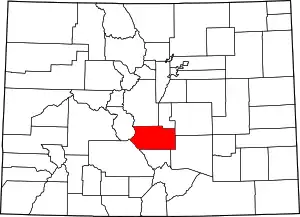 Map of Colorado highlighting Fremont County | |
| Towns | ||
| CDPs | ||
| Unincorporated communities | ||
| Ghost towns | ||
| ||