Coaldale, Colorado
Coaldale is an unincorporated town, a post office, and a census-designated place (CDP) located in southwestern Fremont County, Colorado, United States. The Coaldale post office has the ZIP Code 81222.[3] At the United States Census 2010, the population of the Coaldale CDP was 255, while the population of the 81222 ZIP Code Tabulation Area was 263 including adjacent areas.[4] Fremont County governs the unincorporated town.
Coaldale, Colorado | |
|---|---|
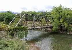 An abandoned bridge over the Arkansas River in Coaldale | |
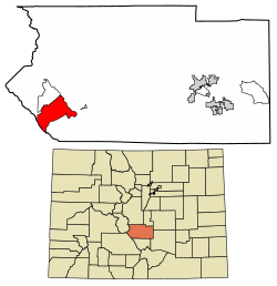 Location of the Coaldale CDP in Fremont County, Colorado. | |
 Coaldale Location of the Coaldale CDP in the United States. | |
| Coordinates: 38°21′21″N 105°48′47″W[1] | |
| Country | |
| State | |
| County | Fremont County |
| Founded | 1891 |
| Government | |
| • Type | unincorporated community |
| Area | |
| • Total | 31.048 sq mi (80.413 km2) |
| • Land | 31.048 sq mi (80.413 km2) |
| • Water | 0.000 sq mi (0.000 km2) |
| Elevation | 8,720 ft (2,658 m) |
| Population (2010) | |
| • Total | 255 |
| • Density | 8.2/sq mi (3.2/km2) |
| Time zone | UTC-7 (MST) |
| • Summer (DST) | UTC-6 (MDT) |
| ZIP Code[3] | 81222 |
| Area code(s) | 719 |
| GNIS feature[2] | Coaldale CDP |
Geography
Coaldale is located in southwestern Fremont County. It is bordered to the northwest by the community of Howard. The northeastern edge of the CDP follows the Arkansas River, and U.S. Route 50 follows the river through the CDP. Cañon City, the county seat, is 37 miles (60 km) to the east (downriver), while Salida is 21 miles (34 km) northwest (upriver).
The Coaldale CDP has an area of 19,870 acres (80.413 km2), all land.[1] The CDP extends southwest out of the Arkansas River valley up into San Isabel National Forest and the Sangre de Cristo Range. The southeastern edge of the CDP follows the Hayden Creek valley up to Hayden Pass; the southwestern edge follows the Saguache County line along the crest of the Sangre de Cristos; and the northwestern edge follows Stout Creek and Kerr Gulch Road back down to the Arkansas River valley.
Demographics
The United States Census Bureau initially defined the Coaldale CDP for the United States Census 2010.
| Year | Pop. | ±% |
|---|---|---|
| 2010 | 255 | — |
| 2020 | — | |
| Source: United States Census Bureau | ||
See also
- Outline of Colorado
- State of Colorado
- Colorado cities and towns
- Colorado counties
- Colorado metropolitan areas
References
- "State of Colorado Census Designated Places - BAS20 - Data as of January 1, 2020". United States Census Bureau. Retrieved December 22, 2020.
- "U.S. Board on Geographic Names: Domestic Names". United States Geological Survey. Retrieved December 19, 2020.
- "Look Up a ZIP Code". United States Postal Service. Retrieved December 19, 2020.
- "2010: DEC Summary File 1". United States Census Bureau. Retrieved December 22, 2020.
External links
- Coaldale @ Colorado.com
- Coaldale @ UncoverColorado.com
- Coaldale, Colorado Mining Claims And Mines
- Fremont County website
Municipalities and communities of Fremont County, Colorado, United States | ||
|---|---|---|
| Cities | 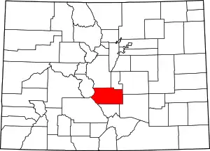 Map of Colorado highlighting Fremont County | |
| Towns | ||
| CDPs | ||
| Unincorporated communities | ||
| Ghost towns | ||
| ||