List of Christopher Wren churches in London
Sir Christopher Wren was 33 years old and near the beginning of his career as an architect when the Great Fire of London in 1666 destroyed many of the city's public buildings, including 88 of its parish churches. Wren's office was commissioned to build 51 replacement churches and St Paul's Cathedral. Many of these buildings survive to this day; others have been substantially altered or rebuilt. Some others were completely or partially destroyed during the German Blitz of 1940–41; yet others were demolished for different reasons.
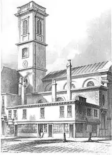
Churches in the City of London
Many of Wren's churches were demolished as the population of the City of London declined in the 19th century and more were destroyed or damaged during the Blitz.
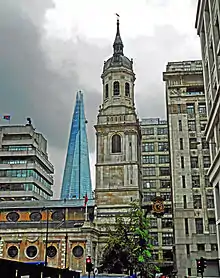
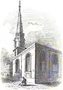
Survived in original form
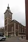
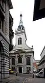
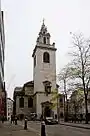
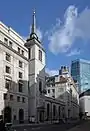
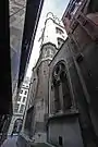
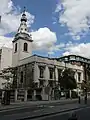
_-_geograph.org.uk_-_560482.jpg.webp)
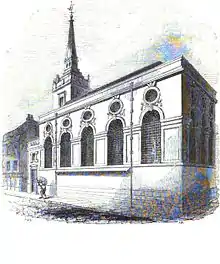
Substantially altered before the Blitz
| Image | Name | Location | Date | Listing | Comment | Coordinates |
|---|---|---|---|---|---|---|
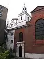
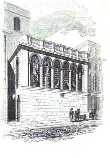
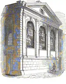
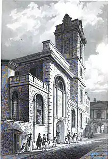
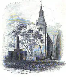
 | St Magnus-the-Martyr | Lower Thames Street, Bridge, City of London | 1671–87 | Grade I (1950) | altered after London Bridge was widened in 1762 | 51°30′33.41″N 0°5′10.81″W |
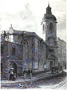
 | St Mary-at-Hill | Lovat Lane, Billingsgate, City of London | 1670–76 | Grade I (1950) | altered in 1787–88 and 1826–27 | 51.510069°N 0.08374°W |
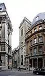
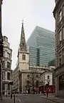
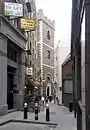
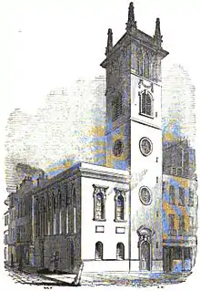
Substantially rebuilt after the Blitz
The Blitz in 1940–1941 damaged nearly all the churches in the City of London and many were nearly destroyed leaving just the outer walls and tower. However most of them were rebuilt to Wren's original design.
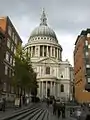
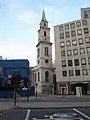
_Royal_-_geograph.org.uk_-_491255.jpg.webp)
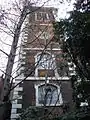
Tower remaining
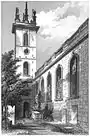
These churches were destroyed in the Blitz or demolished in the 19th century. Only their towers remained with perhaps a short section of the outer wall. They are no longer working churches.
| Image | Name | Location | Date | Listing | Comment | Coordinates |
|---|---|---|---|---|---|---|
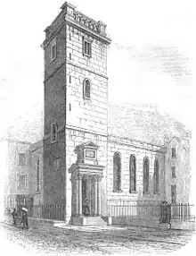
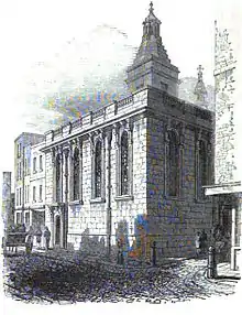
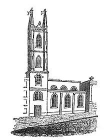
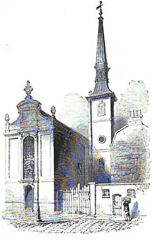
 | St Mary Somerset | Upper Thames Street, Queenhithe, City of London | 1686–94 | Grade I (1950) | Body of the church demolished in 1871. Tower surrounded by small garden | 51°30′40.92″N 0°5′48.80″W |
 | St Olave Old Jewry | Ironmonger Lane, Walbrook, City of London | 1670–79 | Grade I (1950) | Body of the church was demolished in 1887. Tower is part of an office building. | 51°30′52.15″N 0°5′28.70″W |
 | oChrist Church Greyfriars | Newgate Street, Farringdon Within, City of London | 1677–91 | Grade I (1950) | Destroyed in the Blitz. The ruins are a public garden, the tower is private residence | 51°30′56.94″N 0°5′56.93″W |
 | St Alban's, Wood Street | Wood Street, Bassishaw, City of London | 1682–87 | Grade II (1950) | Destroyed in the Blitz. The tower is private dwelling | 51°30′59.69″N 0°5′38.95″W |
 | St Augustine Watling Street | Watling Street, Bread Street Ward, City of London | 1680–87 | Grade I (1950) | Destroyed in the Blitz. Tower part of St Paul's Cathedral Choir School | 51°30′48.52″N 00°05′49.00″W |
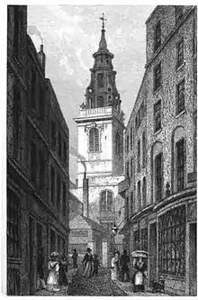
 | St Dunstan-in-the-East | St Dunstan's Hill, Billingsgate, City of London | 1698 | Grade I (1950) | Rebuilt in 1817–21, but destroyed in the Blitz. Ruins are a public garden | 51°30′34.82″N 0°4′57.80″W |
Stones re-used
| Image | Name | Location | Date | Listing | Comment | Coordinates |
|---|---|---|---|---|---|---|
 | All Hallows Lombard Street | Lombard Street, Langbourn, City of London | 1686–94 | never listed | Demolished in 1939, with the tower and interior fittings moved to All Hallows Twickenham | 51°30′39.09″N 0°5′5.84″W |
 | St Mary Aldermanbury | Aldermanbury, Bassishaw, City of London | 1670–74 | Grade II (1972) | Ruined in 1940, and the stones transported to Fulton, Missouri in 1964. Rebuilt as a memorial to Sir Winston Churchill | 51°30′59.34″N 0°5′35.06″W |
Demolished due to the Union of Benefices Act (chronological order)
The population of the City of London declined sharply in the 19th century, and the Union of Benefices Act 1860 reduced the number of parish churches. The surplus churches were demolished.
Demolished for other reasons (chronological order)
| Image | Name | Location | Date | Demolition | Reason | Coordinates |
|---|---|---|---|---|---|---|
 | St Christopher le Stocks | Threadneedle Street, Broad Street Ward, City of London | 1670–71 | demolished in 1782 | to provide space for the extension of the Bank of England | 51.5141°N 0.0886°W |
 | St Michael, Crooked Lane | Miles's Lane, Candlewick, City of London | 1687 | demolished in 1831 | wider approaches were needed for the rebuilt London Bridge | 51.51070°N 0.087280°W |
 | St Bartholomew-by-the-Exchange | Bartholomew Lane, Broad Street Ward, City of London | 1675–83 | demolished in 1840 | to provide space for the widening of Threadneedle Street | 51.51376°N 0.0873°W |
 | St Benet Fink | Threadneedle Street, Broad Street Ward, City of London | 1670–75 | demolished between 1841 and 1846 | to improve the site of the Royal Exchange | 51°30′50″N 0°5′10″W |
 | St Michael Bassishaw | Basinghall Street, Bassishaw, City of London | 1675–79 | demolished in 1900 | judged structurally unsafe in 1892 | 51°31′0.1″N 0°5′30″W |
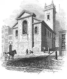 | St George Botolph Lane | Botolph Lane, Billingsgate, City of London | 1671–76 | demolished in 1904 | judged structurally unsafe and closed 1901 | 51°30′38″N 0°5′7″W |
Destroyed in the Blitz
These churches were destroyed in the Blitz and their ruins demolished afterwards.
| Image | Name | Location | Date | Demolition | Coordinates |
|---|---|---|---|---|---|
 | St Stephen Coleman Street | Coleman Street, Coleman Street Ward, City of London | 1677 | 1940 | 51.5155°N 0.0904°W |
 | St Mildred, Bread Street | Bread Street, Bread Street Ward, City of London | 1677–83 | 1941 | 51.5123°N 0.0952°W |
 | St Swithin, London Stone | Cannon Street, Walbrook, City of London | 1678 | 1962 | 51°30′42″N 0°5′22″W |
Interior refurbished by Christopher Wren
| Image | Name | Location | Date | Listing | Comment | Coordinates |
|---|---|---|---|---|---|---|
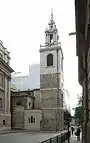
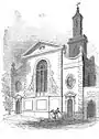
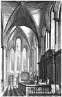 | Temple Church | Fleet Street, Farringdon Without, City of London | 1682–83 | Grade I (1950) | During the restoration after the Blitz Wren's wooden altar was discovered in a museum and was restored to its original position | 51°30′47.52″N 0°06′37.44″W |
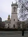
Churches built outside the City of London
These churches were outside the area of the Great Fire of London.
| Image | Name | Location | Date | Listing | Comment | Coordinates |
|---|---|---|---|---|---|---|
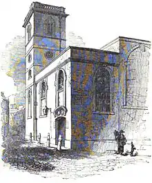
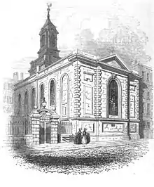
 | St Anne's Church, Soho | Dean Street, Soho, City of Westminster | 1677–85 | Grade II (1958) | The body of the church by Wren and William Talman was destroyed in the Blitz and later totally demolished; the preserved tower was built by S.P. Cockerell in 1801–03 | 51.5124°N 0.1323°W |
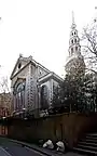
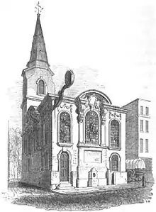
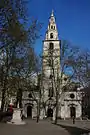 | St Clement Danes | The Strand, City of Westminster | 1680–82 | Grade I (1958) | Destroyed in 1941; reconsecrated in 1958 after the Blitz. | 51.513107°N 0.113898°W |
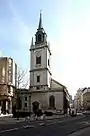
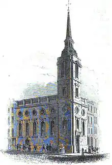
.jpg.webp) | St James's Church, Piccadilly | Piccadilly, St James's, City of Westminster | 1676–84 | Grade I (1958) | Destroyed in 1940; restored in 1947–54 after the Blitz | 51°30′31″N 0°8′12″W |
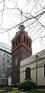
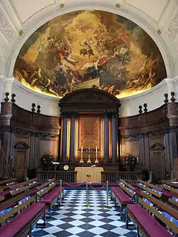 | Chapel of the Royal Hospital Chelsea | Royal Hospital Road, Chelsea, Royal Borough of Kensington and Chelsea | 1682–87 | Grade I (1969) | Wren designed the rest of the Hospital, as well. | 51°29′11″N 0°9′28″W |
Bibliography
- Betjeman, John (1992) [1967], Sovereign City of London Churches, Andover: Pitkin, ISBN 978-0-85372-565-7
- Godwin, George (1839), Churches of London, Vols.1–2, C. Tilt
- Huelin, G (1996), Vanished Churches of the City of London, London: Guildhall Library Publications, ISBN 978-0-900422-42-3
- Reynolds, H (1922), The Churches of the City of London, London: The Bodley Head Limited
External links
| Wikimedia Commons has media related to Christopher Wren. |
- Friends of the City Churches
- Church Bells of the City of London
- City of London Churches by Mark McManus
- Churches in the City from the Diocese of London
- Where the existing Wren churches are in London from Google maps
- View interiors of Wren Churches in 360 degrees