List of Cologne KVB stations
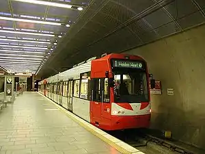
This is a list of KVB light rail stations of the Cologne rapid transit system. The system covers the city of Cologne, as well as several surrounding cities (Bergisch Gladbach, Bonn, Bornheim, Brühl, Frechen, Hürth, Leverkusen-Schlebusch, Wesseling) and is operated by Cologne Stadtbahn (Cologne urban rail).

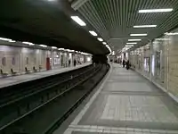
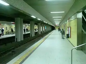
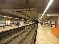
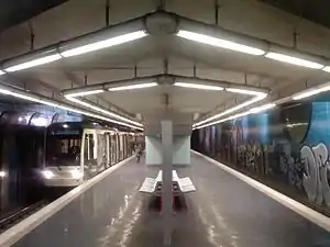
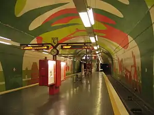
Stations and system is owned by Kölner Verkehrs-Betriebe (KVB), member of the Verkehrsverbund Rhein-Sieg (VRS - Rhein-Sieg Transit Authority, formed in 1987 with transit authorities in Bonn to consolidate the transit authorities in the Cologne/Bonn region and operate a joint fare structure). The KVB system includes a total of 216[1] stations, of which 10 are elevated and 39 are underground stations. 3 additional underground stations are currently under construction.
Stations
| * | Transfer stations |
| † | Terminals |
| ** | Transfer station and terminal |


| 1 | 3 | 4 | 5 | 7 | 9 | 12 | 13 | 15 | 16 | 18 | ||||||
|---|---|---|---|---|---|---|---|---|---|---|---|---|---|---|---|---|
| lines | station | notes | interchange | structure | opened | |||||||||||
| 1 | 7 | 13 | Aachener Straße/ Gürtel * | at-grade | ||||||||||||
| 3 | 4 | Akazienweg | underground | 1992 | ||||||||||||
| 5 | Am Butzweilerhof † | at-grade | 2010 | |||||||||||||
| 13 | 16 | Amsterdamer Straße/Gürtel * | elevated, at-grade | 1974 | ||||||||||||
| 3 | 4 | 16 | 18 | Appellhofplatz * | underground | 1968 | ||||||||||
| 9 | Autobahn | at-grade | ||||||||||||||
| 12 | 15 | 16 | 18 | Barbarossaplatz * | at-grade | |||||||||||
| 1 | Bensberg † | underground | 2000 | |||||||||||||
| 1 | 3 | 4 | 9 | Bf Deutz/Messe * Bf Deutz/Lanxess Arena * | underground, at-grade | |||||||||||
| 13 | 18 | Bf Mülheim * | underground | 1997 | ||||||||||||
| 3 | 4 | Bocklemünd † | at-grade | |||||||||||||
| 18 | Boltensternstraße | at-grade | 1974 | |||||||||||||
| 5 | 16 | 18 | Breslauer Platz/Hauptbahnhof * | underground | 1974 | |||||||||||
| 15 | 16 | Chlodwigplatz | underground, at-grade | 2015 | ||||||||||||
| 12 | 15 | Chorweiler ** | underground | 1973 | ||||||||||||
| 12 | 15 | Christophstraße/ Mediapark | underground | 1987 | ||||||||||||
| 1 | 7 | 9 | Deutzer Freiheit | at-grade | ||||||||||||
| 1 | 9 | Deutz Technische Hochschule | underground | |||||||||||||
| 5 | 16 | 18 | Dom/Hauptbahnhof * | underground | 1974 | |||||||||||
| 5 | 12 | 15 | 16 | 18 | Ebertplatz * | underground | 1974 | |||||||||
| 13 | Escher Straße | elevated | ||||||||||||||
| 12 | 15 | Florastraße | underground | 1974 | ||||||||||||
| 3 | 4 | 5 | 12 | 15 | Friesenplatz * | underground | 1987 | |||||||||
| 1 | Fuldaer Straße | underground | ||||||||||||||
| 13 | Geldernstraße/ Parkgürtel * | underground | ||||||||||||||
| 3 | Görlinger-Zentrum † | at-grade | 2018 | |||||||||||||
| 3 | 4 | 5 | Hans-Böckler Platz/Bf West * | underground | 1987 | |||||||||||
| 12 | 15 | Hansaring * | underground | 1974 | ||||||||||||
| 12 | 15 | Heimersdorf | underground | 1971 | ||||||||||||
| 1 | 5 | 7 | 9 | Heumarkt | underground, at-grade | |||||||||||
| 1 | 9 | Kalk Kapelle | underground | |||||||||||||
| 1 | 9 | Kalk Post | underground | |||||||||||||
| 4 | Keupstraße | at-grade | ||||||||||||||
| 9 | Königsforst † | at-grade | 1904 | |||||||||||||
| 3 | 4 | Körnerstraße | underground | 1989 | ||||||||||||
| 5 | Lenauplatz | at-grade | ||||||||||||||
| 3 | 4 | Leyendeckerstraße | underground | 1992 | ||||||||||||
| 5 | Liebigstraße | at-grade | ||||||||||||||
| 9 | Lindenburg | at-grade | ||||||||||||||
| 12 | 15 | Lohsestraße | underground | 1987 | ||||||||||||
| 9 | Mauritiuskirche | at-grade | ||||||||||||||
| 13 | Melatengürtel * | at-grade | ||||||||||||||
| 9 | Mommsenstraße | at-grade | ||||||||||||||
| 1 | 3 | 4 | 7 | 9 | 16 | 18 | Neumarkt * | underground, at-grade | ||||||||
| 12 | 13 | 15 | Neusser Straße/Gürtel* | underground, elevated | 1974 | |||||||||||
| 9 | Ostheim | at-grade | ||||||||||||||
| 3 | 4 | Piusstraße | underground | 1989 | ||||||||||||
| 7 | Porz Markt | at-grade | ||||||||||||||
| 9 | Porzer Straße | at-grade | ||||||||||||||
| 3 | 4 | 16 | 18 | Poststraße * | underground | |||||||||||
| 9 | Rath/Heumar | at-grade | ||||||||||||||
| 5 | 16 | 18 | Reichenspergerplatz | underground | ||||||||||||
| 9 | Röttgensweg | at-grade | ||||||||||||||
| 3 | 4 | Rochusplatz | underground | 1992 | ||||||||||||
| 16 | Rodenkirchen | at-grade | ||||||||||||||
| 1 | 7 | 12 | 15 | Rudolfplatz * | underground, at-grade | 1987 | ||||||||||
| 16 | Schönhauser Straße | at-grade | ||||||||||||||
| 7 | Severinsbrücke | at-grade | ||||||||||||||
| 3 | 4 | Severinstraße | underground, at-grade | 2015 | ||||||||||||
| 13 | 18 | Slabystraße * | elevated, at-grade | 1974 | ||||||||||||
| 3 | 4 | Stegerwaldsiedlung | at-grade | |||||||||||||
| 9 | Steinweg | at-grade | ||||||||||||||
| 7 | Stüttgenhof | at-grade | ||||||||||||||
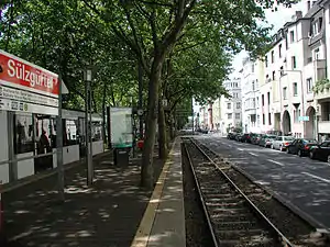
| 13 | 18 | Sülzgürtel ** | at-grade | |||||||||||||
| 3 | 18 | Thielenbruch † | at-grade | |||||||||||||
| 15 | 16 | Ubierring † | at-grade | |||||||||||||
| 3 | 4 | Venloer Straße/Gürtel * | underground | 1989 | ||||||||||||
| 9 | Vingst | underground | ||||||||||||||
| 1 | Weiden West ** | at-grade | ||||||||||||||
| 3 | 4 | Westfriedhof | at-grade | |||||||||||||
| 9 | Weyertal | at-grade | ||||||||||||||
| 4 | 13 | 16 | Wiener Platz * | underground, at-grade | 1997 | |||||||||||
| 18 | Zoo/Flora | at-grade | ||||||||||||||
| 7 | Zündorf † | at-grade | ||||||||||||||
| source: Rapid Transit Map, Cologne/Bonn 2010 (in English) | ||||||||||||||||
See also
References
External links
- KVB official site (in German and English)

