List of Ramsar sites in Australia
This is a list of wetlands in Australia that are designated by the Ramsar Convention as sites of international importance. Under the convention, the wetlands are considered as being of significant value not only for the Australian community, but for humanity as a whole.
The Ramsar Convention on Wetlands came into force for Australia on 21 December 1975. As of 28 February 2018, Australia has 66 sites designated as Wetlands of International Importance, with a total area of 8,342,175 hectares (20,613,960 acres).[1][2][3]
Management of Ramsar wetlands in the Australian jurisdiction
The management of Ramsar sites listed within Australia is controlled at national level by the Australian government via the Environment Protection and Biodiversity Conservation Act 1999 and its accompanying regulations, the Environment Protection and Biodiversity Conservation Regulations 2000.[4][5]
The act, as of 2015, lists the principles required for meeting treaty obligations in respect to "wetlands of international importance" including "environmental approvals" (i.e. sections 16-17B), the prerequisites for the making of both "declarations" and "bilateral agreements" (i.e. sections 34C and 37F, and 52 respectively), the approval process (i.e. section 138), "strategic assessments" (i.e. section 134J), and the management approach (i.e. sections 325 to 336 inclusive).[4]
The applicable regulation (i.e. regulation 10.02) lists three requirements as of 2015. Firstly, a set of general principles for management is described including the need for "public consultation," the involvement of parties with an interest and/or who may be affected by the management of wetland, as well as allowing for "continuing community and technical input." Secondly, the requirements for the management plan to be prepared for each listed wetland are described. Thirdly, the requirements for the "environmental impact assessment and approval" are described for parties wishing to undertake activities that are likely to have "a significant impact on the ecological character of a Ramsar wetland."[5][6]
Australian Capital Territory
The following wetlands are located in the Australian Capital Territory:[1]
| Name | Location | Coordinates | Area | Designated | Designation No. | Description[2] | Image |
|---|---|---|---|---|---|---|---|
| Ginini Flats Subalpine Bog Complex | Namadgi National Park | 35°31′S 148°46′E | 125 ha (309 acres) | 11 March 1996 | RS793 |
New South Wales
The following wetlands are located in New South Wales:[1]
| Name | Location | Coordinates | Area | Designated | Designation No. | Description[2] | Image |
|---|---|---|---|---|---|---|---|
| Blue Lake | Kosciuszko National Park | 36°24′S 148°19′E | 320 hectares (790 acres) | 17 March 1996 | RS800 | 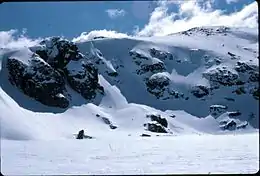 | |
| Fivebough and Tuckerbil Swamps | Riverina | 34°30′S 146°23′E | 689 hectares (1,700 acres) | 21 October 2002 | RS1224 | 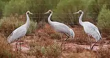 | |
| Gwydir Wetlands | North West Slopes | 34°30′S 146°23′E | 823 hectares (2,030 acres) | 14 June 1999 | RS993 | 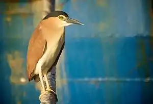 | |
| Hunter Estuary Wetlands | Newcastle | 32°52′S 151°43′E | 2,971 hectares (7,340 acres) | 21 February 1984 | RS287 | 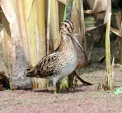 | |
| Little Llangothlin Lagoon | Northern Tablelands | 30°05′S 151°47′E | 258 hectares (640 acres) | 17 March 1996 | RS798 | ||
| Lake Pinaroo | Sturt National Park, Far West | 29°06′S 141°13′E | 800 hectares (2,000 acres) | 17 March 1996 | RS799 | 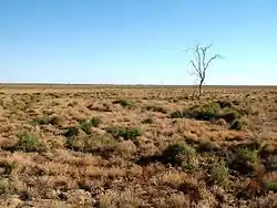 | |
| Macquarie Marshes | North West Slopes | 30°45′S 147°44′E | 18,726 hectares (46,270 acres) | 1 August 1986 | RS337 | 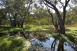 | |
| Myall Lakes | Mid North Coast | 32°30′S 152°17′E | 44,612 hectares (110,240 acres) | 14 June 1999 | RS994 | 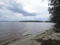 | |
| Narran Wetlands | North West Slopes | 29°43′S 147°26′E | 5,530 hectares (13,700 acres) | 14 June 1999 | RS995 | 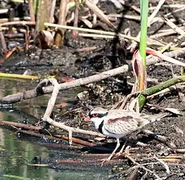 | |
| Central Murray Forests | Riverina | 35°39′S 144°39′E | 84,028 hectares (207,640 acres) | 20 May 2003 | RS1291 | ||
| Paroo River Wetlands | Far West | 30°20′S 143°51′E | 138,304 hectares (341,760 acres) | 13 September 2007 | RS1716 | 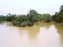 | |
| Towra Point Nature Reserve | Sutherland Shire, Sydney | 34°00′S 151°10′E | 386 hectares (950 acres) | 21 February 1984 | RS286 |  |
Northern Territory
The following wetlands are located in the Northern Territory:[1]
| Name | Location | Coordinates | Area | Designated | Designation No. | Description[2] | Image |
|---|---|---|---|---|---|---|---|
| Cobourg Peninsula | Garig Gunak Barlu National Park | 11°15′S 132°15′E | 220,700 hectares (545,000 acres) | 8 May 1974 | RS1 | 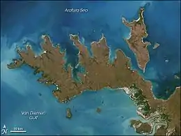 | |
| Kakadu National Park (Stage 1) | Alligator Rivers, Kakadu National Park | 12°40′S 132°45′E | 683,000 hectares (1,690,000 acres) | 12 June 1980 | RS204 | 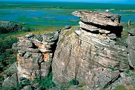 | |
| Kakadu National Park (Stage 2) | 12°30′S 132°30′E | 692,940 hectares (1,712,300 acres) | 15 September 1989 | RS441 | |||
Queensland
The following wetlands are located in Queensland:[1]
| Name | Location | Coordinates | Area | Designated | Designation No. | Description[2] | Image |
|---|---|---|---|---|---|---|---|
| Bowling Green Bay | North Queensland | 19°27′S 147°15′E | 35,500 hectares (88,000 acres) | 22 October 1993 | RS632 | ||
| Currawinya Lakes | South West Queensland | 28°45′S 144°19′E | 151,300 hectares (374,000 acres) | 11 March 1996 | RS791 | 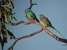 | |
| Great Sandy Strait | Wide Bay–Burnett | 25°28′S 152°54′E | 93,160 hectares (230,200 acres) | 14 June 1999 | RS992 | 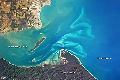 | |
| Moreton Bay | South East Queensland | 27°20′S 153°10′E | 113,314 hectares (280,000 acres) | 22 October 1993 | RS631 | 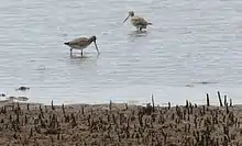 | |
| Shoalwater and Corio Bays | Central Queensland | 22°40′S 150°17′E | 239,100 hectares (591,000 acres) | 11 March 1996 | RS792 | 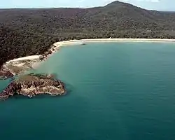 |
South Australia
The following wetlands are located in South Australia:[1]
| Name | Location | Coordinates | Area | Designated | Designation No. | Description[2] | Image |
|---|---|---|---|---|---|---|---|
| Banrock Station Wetland Complex | Riverland | 34°11′S 140°20′E | 1,375 hectares (3,400 acres) | 21 October 2002 | RS1221 | 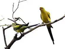 | |
| Bool and Hacks Lagoons | Limestone Coast | 37°08′S 140°41′E | 3,200 hectares (7,900 acres) | 1 November 1985 | RS322 | 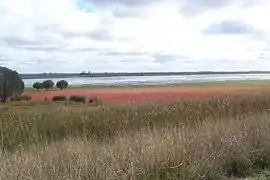 | |
| Coongie Lakes | Lake Eyre Basin | 27°27′S 140°00′E | 1,980,000 hectares (4,900,000 acres) | 1 June 1987 | RS376 | 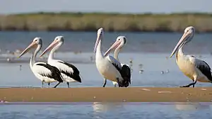 | |
| Coorong and Lakes Alexandrina and Albert Wetland | Lake Alexandrina | 35°56′S 139°18′E | 140,500 hectares (347,000 acres) | 1 November 1985 | RS321 | 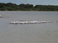 | |
| Piccaninnie Ponds Karst Wetlands | Limestone Coast | 38°3′3″S 140°56′11″E | 862 hectares (2,130 acres)[7] | 21 December 2012 | RS2136 | ||
| Riverland | Riverland | 34°02′S 140°51′E | 30,600 hectares (76,000 acres) | 23 September 1987 | RS377 |
Tasmania
The following wetlands are located in Tasmania:[1]
| Name | Location | Coordinates | Area | Designated | Designation No. | Description[2] | Image |
|---|---|---|---|---|---|---|---|
| Apsley Marshes | Freycinet Peninsula | 41°56′S 148°12′E | 880 hectares (2,200 acres) | 16 November 1982 | RS255 | ||
| Cape Barren Island, east coast lagoons | Furneaux Group | 40°22′S 148°23′E | 4,370 hectares (10,800 acres) | 16 November 1982 | RS255 | 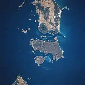 | |
| Interlaken Lakeside Reserve | Central Highlands | 42°09′S 147°10′E | 520 hectares (1,300 acres) | 16 November 1982 | RS259 | ||
| Jocks Lagoon | St Helens | 41°21′S 148°18′E | 18 hectares (44 acres) | 16 November 1982 | RS258 | ||
| Lavinia | King Island | 39°45′S 144°05′E | 7,020 hectares (17,300 acres) | 16 November 1982 | RS253 | ||
| Little Waterhouse Lake | North East | 40°52′S 147°37′E | 57 hectares (140 acres) | 16 November 1982 | RS260 | 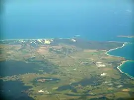 | |
| Logan Lagoon | Flinders Island, Furneaux Group | 40°10′S 148°17′E | 2,320 hectares (5,700 acres) | 16 November 1982 | RS252 | ||
| Lower Ringarooma River | North East | 40°54′S 147°56′E | 4,160 hectares (10,300 acres) | 16 November 1982 | RS257 | 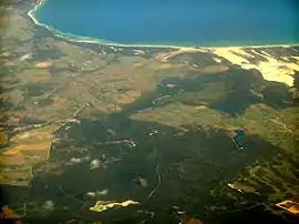 | |
| Moulting Lagoon Nature Reserve | Freycinet Peninsula | 42°05′S 148°10′E | 4,580 hectares (11,300 acres) | 16 November 1982 | RS251 | ||
| Pittwater-Orielton Lagoon | Southern Tasmania | 42°48′S 147°30′E | 3,175 hectares (7,850 acres) | 16 November 1982 | RS254 |
Victoria
The following wetlands are located in Victoria:[1]
| Name | Location | Coordinates | Area | Designated | Designation No. | Description[2] | Image |
|---|---|---|---|---|---|---|---|
| Barmah Forest | Goulburn Valley, Hume | 35°55′S 145°08′E | 28,515 hectares (70,460 acres) | 15 December 1982 | RS262 | ||
| Corner Inlet | South Gippsland | 38°45′S 146°32′E | 67,186 hectares (166,020 acres) | 15 December 1982 | RS261 | ||
| Glenelg Estuary and Discovery Bay Ramsar Site | Glenelg Shire | 38°05′S 141°07′E | 22,289 hectares (55,080 acres) | 28 February 2018 | RS2344 | [3] | |
| Edithvale-Seaford Wetlands | Port Phillip | 38°04′S 145°07′E | 261 hectares (640 acres) | 29 August 2001 | RS1096 | 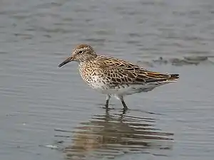 | |
| Gippsland Lakes | East Gippsland | 38°00′S 147°36′E | 60,015 hectares (148,300 acres) | 15 December 1982 | RS269 |
| |
| Gunbower Forest | 35°49′S 144°19′E | 19,931 hectares (49,250 acres) | 15 December 1982 | RS263 | |||
| Hattah-Kulkyne Lakes | Murray Mallee | 34°41′S 142°26′E | 955 hectares (2,360 acres) | 15 December 1982 | RS264 | 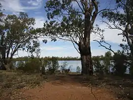 | |
| Kerang Wetlands | Murray Mallee | 35°40′S 143°56′E | 9,419 hectares (23,270 acres) | 15 December 1982 | RS265 | ||
| Lake Albacutya | Wimmera | 35°46′S 141°58′E | 5,731 hectares (14,160 acres) | 15 December 1982 | RS270 | ||
| Port Phillip Bay and Bellarine Peninsula | Port Phillip, Bellarine Peninsula | 38°04′S 144°36′E | 22,897 hectares (56,580 acres) | 15 December 1982 | RS266 | ||
| Western District Lakes | Western District | 38°10′S 143°31′E | 32,898 hectares (81,290 acres) | 15 December 1982 | RS268 | ||
| Western Port Bay | Western Port | 38°22′S 145°17′E | 59,297 hectares (146,530 acres) | 15 December 1982 | RS267 | ||
Western Australia
The following wetlands are located in Western Australia:[1]
| Name | Location | Coordinates | Area | Designated | Designation No. | Description[2] | Image |
|---|---|---|---|---|---|---|---|
| Becher Point Wetlands | Swan Coastal Plain | 32°23′S 115°44′E | 677 hectares (1,670 acres) | 5 January 2001 | RS1048 | ||
| Eighty Mile Beach | Kimberley | 19°31′S 120°40′E | 125,000 hectares (310,000 acres) | 7 June 1990 | RS480 | 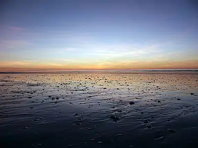 | |
| Forrestdale and Thomsons Lakes | Swan Coastal Plain | 32°09′S 115°52′E | 754 hectares (1,860 acres) | 7 June 1990 | RS481 | ||
| Lake Gore | Goldfields-Esperance | 33°47′S 121°29′E | 4,017 hectares (9,930 acres) | 5 January 2001 | RS1049 | ||
| Lake Warden System | Goldfields-Esperance | 33°48′S 121°56′E | 2,300 hectares (5,700 acres) | 7 June 1990 | RS485 | 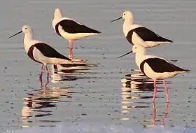 | |
| Lakes Argyle and Kununurra | Kimberley | 16°19′S 128°44′E | 150,000 hectares (370,000 acres) | 7 June 1990 | RS478 | 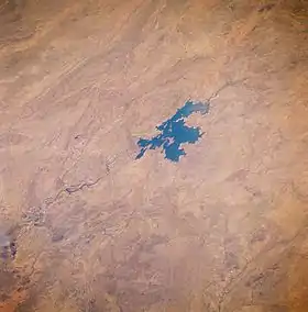 | |
| Muir-Byenup System | South West | 34°29′S 116°43′E | 10,631 hectares (26,270 acres) | 5 January 2001 | RS1050 |  | |
| Ord River Floodplain | Kimberley | 15°15′S 128°22′E | 141,453 hectares (349,540 acres) | 7 June 1990 | RS477 |  | |
| Peel-Yalgorup System | Swan Coastal Plain | 32°49′S 115°42′E | 26,530 hectares (65,600 acres) | 7 June 1990 | RS482 | ||
| Roebuck Bay | Kimberley | 18°07′S 122°16′E | 55,000 hectares (140,000 acres) | 7 June 1990 | RS479 |  | |
| Toolibin Lake | Wheatbelt | 32°55′S 117°36′E | 493 hectares (1,220 acres) | 7 June 1990 | RS483 | ||
| Vasse-Wonnerup System | South West | 33°37′S 115°25′E | 1,115 hectares (2,760 acres) | 7 June 1990 | RS484 |  |
External territories
The following wetlands are located in the External territories:[1]
| Name | Location | Coordinates | Area | Designated | Designation No. | Description[2] | Image |
|---|---|---|---|---|---|---|---|
| Ashmore Reef National Nature Reserve | Ashmore and Cartier Islands | 12°15′S 123°02′E | 58,300 hectares (144,000 acres) | 21 October 2002 | RS1220 | ||
| Coral Sea Reserves (Coringa-Herald and Lihou Reef and Cays) | Coral Sea Islands Territory | 17°04′S 150°39′E | 1,729,200 hectares (4,273,000 acres) | 21 October 2002 | RS1222 | ||
| The Dales | Christmas Island | 10°28′S 105°33′E | 57 hectares (140 acres) | 21 October 2002 | RS1225 | ||
| Elizabeth and Middleton Reefs Marine National Nature Reserve | Coral Sea Islands Territory | 29°41′S 159°06′E | 188,000 hectares (460,000 acres) | 21 October 2002 | RS1223 |  | |
| Hosnies Spring | Christmas Island | 10°28′S 105°41′E | 1 hectare (2.5 acres) | 11 December 1990 | RS512 | ||
| Pulu Keeling National Park | Cocos (Keeling) Islands | 11°50′S 96°49′E | 122 hectares (300 acres) | 17 March 1996 | RS797 |  |
References
- "The List of Wetlands of International Importance" (PDF) (PDF). The Ramsar Convention on Wetlands. 19 June 2014. Retrieved 28 June 2014.
- "The Annotated Ramsar List: Australia". The Annotated Ramsar List of Wetlands of International Importance. The Ramsar Convention on Wetlands. 10 April 2013. Archived from the original on 19 September 2011. Retrieved 28 June 2014.
- "Glenelg Estuary and Discovery Bay Ramsar Site" (PDF). Ramsar Convention Secretriat. 28 February 2018. Retrieved 22 September 2018.
- "Environment Protection and Biodiversity Conservation Act 1999". Australasian Legal Information Institute. Retrieved 12 October 2015.
- "Environment Protection and Biodiversity Conservation Regulations 2000 - Reg 10.02". Australasian Legal Information Institute. Retrieved 11 October 2015.
- "Environment Protection and Biodiversity Conservation Regulations 2000 - Schedule 6". Australasian Legal Information Institute. Retrieved 11 October 2015.
- Peddie, Clare. "Piccaninnie Ponds now a wetland world wonder". The Advertiser. Retrieved 24 January 2013.