List of airports in Syria
This is a list of airports in Syria, sorted by location.
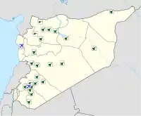
Map of airports in Syria
Syria, officially the Syrian Arab Republic, is a country in Western Asia, bordering Lebanon and the Mediterranean Sea to the west, Turkey to the north, Iraq to the east, Jordan to the south, and Israel to the southwest. Syria's capital city is Damascus.
Airports
Airport names shown in bold have scheduled passenger service on commercial airlines.
Public airports
Closed airports
| Name | Location served | Governorate | Held by | ICAO | IATA | Utilization | Helipads | Runways | Shelters | Squadrons | Coordinates |
|---|---|---|---|---|---|---|---|---|---|---|---|
| Fiq/Al Al Airfield | Fiq & Al ‘Al | Quneitra | OS73 | none | Public | 0 | 1 | 0 | 0 | 32°47′12″N 35°43′05″E | |
| Tabqa Airport (Tabqa Airbase) |
Tabqa | Raqqa | OS59 | none | Public Military |
0 | 1 | 18 | ? | 35°45′17″N 38°34′01″E |
See also
- Al-Dumayr Military Airport
- List of airports by ICAO code: O#OS - Syria
- List of Syrian Air Force bases
- List of Syrian Air Force squadrons
- Military of Syria
- Syrian Air Force
- Transport in Syria
- Wikipedia: WikiProject Aviation/Airline destination lists: Asia#Syria
References
- Syrian Army captures Palmyra Airbase in blitz offensive – Map update
- Syrian Army captures Palmyra Airbase in blitz offensive – Map update
- "Russia building airstrip in Syria's Latakia: Russia has reportedly brought hundreds of technicians and military advisers to Hmaymeen military airport in Latakia province". Middle East Eye. MEE. 14 September 2015. Retrieved 14 August 2016.
Observatory director Rami Abdel Rahman said sources also reported that Russia was enlarging the Hamadiyeh airport in Tartus province, another government stronghold that is south of Latakia. The airport is currently used by aircraft that spray crops with pesticide.
- Syria carved up, as regime forces enter Kurdish-held areas
External links
- "ICAO Location Indicators by State" (PDF). International Civil Aviation Organization. 2006-01-12.
- "UN Location Codes: Syrian Arab Republic (includes IATA codes)". UN/LOCODE 2009-2. UNECE. 2010-02-08.
- Airports in Syria. World Aero Data.
- Syrian Arab Air Force. Global Security.
- Syrian Arab Air Force. Scramble.
This article is issued from Wikipedia. The text is licensed under Creative Commons - Attribution - Sharealike. Additional terms may apply for the media files.