List of barangays in Zamboanga City
Zamboanga City, a highly urbanized city since 22 November 1983, comprises 98 barangays, which are grouped into 13 geographic districts.[1] The territory of Zamboanga City covers approximately 148,338.40 hectares, of which 142,089.90 (95.8%) lies on mainland Mindanao and 6,248.50 (4.2%) are on islands.[2]
In 2005, 30 barangays were classified as urban, while the remaining 68 were rural.[1][2] However, due to rapid urbanization, there are now 58 urban barangays where 746,315 (86.6%) of Zamboanga City's population lives.[3] The remaining 40 rural barangays are home to 115,484 residents, representing 13.4% of the total population.[3]
The city is divided into two legislative districts, roughly corresponding to west (1st District) and east (2nd District) coasts, for the purposes of electing members to the House of Representatives of the Philippines and the Sangguniang Panlungsod. The 1st District encompasses the geographic districts of Ayala, Baliwasan, Labuan, Santa Maria, Zamboanga Central and the southern part of Santa Barbara; the 2nd District covers the rest of the geographic district of Santa Barbara, along with Curuan, Manicahan, Mercedes, Putik, Tetuan, Vitali and the Island Barangays.
List of Barangays
| Barangays of Zamboanga City | |||||||||
|---|---|---|---|---|---|---|---|---|---|
| Administration | Population[3] | PSGC Code and Class[3] | |||||||
| Barangay | Geographic District [1] | Legislative District | Area (ha)[4] | 2015 | 2010 | Change | Code | Urban/Rural | |
| Arena Blanco | Tetuan | II | 51.5717 | 12,589 | 10,016 | +25.69% | 97332001 | Urban | |
| Ayala | Ayala | I | 529.1303 | 22,547 | 20,096 | +12.20% | 97332002 | Urban | |
| Baliwasan | Baliwasan | I | 126.5476 | 25,042 | 27,070 | −7.49% | 97332004 | Urban | |
| Baluno | Ayala | I | 1,643.4602 | 3,155 | 2,315 | +36.29% | 97332005 | Rural | |
| Boalan | Putik | II | 865.561 | 8,696 | 7,435 | +16.96% | 97332010 | Urban | |
| Bolong | Manicahan | II | 1,574.0594 | 6,460 | 5,862 | +10.20% | 97332011 | Urban | |
| Buenavista | Curuan | II | 1,003.5189 | 6,485 | 5,837 | +11.10% | 97332012 | Urban | |
| Bunguiao | Manicahan | II | 2,562.0727 | 7,287 | 7,368 | −1.10% | 97332013 | Urban | |
| Busay (Sacol Island) | Island Barangays | II | 436.3663 | 3,359 | 2,931 | +14.60% | 97332014 | Rural | |
| Cabaluay | Mercedes | II | 872.2986 | 6,350 | 5,802 | +9.45% | 97332015 | Urban | |
| Cabatangan | Santa Maria | I | 896.6494 | 13,680 | 9,944 | +37.57% | 97332016 | Urban | |
| Cacao | Mercedes | II | 1,194.4581 | 1,347 | 1,045 | +28.90% | 97332017 | Rural | |
| Calabasa | Curuan | II | 1,849.9353 | 3,222 | 2,685 | +20.00% | 97332018 | Rural | |
| Calarian | Baliwasan | I | 253.8887 | 28,899 | 25,331 | +14.09% | 97332019 | Urban | |
| Camino Nuevo | Zamboanga Central | I | 68.6803 | 7,739 | 8,295 | −6.70% | 97332099 | Urban | |
| Campo Islam | Baliwasan | I | 26.2606 | 12,552 | 11,237 | +11.70% | 97332020 | Urban | |
| Canelar | Zamboanga Central | I | 92.7185 | 11,100 | 11,160 | −0.54% | 97332021 | Urban | |
| Capisan | Baliwasan | I | 490.5677 | 1,408 | 1,090 | +29.17% | 97332098 | Rural | |
| Cawit | Ayala | I | 378.0762 | 9,249 | 9,124 | +1.37% | 97332022 | Urban | |
| Culianan | Mercedes | II | 900.5328 | 8,318 | 8,524 | −2.42% | 97332023 | Urban | |
| Curuan | Curuan | II | 7,216.0695 | 8,796 | 7,378 | +19.22% | 97332024 | Urban | |
| Dita | Curuan | II | 133.7222 | 2,085 | 3,831 | −45.58% | 97332025 | Rural | |
| Divisoria | Putik | II | 286.2707 | 9,218 | 9,042 | +1.95% | 97332026 | Urban | |
| Dulian (Upper Bunguiao) | Curuan | II | 1,542.3299 | 2,570 | 2,023 | +27.04% | 97332027 | Rural | |
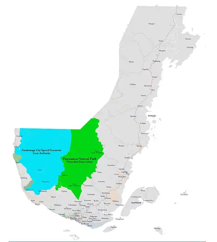
| Dulian (Upper Pasonanca) | Santa Maria | I | 679.6396 | 1,325 | 1,363 | −2.79% | 97332028 | Rural | |
| Guisao | Mercedes | II | 567.3387 | 3,398 | 2,560 | +32.73% | 97332030 | Rural | |
| Guiwan | Tetuan | II | 178.0205 | 14,302 | 15,323 | −6.66% | 97332031 | Urban | |
| Kasanyangan | Santa Barbara | II | 14,114 | 8,425 | +67.53% | 97332101 | Urban | ||
| La Paz | Labuan | I | 1,740.0822 | 7,557 | 5,606 | +34.80% | 97332032 | Urban | |
| Labuan | Labuan | I | 1,961.7203 | 11,457 | 11,470 | −0.11% | 97332033 | Urban | |
| Lamisahan | Manicahan | II | 2,125.8888 | 2,289 | 2,995 | −23.57% | 97332034 | Rural | |
| Landang Gua | Island Barangays | II | 589.8559 | 2,993 | 2,980 | +0.44% | 97332035 | Rural | |
| Landang Laum | Island Barangays | II | 268.547 | 4,768 | 4,803 | −0.73% | 97332036 | Rural | |
| Lanzones | Mercedes | II | 953.1401 | 3,287 | 2,743 | +19.83% | 97332037 | Rural | |
| Lapakan | Mercedes | II | 955.383 | 1,378 | 1,529 | −9.88% | 97332038 | Rural | |
| Latuan (Curuan) | Curuan | II | 98.0766 | 2,457 | 2,125 | +15.62% | 97332039 | Rural | |
| Licomo | Vitali | II | 1,707.8995 | 5,317 | 5,727 | −7.16% | 97332100 | Urban | |
| Limaong | Vitali | II | 1,853.7832 | 4,000 | 3,445 | +16.11% | 97332040 | Rural | |
| Limpapa | Labuan | I | 696.3089 | 5,782 | 5,160 | +12.05% | 97332041 | Urban | |
| Lubigan | Curuan | II | 1,416.7021 | 2,945 | 1,149 | +156.31% | 97332042 | Rural | |
| Lumayang | Putik | II | 790.0515 | 1,471 | 1,377 | +6.83% | 97332043 | Rural | |
| Lumbangan | Putik | II | 440.1625 | 3,235 | 3,308 | −2.21% | 97332044 | Rural | |
| Lunzuran | Putik | II | 742.5246 | 9,931 | 8,221 | +20.80% | 97332045 | Urban | |
| Maasin | Ayala | I | 556.426 | 8,958 | 7,978 | +12.28% | 97332046 | Urban | |
| Malagutay | Baliwasan | I | 627.8804 | 6,657 | 5,654 | +17.74% | 97332047 | Urban | |
| Mampang | Tetuan | II | 726.0937 | 34,312 | 22,857 | +50.12% | 97332048 | Urban | |
| Manalipa | Island Barangays | II | 288.4444 | 2,143 | 1,922 | +11.50% | 97332049 | Rural | |
| Mangusu | Vitali | II | 828.1945 | 4,783 | 4,776 | +0.15% | 97332050 | Rural | |
| Manicahan | Manicahan | II | 1,801.7465 | 10,081 | 9,129 | +10.43% | 97332051 | Urban | |
| Mariki | Santa Barbara | I | 0.3085 | 1,775 | 5,895 | −69.89% | 97332052 | Urban | |
| Mercedes | Mercedes | II | 1,288.5634 | 14,721 | 12,050 | +22.17% | 97332053 | Urban | |
| Muti | Curuan | II | 1,233.2268 | 2,983 | 3,123 | −4.48% | 97332054 | Rural | |
| Pamucutan | Labuan | I | 563.1417 | 4,059 | 3,764 | +7.84% | 97332055 | Rural | |
| Pangapuyan | Island Barangays | II | 9.2339 | 590 | 534 | +10.49% | 97332056 | Rural | |
| Panubigan | Curuan | II | 431.0032 | 1,610 | 982 | +63.95% | 97332057 | Rural | |
| Pasilmanta (Sacol Island) | Island Barangays | II | 664.1481 | 2,122 | 1,480 | +43.38% | 97332058 | Rural | |
| Pasobolong | Putik | II | 3,758 | 3,257 | +15.38% | 97332102 | Rural | ||
| Pasonanca | Santa Maria | I | 1,146.665 | 27,374 | 27,231 | +0.53% | 97332059 | Urban | |
| Patalon | Labuan | I | 1,400.8893 | 8,128 | 7,187 | +13.09% | 97332060 | Urban | |
| Putik | Putik | II | 279.215 | 19,681 | 19,653 | +0.14% | 97332065 | Urban | |
| Quiniput | Curuan | II | 1,031.6762 | 3,329 | 2,647 | +25.77% | 97332066 | Rural | |
| Recodo | Ayala | I | 176.6764 | 17,395 | 18,172 | −4.28% | 97332067 | Urban | |
| Rio Hondo | Santa Barbara | I | 180.372 | 3,326 | 10,565 | −68.52% | 97332068 | Urban | |
| Salaan | Putik | II | 1,698.946 | 4,073 | 3,310 | +23.05% | 97332069 | Rural | |
| San Jose Cawa-cawa | Baliwasan | I | 36.2309 | 6,173 | 7,991 | −22.75% | 97332070 | Urban | |
| San Jose Gusu | Baliwasan | I | 154.6178 | 16,723 | 24,542 | −31.86% | 97332071 | Urban | |
| San Roque | Santa Maria | I | 406.6463 | 27,889 | 25,531 | +9.24% | 97332072 | Urban | |
| Sangali | Manicahan | II | 1,259.3212 | 20,766 | 19,230 | +7.99% | 97332073 | Urban | |
| Santa Barbara | Santa Barbara | I | 14.7966 | 4,762 | 7,961 | −40.18% | 97332074 | Urban | |
| Santa Catalina | Santa Barbara | II | 54.2083 | 17,294 | 17,955 | −3.68% | 97332075 | Urban | |
| Santa Maria | Santa Maria | I | 355.8146 | 25,185 | 21,926 | +14.86% | 97332076 | Urban | |
| Santo Niño | Baliwasan | I | 25.0831 | 4,129 | 6,790 | −39.19% | 97332077 | Urban | |
| Sibulao (Caruan) | Vitali | II | 1,148.7588 | 4,244 | 2,748 | +54.44% | 97332078 | Rural | |
| Sinubung | Labuan | I | 905.1368 | 4,689 | 2,690 | +74.31% | 97332079 | Rural | |
| Sinunoc | Ayala | I | 852.8397 | 16,507 | 16,942 | −2.57% | 97332080 | Urban | |
| Tagasilay | Vitali | II | 1,616.5975 | 2,971 | 2,607 | +13.96% | 97332081 | Rural | |
| Taguiti | Vitali | II | 1,377.338 | 1,460 | 899 | +62.40% | 97332082 | Rural | |
| Talabaan | Mercedes | II | 891.854 | 5,340 | 4,181 | +27.72% | 97332083 | Rural | |
| Talisayan | Ayala | I | 3,498.2387 | 8,220 | 7,285 | +12.83% | 97332084 | Urban | |
| Talon-talon | Tetuan | II | 591.8379 | 34,916 | 30,535 | +14.35% | 97332085 | Urban | |
| Taluksangay | Mercedes | II | 25.0707 | 10,237 | 8,108 | +26.26% | 97332086 | Urban | |
| Tetuan | Tetuan | II | 304.2304 | 29,785 | 29,082 | +2.42% | 97332087 | Urban | |
| Tictapul | Vitali | II | 202.7718 | 3,817 | 3,515 | +8.59% | 97332088 | Rural | |
| Tigbalabag | Vitali | II | 1,357.9765 | 1,803 | 1,491 | +20.93% | 97332089 | Rural | |
| Tigtabon | Island Barangays | II | 22.1714 | 5,292 | 5,071 | +4.36% | 97332090 | Urban | |
| Tolosa | Mercedes | II | 551.3498 | 2,773 | 3,157 | −12.16% | 97332091 | Rural | |
| Tugbungan | Tetuan | II | 380.7098 | 23,837 | 23,001 | +3.63% | 97332092 | Urban | |
| Tulungatung | Ayala | I | 278.0743 | 9,246 | 6,055 | +52.70% | 97332093 | Urban | |
| Tumaga | Santa Maria | I | 273.9979 | 30,824 | 25,184 | +22.40% | 97332094 | Urban | |
| Tumalutab | Island Barangays | II | 76.393 | 2,417 | 2,048 | +18.02% | 97332095 | Rural | |
| Tumitus | Vitali | II | 1,786.5 | 3,026 | 2,494 | +21.33% | 97332096 | Rural | |
| Victoria | Manicahan | II | 2,802 | 2,326 | +20.46% | 97332103 | Rural | ||
| Vitali | Vitali | II | 5,409.2099 | 9,406 | 8,895 | +5.74% | 97332097 | Urban | |
| Zambowood | Putik | II | 10,166 | 7,627 | +33.29% | 97332104 | Urban | ||
| Zone I (Poblacion) | Zamboanga Central | I | 14.7966 | 4,112 | 3,405 | +20.76% | 97332061 | Urban | |
| Zone II (Poblacion) | Zamboanga Central | I | 12.9338 | 2,143 | 2,865 | −25.20% | 97332062 | Urban | |
| Zone III (Poblacion) | Zamboanga Central | I | 29.0295 | 1,519 | 2,030 | −25.17% | 97332063 | Urban | |
| Zone IV (Poblacion) | Zamboanga Central | I | 27.1036 | 1,309 | 3,046 | −57.03% | 97332064 | Urban | |
| Zamboanga City | 81,634.3618 | 861,799 | 807,129 | ||||||
| Source: Philippine Statistics Authority - Philippine Standard Geographic Code - Zamboanga City - Barangays | |||||||||
References
- "Poverty Map, City of Zamboanga" (PDF). Peace Equity Access for Community Empowerment Foundation (PEF), Inc. 2005. Archived from the original (PDF) on 31 March 2012.
- "Action Plan Report Zamboanga City". Philippine Sanitation Alliance (USAID). 17 August 2010. Archived from the original on 21 August 2016. Retrieved 12 August 2019.
- "Philippine Statistics Authority - Philippine Standard Geographic Code - Zamboanga City - Barangays". Philippine Statistics Authority. 2 May 2019. Retrieved 12 August 2019.
- Eddie Artajo. "Zamboanga City Barangays with Land Area". Archived from the original on 4 February 2016. Retrieved 12 August 2019. Note: The land area information posted in this unofficial resource is unverified.
Ciudad de Zamboanga | ||
| Geography |  | |
| Government | ||
| History | ||
| Buildings | ||
| Education | ||
| Media |
| |
| Culture | ||
| Transportation | ||