List of highest points of Canadian provinces and territories
This is a list of the highest points of the Canadian provinces and territories, by height.

- Notes
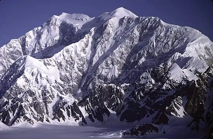
- ^A Fairweather Mountain is the officially gazetted name, but Mount Fairweather is the common usage. Mount Fairweather is on the boundary with Alaska, with only the summit and about 1/3 of the peak's massif within British Columbia. The highest summit completely within British Columbia is Mount Waddington 4,019 m (13,186 ft) in the Pacific Ranges of the Coast Mountains.
- ^B Because it is on the Continental Divide of the Americas, Mount Columbia is in British Columbia as well as Alberta.
- ^C Nirvana is the unofficial name of this mountain and shows on alpine literature as such, as of 2008 the Canadian Government still refers to it as "unnamed peak".
- ^D This peak, which lies on the border between the two provinces, is known as Mount Caubvick in Newfoundland and Labrador and Mont D'Iberville in Quebec. The difference in heights between the Labrador and Quebec sides is not a misprint; the summit of the mountain is entirely within Labrador, about 10 m (33 ft) from the provincial border.
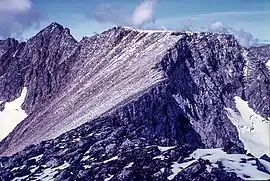
- ^E The main peak of Maple Mountain has a higher vertical rise over the surrounding landscape, 37 m (121 ft) higher than the Ishpatina Ridge rising over Scarecrow Lake.
Lowest points
Since there is no land area of Canada that is below sea level,[1] the lowest elevation of Canada is at any point along its maritime coast, and all provinces and territories except Alberta and Saskatchewan have a maritime coast. The shore of Lake Athabasca, which straddles Alberta and Saskatchewan, is Saskatchewan's lowest dry point (213 m (699 ft) above sea level). The Slave River (which drains Lake Athabasca) flows from Northeastern Alberta into the Northwest Territories and is Alberta's lowest point at the N.W.T. border (152 m (499 ft) above sea level). However, the False Creek Tunnel, part of the Canada Line rail-based transit system in Vancouver, at 29 metres below sea level, is the lowest publicly accessible point in Canada.[2] Parts of the City of Richmond are below sea-level, though behind dikes.
References
- Highest Points by Province and Territory Archived 2006-05-07 at the Wayback Machine at the Atlas of Canada
- "Archived copy". Archived from the original on 2006-06-04. Retrieved 2008-09-07.CS1 maint: archived copy as title (link)