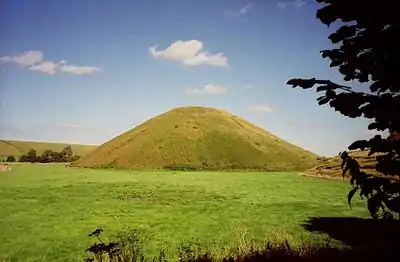
List of hills of Devon
This is a list of hills in Devon. Many of these peaks are important historical, archaeological and nature conservation sites, as well as popular hiking and tourist destinations in the county of Devon in southwest England.
Colour key
| Class | Prominence |
|---|---|
| Marilyns | 150 – 599 m |
| HuMPs | 100 – 149 m |
| TuMPs | 30 – 99 m |
| Unclassified | 0 – 29 m |
The table is colour-coded based on the classification or "listing" of the mountain or hill. The types that occur in Devon are Marilyns, HuMPs and TuMPs, listings based on topographical prominence. "Prominence" correlates strongly with the subjective significance of a summit. Peaks with low prominences are either subsidiary tops of a higher summit or relatively insignificant independent summits. Peaks with high prominences tend to be the highest points around and likely to have extraordinary views.
A Marilyn is a hill with a prominence of at least 150 metres or about 500 feet.[1] A "HuMP" (the acronym comes from "Hundred Metre Prominence) is a hill with a prominence of at least 100 but less than 150 metres.[2] In this table Marilyns are in beige and HuMPs in lilac. A "TuMP" as defined here is a hill with a prominence of at least 30 but less than 100 metres. The term "sub-Marilyn" or "sub-HuMP" is used, e.g. in the online Database of British and Irish Hills to indicate hills that fall just below the threshold. To qualify for inclusion, hills must either be 400 metres or higher with a prominence of at least 30 metres, below 400 metres with a prominence of at least 90 metres (the threshold for a sub-HuMP) or be in some other way notable.
For further information see the Lists of mountains and hills in the British Isles and the individual articles on Marilyns, HuMPs, and TuMPs; by way of contrast, see also the article listing Tumps (a traditional term meaning a hillock, mound, barrow or tumulus).
List of mountains and hills
In the UK and Ireland, a mountain is usually taken to be at least 2,000 feet high. By that definition, Devon has two mountains: High Willhays and Yes Tor.
| Hill | Height (m) | Prom. (m) | Grid ref. | Class | Parent | Range/Region | Remarks | Image |
|---|---|---|---|---|---|---|---|---|
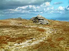
| High Willhays[3] | 621 | 537 | SX580892 | Marilyn, Simm, Hewitt, Nuttall, HuMP, TuMP, Devon county top (historical and current) | High Street[4] | Dartmoor | Devon's county top. Highest point of Dartmoor. |
 |
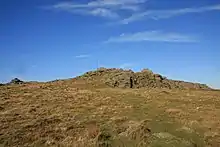
| Yes Tor[3] | 619 | 24 | SX580901 | Sub-Simm, Nuttall, Buxton & Lewis | High Willhays | Dartmoor | Second highest point on Dartmoor. Trig point on rock tor at summit. Mountain. |
 |
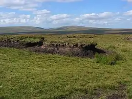
| Cut Hill[3] | 603 | 90 | SX598827 | Simm, Dewey, Sub-HuMP, TuMP | High Willhays | Dartmoor | Joint third highest point in Devon. Grassy mound at summit. |
 |
| Hangingstone Hill[3] | 603 | 48 | SX617861 | Simm, Dewey, TuMP | High Willhays | Dartmoor | Joint third highest point in Devon. Small cairn on mound of grass and stones 10m N of stone hut. |
 |
| Great Links Tor[3] | 589 | 112 | SX550867 | HuMP, Dewey, TuMP | High Willhays | Dartmoor | Rock by trig point. |  |
| Amicombe Hill (Kitty Tor)[3] |
585 | 36 | SX566872 | Dewey, TuMP | High Willhays | Dartmoor | Rock tor by flagpole. | 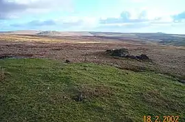 |
| Black Hill (North-West Dartmoor)[3] | 584 | 23 | SX604846 | Sub-Dewey | High Willhays | Dartmoor | Small cairn on flat summit area. |  |
| Cosdon Hill[3] | 550 | 82 | SX636915 | Dewey, TuMP | High Willhays | Dartmoor | Summit at rim of hollow 8m NW of trig point. |  |
| Brown's House Top[3] | 539 | 27 | SX614804 | Sub-Dewey | High Willhays | Dartmoor | Flat, grassy summit. |  |
| Great Mis Tor[3] | 538 | 81 | SX562769 | Dewey, TuMP | High Willhays | Dartmoor | Summit marked by rock next to range warning flagpole on rock tor. |  |
| Sittaford Tor[3] | 538 | 22 | SX633830 | sub-Dewey | High Willhays | Dartmoor | Grassy mound at summit. |  |
| Hameldown, Hamel Down[3] |
532 | 97 | SX705799 | Dewey, sub-HuMP, TuMP | High Willhays | Dartmoor | Summit is on rim of hollowed tumulus 8m from modern stone sign. Trig point, 700m away, is 2m lower. | 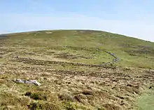 |
| Steeperton Tor[3] | 532 | 31 | SX618887 | Dewey, TuMP | High Willhays | Dartmoor | Summit on top of rock tor. |  |
| Hare Tor[3] | 531 | 26 | SX550842 | Sub-Dewey | High Willhays | Dartmoor | Summit on ground by concreted iron ring about 2m from flagpole. |  |
| Higher White Tor[3] | 527 | 49 | SX619785 | Dewey, TuMP | High Willhays | Dartmoor | Summit cairn. |  |
| North Hessary Tor[3] | 517 | 63 | SX578742 | Dewey, TuMP | High Willhays | Dartmoor | Trig point at summit on rock tor. |  |
| Ryder's Hill[3] | 515 | 109 | SX659690 | Dewey, HuMP, TuMP | High Willhays | Dartmoor | Summit on embedded rock 2 m from trig point. |  |
| Beardown Tors[3] | 513 | 32 | SX602773 | Dewey, TuMP | High Willhays | Dartmoor | Summit at SE top of W rock tor. |  |
| East Mill Tor[3] | 513 | 26 | SX599898 | Sub-Dewey | High Willhays | Dartmoor | Flat rock slab summit. |  |
| White Ridge[3] | 506 | 50 | SX648821 | Dewey, TuMP | High Willhays | Dartmoor | Featureless summit. |  |
| Assycombe Hill[3] | 497 | 56 | SX665820 | TuMP | High Willhays | Dartmoor | Edge of Fernworthy Forest. Stone rows and other signs of ancient settlement. |  |
| Hookney Tor[3] | 497 | 22 | SX699813 | Unclassified | High Willhays | Dartmoor | On the Two Moors Way. |  |
| Hound Tor[3] | 495 | 20 | SS732368 | Unclassified | High Willhays | Dartmoor | Tor close to track between Hangingstone Hill and Cosdon Hill |  |
| Five Barrows Hill[3] | 493 | 81 | SX628890 | TuMP | Dunkery Beacon | Exmoor | Summit is 2m N of trig point on tumulus |  |
| Penn Moor[3] | 493 | 41 | SX602645 | TuMP | High Willhays | Dartmoor | Summit about 100m NNE of trig point. |  |
| Birch Tor[3] | 487 | 35 | SX686815 | TuMP | High Willhays | Dartmoor | Tor on open moorland. Two Moors Way runs past the summit aboutg 300m to the N. |
 |
| Quickbeam Hill[3] | 481 | 35 | SX653654 | TuMP | High Willhays | Dartmoor | Open summit with tumulus and Petre's Cross Two Moors Way circles the summit from SW to NE; a track branches off to the summit. Extensive signs of ancient settlement, including cairn circle, barrows, crosses and a "blowing house" |
 |
| Belstone Tor[3] | 479 | 47 | SX614920 | TuMP | High Willhays | Dartmoor | Tor on open moorland summit surrounded by crags Irishman's Wall runs past about 100m to the south; a N-S track passes the summit about 400m to the W. |
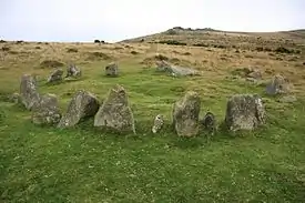 |
| Rippon Tor[3] | 476 | 118 | SX746755 | HuMP | High Willhays | Dartmoor | Summit is the slab of rock 4m ENE of trig point Car park on B3387 about 600 m N of the summit. |
 |
| Shoulsbarrow Common[3] | 476 | 118 | SS709392 | TuMP | Dunkery Beacon | Exmoor | Summit at fence junction A hillfort, Shoulsbury Castle lies on the western slopes of the hill |
 |
Notes
- Parts of Dartmoor are military training areas which means the peaks in these areas are only accessible to the public at certain times.
- The following summit(s) have been omitted from the table as they are sub-peaks, as per the UIAA definition[5] or alternative names of hills in the main list:
- Whitehorse Hill (601m), Dartmoor, subpeak of Hangingstone Hill 600 m to the N.
See also
- List of mountains and hills of the United Kingdom
- List of Marilyns in England
References and footnotes
- Dawson, Alan (1992). The Relative Hills of Britain. Milnthorpe: Cicerone Press. ISBN 1-85284-068-4. Archived from the original on 2010-09-21.
- Jackson, Mark. "More Relative Hills of Britain" (PDF). Relative Hills of Britain. Archived from the original (PDF) on 12 October 2013. Retrieved 31 March 2013.
- Name, height, prominence, grid and class data from: Database of British and Irish Hills, retrieved 8-9 Jul 2016. Also parent data and summit description unless otherwise stated.
- Jackson, Mark (2009). More Relative Hills of Britain, Marilyn News Centre, UK.
- The UIAA classify peaks with a drop of less than 30m as subpeaks.
