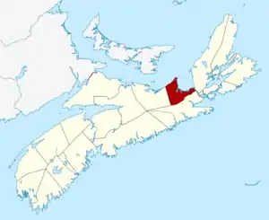
List of historic places in Antigonish County, Nova Scotia
List of historic places
| Name | Address | Coordinates | IDF | IDP | IDM | Image | |
|---|---|---|---|---|---|---|---|
| Antigonish County Court House National Historic Site of Canada | 170 Main Street, Antigonish, NS | 45°37′00″N 62°00′00″W | 7354 |  | |||
| Leonard Carey Archibald House | 40 Old South River Road, Antigonish, NS | 45°37′13″N 61°58′42″W | 15208 |  | |||
| Bayfield School | 588 Bayfield Road, Bayfield, NS | 45°37′44″N 61°44′47″W | 15668 |  | |||
| Cape George Heritage School Museum | 5758 Highway 337, Cape George, NS | 45°51′05″N 61°55′40″W | 14585 |  | |||
| Cape George Lighthouse | Highway 337, Cape George, NS | 45°52′27″N 61°54′01″W | 20718 | ||||
| Holy Rosary Church | 6205 Highway #337, Ballantynes Cove, NS | 45°51′28″N 61°55′32″W | 15401 |  | |||
| Kings United Church | 21 Copper Lake Road, Loch Katrine, NS | 45°24′57″N 61°57′03″W | 14084 |  | |||
| Kirk Place | 219 Main Street, Antigonish, NS | 45°37′21″N 61°59′22″W | 6804 |  | |||
| Captain MacDougall House | 12559 Havre Boucher Road, Havre Boucher, NS | 45°39′20″N 61°31′31″W | 15185 |  | |||
| Bard John MacLean Cemetery | No. 4 Highway, Glen Bard, NS | 45°20′33″N 62°05′27″W | 7331 |  | |||
| MacPhee House | 1550 Highway 7, North Lochaber, NS | 45°27′17″N 62°00′42″W | 15102 |  | |||
| Manson House | Highway #7, North Lochaber, NS | 45°26′49″N 62°00′52″W | 5235 | 15167 |  | ||
| Pettipas House | 9707 Highway 4, Tracadie, NS | 45°37′15″N 61°38′14″W | 15043 |  | |||
| St. George's Church | 9415 Highway 337, Georgeville, NS | 45°49′27″N 62°01′25″W | 14171 |  | |||
| St. Joseph's Glebe House | 2733 Addington Forks Road, St. Joseph, NS | 45°32′21″N 62°04′39″W | 4237 | 15207 |  | ||
| St. Margaret's Church | 5559 Highway 245, Arisaig, NS | 45°46′31″N 62°09′57″W | 15384 |  | |||
| Saint Ninian's Cathedral | 121 Saint Ninian's Street, Antigonish, NS | 45°37′12″N 61°59′37″W | 4600 |  More images | |||
| St. Peter's Roman Catholic Church | 9676 Highway #4, Tracadie, NS | 45°37′25″N 61°38′26″W | 7337 | 15390 |  | ||
| Tracadie United Baptist Church | 274 Highway 16; RR#1, Monastery, NS | 45°34′54″N 61°35′19″W | 15181 |  |
See also
This article is issued from Wikipedia. The text is licensed under Creative Commons - Attribution - Sharealike. Additional terms may apply for the media files.
