List of historic places in Kings County, New Brunswick
This article is a list of historic places in Kings County, New Brunswick entered on the Canadian Register of Historic Places, whether they are federal, provincial, or municipal.
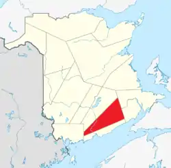
List of historic places
| Name | Address | Coordinates | IDF | IDP | IDM | Image | |
|---|---|---|---|---|---|---|---|
| Alwington Manor | 15 Station Road, Grand Bay-Westfield, NB | 45°20′52″N 66°13′26″W | 19338 |  | |||
| Anglican Church of the Resurrection | 20 MacDonald Avenue, Grand Bay-Westfield, NB | 45°18′26″N 66°11′48″W | 19332 | | |||
| Arnold House | 811 Main Street, Sussex, NB | 45°43′16″N 65°30′04″W | 10327 | | |||
| Belleview Hotel | 15 Station Road, Rothesay, NB | 45°23′21″N 65°59′55″W | 6977 | | |||
| Black Loyalist Land Grants | Douglas Street, Grand Bay-Westfield, NB | 45°21′17″N 66°14′48″W | 19312 | | |||
| Black-Palmer Residence | 65 Church Street, Sussex, NB | 45°43′16″N 65°30′38″W | 10322 | | |||
| Brenan House | 3189 Rothesay Road, Rothesay, NB | 45°23′09″N 65°59′51″W | 7083 | | |||
| 9 Brittain Road | 9 Brittain Road, Grand Bay-Westfield, NB | 45°23′49″N 66°17′30″W | 18368 | | |||
| Brock House | 10 Maiden Lane, Rothesay, NB | 45°23′07″N 65°59′42″W | 10260 | | |||
| Brooks Residence | 148 Maple Avenue, Sussex, NB | 45°43′35″N 65°30′15″W | 8706 | | |||
| Church Avenue Fountain | 135 Church Avenue, Sussex, NB | 45°43′08″N 65°30′37″W | 8697 | | |||
| 8 Church Avenue | 8 Church Avenue, Rothesay, NB | 45°23′23″N 65°59′44″W | 7049 | | |||
| Cleasby | 4 Allison Drive, Rothesay, NB | 45°22′41″N 65°59′43″W | 10218 | | |||
| George W. Crawford House | 2 Brundage Point Road, Grand Bay-Westfield, NB | 45°20′55″N 66°13′30″W | 19343 | | |||
| Crosby House | 3197 Rothesay Road, Rothesay, NB | 45°23′10″N 65°59′52″W | 7074 | | |||
| Depot Hotel | 1 Queen Street, Sussex, NB | 45°43′22″N 65°30′50″W | 8714 | | |||
| Diadema White House | 177 Church Street, Sussex, NB | 45°43′02″N 65°30′33″W | 10307 | | |||
| Dominion Building | 524 Main Street, Sussex, NB | 45°43′25″N 65°30′40″W | 8711 | | |||
| Duart Hall | 19 Station Road, Rothesay, NB | 45°23′24″N 65°59′55″W | 6978 | | |||
| Fairweather Residence | 170 Church Avenue, Sussex, NB | 45°43′04″N 65°30′31″W | 8708 | | |||
| Firshade | 3000 Rothesay Road, Rothesay, NB | 45°22′49″N 65°59′46″W | 7051 | | |||
| Forbes Residence | 60 Essex Street, Sussex, NB | 45°43′23″N 65°31′09″W | 10336 | | |||
| Fort Nerepis National Historic Site of Canada | Woodman's Point Road, Grand Bay-Westfield, NB | 45°22′13″N 66°14′03″W | 13166 | 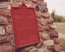 | |||
| 42 Gondola Point Road | 42 Gondola Point Road, Rothesay, NB | 45°23′32″N 65°59′49″W | 7107 | | |||
| Gunn House | 201 St George Street, Sussex, NB | 45°43′17″N 65°31′24″W | 10325 | | |||
| Hampton Gaol (Jail) | 17 Centennial Rd., Hampton, NB | 45°31′35″N 65°49′35″W | 5735 | 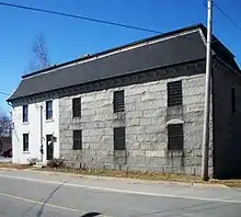 | |||
| 18 Hampton Road | 18 Hampton Road, Rothesay, NB | 45°23′19″N 65°59′39″W | 7025 | | |||
| Intercolonial Railway Station | Broad Street, Sussex, NB | 45°43′21″N 65°30′47″W | 6887 | 8712 | | ||
| Jonah Residence | 977 Main Street, Sussex, NB | 45°43′03″N 65°29′40″W | 10305 | | |||
| Kennebecasis Rowing Sculpture | Rothesay Road, Rothesay, NB | 45°22′22″N 66°00′35″W | 10246 | | |||
| Kings County Court House | 648 Main Street, Hampton, NB | 45°31′35″N 65°49′37″W | 12896 | 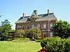 | |||
| Kingston Historic District | Crossroads of Routes 845 and 850, Kingston, NB | 45°30′10″N 65°58′30″W | 7438 | | |||
| Kirkhill Cemetery | Duke Street, Sussex, NB | 45°43′37″N 65°31′05″W | 8704 | | |||
| Kirtley-Hayter Homestead | 171 Woolastook Drive, Grand Bay-Westfield, NB | 45°19′07″N 66°11′58″W | 19339 | | |||
| The Knoll | 7 Knoll Lane, Rothesay, NB | 45°23′07″N 65°59′30″W | 10221 | | |||
| Lewin House | 25 Gondola Point Road, Rothesay, NB | 45°23′24″N 65°59′52″W | 7048 | | |||
| Lingley Family Homestead | 2 Mallard Drive, Grand Bay-Westfield, NB | 45°21′46″N 66°14′39″W | 19341 | | |||
| McKnight House | 155 Green Road, Rothesay, NB | 45°22′30″N 65°59′54″W | 10244 | | |||
| Mount Hope Cemetery | 700 Nerepis Road, Grand Bay-Westfield, NB | 45°23′50″N 66°18′03″W | 18341 | | |||
| Mount Hope Farm | 690 Nerepis Road, Grand Bay-Westfield, NB | 45°23′48″N 66°17′56″W | 1250 | | |||
| Nase Cemetery | Next to 273 Nerepis Road, Grand Bay-Westfield, NB | 45°21′26″N 66°14′15″W | 18363 | | |||
| Nerepis School Site | 670 Nerepis Road, Grand Bay-Westfield, NB | 45°23′48″N 66°17′41″W | 18342 | | |||
| 33 Nerepis Road | 33 Nerepis Road, Grand Bay-Westfield, NB | 45°20′05″N 66°12′59″W | 18385 | | |||
| 34 Nerepis Road | 34 Nerepis Road, Grand Bay-Westfield, NB | 45°20′08″N 66°12′56″W | 18362 | | |||
| 52 Nerepis Road | 52 Nerepis Road, Grand Bay-Westfield, NB | 45°20′12″N 66°13′00″W | 18386 | | |||
| 525 Nerepis Road | 525 Nerepis Road, Grand Bay-Westfield, NB | 45°22′46″N 66°16′21″W | 18387 | | |||
| Old Crosby House | 28 Gondola Point Road, Rothesay, NB | 45°23′26″N 65°59′49″W | 6973 | | |||
| Old MacDougall Residence | 197 Church Avenue, Sussex, NB | 45°43′00″N 65°30′35″W | 8709 | | |||
| Old Medical Clinic | 12 Gondola Point Road, Rothesay, NB | 45°23′19″N 65°59′50″W | 7014 | | |||
| Old Portage Trail | 633 Nerepis Road, Grand Bay-Westfield, NB | 45°23′20″N 66°17′05″W | 19335 | | |||
| Our Lady of Perpetual Help Catholic Church | 33 Gondola Point Road, Rothesay, NB | 45°23′27″N 65°59′52″W | 7024 | | |||
| Pamdenec Summer Community | Pamdenec Road, Grand Bay-Westfield, NB | 45°18′58″N 66°11′30″W | 18364 | | |||
| Porter House | 156 Nerepis Road, Grand Bay-Westfield, NB | 45°20′41″N 66°13′28″W | 19330 | | |||
| Purd's | 64 Gondola Point Road, Rothesay, NB | 45°23′42″N 65°59′48″W | 10219 | | |||
| 192 River Valley Drive | 192 River Valley Drive, Grand Bay-Westfield, NB | 45°18′08″N 66°11′42″W | 18388 | | |||
| 241 River Valley Drive | 241 River Valley Drive, Grand Bay-Westfield, NB | 45°18′15″N 66°11′42″W | 19344 | | |||
| Rothesay Common | bordered by Gondola Point Road, Old Hampton Road, and Church Avenue, Rothesay, NB | 45°23′19″N 65°59′46″W | 6975 | | |||
| Rothesay Netherwood School | 40 College Hill Road, Rothesay, NB | 45°22′49″N 65°59′30″W | 7456 | | |||
| Rothesay Railway Station (European and North American) National Historic Site of Canada | near Rothesay Road and Tennis Court Road, Rothesay, NB | 45°23′00″N 66°00′00″W | 7546 | 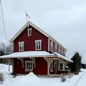 | |||
| 3218 Rothesay Road | 3218 Rothesay Road, Rothesay, NB | 45°23′12″N 65°59′47″W | 6976 | | |||
| St. Augustine's Roman Catholic Church | 279 Nerepis Road, Grand Bay-Westfield, NB | 45°21′34″N 66°14′23″W | 18366 | | |||
| Saint David's United Church | 7 Gondola Point Road, Rothesay, NB | 45°23′17″N 65°59′51″W | 7012 | | |||
| St. James Anglican Cemetery | Nerepis Road, Grand Bay-Westfield, NB | 45°21′03″N 66°13′53″W | 19336 | | |||
| St. Luke's Anglican Church National Historic Site of Canada | 12 Quispamsis Road, Quispamsis, NB | 45°26′57″N 65°58′33″W | 13555 | | |||
| Saint Paul's Anglican Church | 6 Church Avenue, Rothesay, NB | 45°23′22″N 65°59′43″W | 7149 | | |||
| Sand Point Lighthouse | Sand Point Wharf Road, Grand Bay-Westfield, NB | 45°20′33″N 66°11′57″W | 20933 | | |||
| Satalic House | 11 Station Road, Rothesay, NB | 45°23′19″N 65°59′55″W | 7006 | | |||
| Shadow Lawn | 3180 Rothesay Road, Rothesay, NB | 45°23′08″N 65°59′47″W | 7073 | | |||
| Sharp's Corner Drug Store | 3 Broad Street, Sussex, NB | 45°43′24″N 65°30′42″W | 8716 | | |||
| Slipp/Deichmann/Wallace Residence | 34 Sunnyside Drive, Sussex, NB | 45°43′35″N 65°31′17″W | 8715 | | |||
| Squarebriggs Residence | 2 Paradise Row, Sussex, NB | 45°43′18″N 65°31′01″W | 10320 | | |||
| 3 Station Road | 3 Station Road, Rothesay, NB | 45°23′15″N 65°59′55″W | 7009 | | |||
| Stevens Family Cemetery | Brandy Crescent, Grand Bay-Westfield, NB | 45°19′43″N 66°12′11″W | 19334 | | |||
| Stevens Homestead | 268 Woolastook Drive, Grand Bay-Westfield, NB | 45°19′28″N 66°12′13″W | 19333 | | |||
| Stoneycroft | 255 Hampton Road, Quispamsis, NB | 45°24′35″N 65°57′47″W | 10067 | | |||
| Strathnaver | 3105 Rothesay Road, Rothesay, NB | 45°23′00″N 65°59′50″W | 10216 | | |||
| Sussex Ginger Ale Factory | 67 Pleasant Avenue, Sussex, NB | 45°43′13″N 65°30′45″W | 8696 | | |||
| Sutherland Residence | 387 Main Street, Sussex, NB | 45°43′25″N 65°31′04″W | 10339 | | |||
| Trinity Anglican Church | 857 Main Street, Sussex, NB | 45°43′12″N 65°29′59″W | 8713 | | |||
| Trinity Church and Rectory National Historic Site of Canada | , Kingston, NB | 45°30′09″N 65°58′33″W | 12087 | 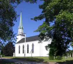 | |||
| Wallace Twins Houses | 376 and 380 Main Street, Sussex, NB | 45°25′27″N 65°31′06″W | 10338 | | |||
| Westfield Beach | , Grand Bay-Westfield, NB | 45°21′17″N 66°14′05″W | 18367 | | |||
| Westfield Golf and Country Club | 8 Golf Club Road, Grand Bay-Westfield, NB | 45°20′12″N 66°13′17″W | 18365 | | |||
| Westfield United Church | 268 Woolastook Drive, Grand Bay-Westfield, NB | 45°20′30″N 66°13′19″W | 19329 | | |||
| Westfield Wharf Site | , Grand Bay-Westfield, NB | 45°20′56″N 66°13′27″W | 18361 | 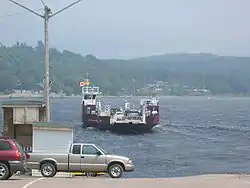 | |||
| Williamson Residence | 371 Main Street, Sussex, NB | 45°43′26″N 65°31′07″W | 10341 | | |||
| Wolastoq National Historic Site of Canada | Entire watershed of Saint John River, central and western New Brunswick, parts of southeastern Quebec, NB | 45°20′24″N 66°12′20″W | 18954 | 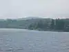 More images |
See also
| Wikimedia Commons has media related to Cultural heritage monuments in New Brunswick. |
This article is issued from Wikipedia. The text is licensed under Creative Commons - Attribution - Sharealike. Additional terms may apply for the media files.
