Kings County, New Brunswick
Kings County (2016 population 68,941[1]) is located in southern New Brunswick, Canada. Its historical shire town is Hampton.
Kings | |
|---|---|
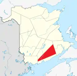 Location within New Brunswick. | |
| Country | |
| Province | |
| Established | 1785 |
| Electoral Districts Federal | Fundy Royal / New Brunswick Southwest |
| Area | |
| • Land | 3,484.22 km2 (1,345.26 sq mi) |
| Population (2016)[1] | |
| • Total | 68,941 |
| • Density | 19.8/km2 (51/sq mi) |
| • Change 2011-2016 | |
| • Dwellings | 29,570 |
| Time zone | UTC-4 (AST) |
| • Summer (DST) | UTC-3 (ADT) |
| Area code(s) | 506 |
| Wikimedia Commons has media related to Kings County, New Brunswick. |
Both the Saint John and Kennebecasis rivers pass through the county.
Approximately half of the Kings County population lives in suburbs of the nearby city of Saint John.
Census subdivisions
Communities
There are seven municipalities within Kings County (listed by 2016 population):[2]
| Official Name | Designation | Area km2 | Population | Parish |
|---|---|---|---|---|
| Quispamsis | Town | 57.21 | 18,245 | Rothesay |
| Rothesay | Town | 34.72 | 11,659 | Rothesay |
| Grand Bay-Westfield | Town | 59.78 | 4,964 | Westfield |
| Hampton | Town | 21.09 | 4,289 | Hampton |
| Sussex | Town | 8.95 | 4,282 | Sussex |
| Sussex Corner | Village | 9.34 | 1,461 | Sussex |
| Norton | Village | 75.35 | 1,382 | Norton |
Parishes
The county is subdivided into fifteen parishes (listed by 2016 population):[2]
| Official Name | Area km2 | Population | Municipalities | Unincorporated communities |
|---|---|---|---|---|
| Studholm | 449.37 | 3,522 | Berwick / Carsonville / Centreville / Collina / Fox Hill / Gibbon / Gibbon Mountain / Head of Millstream / Jordan Mountain / Kierstead Mountain / Kings / Lower Millstream / Marrtown / McGregor Brook / Mount Hebron / Mount Middleton / Mount Pisgah / Newtown / Parleeville / Pearsonville / Pleasant Ridge / Plumweseep / Prescott Hill / Roachville / Sharps Hill / Smiths Creek / Snider Mountain / Studholm / Summerfield / Thompson Corner | |
| Kingston | 200.69 | 2,913 | Bedford / Centreton / Chapel Grove / Clifton Royal / East Riverside-Kinghurst / Elmhurst / Erbs Cove / Grays Mills / Grey Mills / Kingston / Kingston Corner / Kingston Creek / Long Reach / Lower Kingston / Moss Glen / Perry Point / Renforth / Shampers / The Cedars / Waltons Lake / Whitehead / Whites Mills | |
| Hampton | 121.26 | 2,809 | Hampton (town) | Bonney Road / Damascus / Darlings Island / French Village / Hampton / Lakeside / Mount Prospect / Nauwigewauk / Smithtown / Titusville |
| Sussex | 244.02 | 2,516 | Sussex (town) Sussex Corner (village) |
Apohaqui / Campbell Settlement / Cassidy Lake / Drurys Cove / Dutch Valley / Erb Settlement / Hazel Hill / Jeffries Corner / Lisson Settlement / Lower Cove / Markhamville / McCain Settlement / Millbrook / New Line Road / Ratter Corner / Riverbank / Rockville / Southfield / Upper Wards Creek / Vinegar Hill / Wards Creek |
| Westfield | 295.70 | 1,962 | Grand Bay-Westfield (town) | Bayswater / Carters Point / Cheyne Settlement / Days Landing / Hardings Point / Keatings Corner / Lands End / Milkish / Morrisdale / Nerepis / Public Landing / Sand Point / Summerville / Woodmans Point |
| Springfield | 248.54 | 1,525 | Belleisle Creek / Bull Moose Hill / East Scotch Settlement / Elm Brook / Hatfield Point / Irish Settlement / Joliffs Brook / Keirsteadville / Long Point / Lower Midland / Midland / Northrups Corner / Pascobac / Searsville / Springfield / Stewarton / The Grant / Upper Belleisle / Upper Midland / West Scotch Settlement | |
| Cardwell | 311.90 | 1,353 | Anagance / Buckley Settlement / Cardwell / Crockets Corner / Dunsinane / Five Points / Harper Settlement / Lindys / McCully / Mechanic Settlement / Penobsquis / Picadilly / Portage Vale / South Branch / Springdale / Upper Goshen | |
| Norton | 144.76 | 1,301 | Norton (village) | Bloomfield / Central Norton / Guthrie Road / Ketchum Road / Passekeag / Woodpecker Hall |
| Upham | 189.22 | 1,269 | Barnesville / Bloomfield Ridge / Clover Hill / Hanford Brook / Salina / Salt Springs / Upham / Upper Salt Springs / Upperton | |
| Havelock | 349.23 | 1,061 | Anagance Ridge / Canaan Road / Cornhill / Cornhill East / Cosman Settlement / Creek Road / Dubee Settlement / Havelock / Knightville / Lower Ridge / Mannhurst / Perry Settlement / Salem / Samp Hill / Springhill / Whites Mountain | |
| Greenwich | 114.46 | 1,058 | Browns Corner / Browns Flat / Central Greenwich / Cochrane Corner / Days Corner / Evandale / Glenwood / Greenwich Hill / Johnson Croft / Lynch Corner / Oak Point / Upper Greenwich / Victoria Beach | |
| Waterford | 221.27 | 469 | Cedar Camp / Chambers Settlement / Donegal / Parlee Brook / Urney / Walker Settlement / Waterford | |
| Kars | 75.84 | 325 | Beulah / Earle Wharf / Kars / Lower Kars / Tennants Cove | |
| Rothesay | 7.26 | 325 | Quispamsis (town) Rothesay (town) |
Barsa / Bradley Lake / East Riverside-Kinghurst / Fairvale / Golden Grove / Hillhurst / Hunter Lake-Upper Hunter Lake Road / Kennebecasis Park / Renforth / Torryburn / Wells |
| Hammond | 244.45 | 251 | Devine Corner / Hammond / Hammondvale / Hilldale / Hillsdale / Londonderry / Poodiac |
Demographics
|
Mother tongue (2016)[1]
|
Protected areas and attractions
Notable people
Although not everyone in this list was born in Kings County, they all live or have lived in Kings County and have had significant connections to the communities.
References
- "Census Profile, 2016 Census: Kings, County [Census division], New Brunswick". Statistics Canada. Retrieved September 15, 2019.
- "Census Profile, 2016 Census - Select Region 1". Statistics Canada. Retrieved September 16, 2019.
- Statistics Canada: 1996, 2001, 2006 census
- 2011 Statistics Canada Census Profile: Kings County, New Brunswick
External links
Places adjacent to Kings County, New Brunswick | |
|---|---|
| Subdivisions | |
|---|---|
| Cities | |
| Counties | |
| |
This article is issued from Wikipedia. The text is licensed under Creative Commons - Attribution - Sharealike. Additional terms may apply for the media files.