List of numbered roads in Durham Region
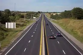
The numbered roads in the Regional Municipality of Durham account for about 832 kilometres (517 mi) of the county road system in the Canadian province of Ontario. The Durham Region Works Department owns and maintains the regional roads and regional highways, while the Ministry of Transportation of Ontario (MTO) owns and maintains the King's Highways in the region. The 67 (7 King's Highways, 4 Regional Highways, and 56 Regional Roads) numbered roads[note 1] provide access to the entirety of the region. Highway 401 forms the backbone of the region, traveling from the western boundary of the region to the eastern boundary alongside Lake Ontario, and serving over 200,000 vehicles per day. Several provincially maintained highways existed in the region prior to 1998, when they were transferred to municipal government in the region as part of a province-wide downloading of highways. Where the regional tier of municipal government has since been responsible for these routes, they have been designated as Durham Regional Highways.
Network

The road network of the Regional Municipality of Durham consists of 832 kilometres (2,087 lane kilometres) of arterial roadway.[4] There are 60 numbered roads, referred to mostly as Regional Roads, though four former King's Highways are referred to as Regional Highways, where they are now owned and maintained by the region.[5]
In addition to the roads, there are 209 bridge and culvert structures currently maintained by the region.[4] The region is not responsible for the bridges over and under Highway 401, Highway 407 and Highway 412 nor the bridges over and under Highway 35/115 or, all of which are maintained by the MTO. The region is also exempt from the construction and maintenance of bridges crossed by railway, but not from bridges which separate road and rail crossings.
History
The regional municipality of Durham was created in 1974 by the merger of portions of Durham and Ontario counties.[6]
Structures
The Regional Municipality of Durham is responsible for the maintenance of both pavement as well as many structures that are over, under, or near the pavement. Bridges, culverts, and traffic signals are all built and maintained by the Works Department.
Services
The Durham Regional Police Service Traffic Enforcement unit handles enforcement of traffic laws, except on the King's Highways, which are patrolled by the Ontario Provincial Police. Speed limits on regional roads vary between 50 and 80 kilometres per hour. Police in Durham will generally not set speed traps, as the region encourages the safe flow of traffic, and punishes unsafe driving rather than speed limits.[7] Maintenance and snow clearing is performed by the Durham Works Department. Five depots operate throughout the region in addition to the traffic operations centre in Whitby.[8]
Numbered roads
Regional Highways
| Route | Name(s) | Western/Southern Terminus | Eastern/Northern Terminus | Length | Communities | Comments | ||
|---|---|---|---|---|---|---|---|---|
|
Kingston Road, Dundas Street West, King Avenue | Toronto–Durham boundary | Durham–Northumberland boundary | 43 km (27 mi) [Map 1] [Map 2] [Map 3] [Map 4] |
Pickering, Ajax, Whitby, Bowmanville, Newcastle | Formerly part of Highway 2, prior to January 1, 1998. Split into four sections; ends 800 meters east of Fothergill Court in Whitby, resumes at Regional Road 55 (Townline Road), and has two discontinuities in Clarington.[10] | ||
|
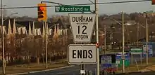
Brock Street North, Baldwin Street | Gatineau hydro corridor, south of Highway 7 (Highway 407 interchange) | 4.8 km (3.0 mi)[Map 5] | Whitby, Brooklin | Formerly part of Highway 12, prior to January 1, 1998; continues north as Highway 12, south as Brock Street | |||
|
Toronto Street South, Brock Street | 25.1 km (15.6 mi) [Map 6] [Map 7] |
Goodwood, Uxbridge | Formerly part of King's Highway 47, prior to April 1, 1997. Continues west as Regional Road 40. Discontinuous between First Avenue/Marietta Street and Fourth Avenue in Uxbridge. | ||||
|
- | Durham–Kawartha Lakes boundary | 6.6 km (4.1 mi)[Map 8] | Talbot | Formerly part of King's Highway 48. Continues east as Kawartha Lakes Road 48. |
Regional Roads
| Route[5] | Name(s)[5] | Western/Southern Terminus[11] | Eastern/Northern Terminus[11] | Length | Communities | Comments | ||
|---|---|---|---|---|---|---|---|---|
|
Brock Road, Main Street | Montgomery Park Road | 46.2 km (28.7 mi) [Map 9] [Map 10] |
Pickering, Uxbridge, Leaskdale, Udora | ||||
|
Simcoe Street, Durham–Victoria Boundary Road | Harbour Road (former Durham Regional Road 62) | Brock Concession Road 14 | 49 km (30 mi) [Map 11] [Map 12] |
Oshawa, Columbus, Raglan, Port Perry, Seagrave, Sonya, Manilla | Signed as Kawartha Lakes Road 2 between Seagrave and Manilla, where the road is maintained by the City of Kawartha Lakes under a boundary road agreement.[4][12] Used originally by the Mississauga Indians to get to Osler Marsh.[13] Later became the main highway to Port Perry, and was later extended to Beaverton.[14] In the 1840s, Abram Farewell proposed maintaining the road with tolls, which were ultimately never imposed.[15] | ||
|
Brock Street West, Centre Street, Fairbanks Street | 1.8 km (1.1 mi) [Map 13] |
Oshawa | |||||
|
Winchester Road, Grandview Street North, Columbus Road, Darlington Concession 8 | 19.8 km (12.3 mi) [Map 14] |
Brooklin, Enniskillen | |||||
|
Taunton Road | 48.1 km (29.9 mi) [Map 15] |
Pickering, Ajax, Whitby, Oshawa, Clarington | Continues west as Steeles Avenue into Toronto | ||||
|
Central Street, Pickering Concession 9, Myrtle Road, Raglan Road | 24.4 km (15.2 mi) [Map 16] |
Pickering, Claremont, Whitby, Oshawa | |||||
|
Saintfield Road | 7.0 km (4.3 mi) [Map 17] |
Seagrave | |||||
|
Island Road | Hood Road / Carnegie Beach Drive | 11.5 km (7.1 mi) [Map 18] |
Passes through the Mississaugas of Scugog Island First Nation reserve, and by the Great Blue Heron Casino.[16] | ||||
|
Brock Street West, Main Street South, Reach Street | 26.1 km (16.2 mi) [Map 19] [Map 20] |
Uxbridge, Epsom, Port Perry, Ontario | |||||
|
Ganaraska Road | Durham–Northumberberland boundary | 9.9 km (6.2 mi) [Map 21] |
Kendal | ||||
|
River Street | 5.7 km (3.5 mi) [Map 22] |
Sunderland | |||||
|
Sandford Road | 12.1 km (7.5 mi) [Map 23] |
Sandford | Continues west into York Region as Herald Road and Green Lane | ||||
|
Cameron Street | 7.1 km (4.4 mi) [Map 24] |
Cannington | |||||
|
Zephyr Road, Brock Concession 3 | 24.5 km (15.2 mi) [Map 25] [Map 26] |
Zephyr, Leaskdale | |||||
|
Liberty Street | 8.9 km (5.5 mi) [Map 27] |
Bowmanville, Hampton | |||||
|
Simcoe Street | Durham–Victoria Boundary Road | 8.7 km (5.4 mi) [Map 28] |
Beaverton | Continues east as Kawartha Lakes Road 8 (Glenarm Road) in the City of Kawartha Lakes | |||
|
Ritson Road | 11.3 km (7.0 mi) [Map 29] |
Oshawa | |||||
|
Mill Street, Main Street, Manvers Road | 6.3 km (3.9 mi) [Map 30] [Map 31] |
Newcastle | |||||
|
Newtonville Road | 11.9 km (7.4 mi) [Map 32] |
Newtonville, Kendal | |||||
|
Shirley Road | 11.0 km (6.8 mi) [Map 33] |
||||||
|
Mosport Road, Boundary Road, Durham Road 20 | 12.5 km (7.8 mi) [Map 34] |
||||||
|
Church Street, Goodwood Road | 18.4 km (11.4 mi) [Map 35] |
Goodwood, Utica, Manchester | Continues east as Highway 7A towards Port Perry | ||||
|
Bayly Street, Victoria Street, Bloor Street | 29.9 km (18.6 mi) [Map 36] |
Pickering, Ajax, Whitby, Oshawa | |||||
|
Lakeridge Road, Osborne Street, Mara Road | 74.4 km (46.2 mi) [Map 37] |
Ajax, Whitby, Pickering, Vallentyne, Port Bolster, Beaverton | Lakeridge Road serves as a boundary line for three-quarters of the municipalities of Durham: Ajax, Pickering, and Uxbridge to the west; Whitby, Scugog, and Brock to the east. | ||||
|
Church Street | CN rail line bridge south of |
1.0 km (0.62 mi) [Map 38] |
Ajax | Regional Road 24 designation was retired from the CN Rail line towards Regional Highway 2 (Kingston Road West) in 2015. | |||
|
Consumers Drive, Stellar Drive, Champlain Avenue | Brock Street | 5.1 km (3.2 mi) [Map 39] [Map 40] |
Whitby, Oshawa | ||||
|
Champlain Avenue | 1.7 km (1.1 mi) [Map 41] |
Whitby, Oshawa | |||||
|
Thickson Road | 15.3 km (9.5 mi) [Map 42] |
Whitby, Brooklin | |||||
|
Altona Road | 10.5 km (6.5 mi) [Map 43] |
Pickering, Whitevale | |||||
|
Rossland Road | 9.9 km (6.2 mi) [Map 44] |
Whitby, Oshawa | |||||
|
Liverpool Road | 2.0 km (1.2 mi) [Map 45] |
Pickering | |||||
|
York–Durham Line | 18.4 km (11.4 mi) [Map 46] |
Stouffville, Mount Albert | Continues east as | ||||
|
Westney Road | Uxbridge-Pickering Townline | 18.7 km (11.6 mi) [Map 47] |
Ajax, Greenwood | Continues northward as Concession Road 6 | |||
|
Harmony Road | 10.3 km (6.4 mi) [Map 48] |
Oshawa | |||||
|
Courtice Road, Enfield Road | 14.7 km (9.1 mi) [Map 49] [Map 50] |
Courtice | |||||
|
Wilson Road | 6.2 km (3.9 mi) [Map 51] |
Oshawa | |||||
|
Hopkins Street, Anderson Street | 3.7 km (2.3 mi) [Map 52] |
Whitby | |||||
|
Finch Avenue | 5.8 km (3.6 mi) [Map 53] |
Pickering | |||||
|
Whites Road | Petticoat Creek Conservation Area | 7.6 km (4.7 mi) [Map 54] |
Pickering | ||||
|
Scott Concession 3, Durham Road 39 | 10.1 km (6.3 mi) [Map 55] |
Zephyr | Continues south as | ||||
|
Salem Road | 6.4 km (4.0 mi) [Map 56] |
Ajax | |||||
|
Darlington–Clarke Townline | 8.1 km (5.0 mi) [Map 57] |
||||||
|
Cochrane Street | Dundas Street West | 2.1 km (1.3 mi) [Map 58] |
Whitby | ||||
|
Harwood Avenue | Lake Driveway | 4.7 km (2.9 mi) [Map 59] |
Ajax | ||||
|
Henry Street | Dundas Street West | 2.0 km (1.2 mi) [Map 60] |
Whitby | ||||
|
Brock Street South | Water Street | 1.3 km (0.81 mi) [Map 61] |
Whitby | Continues north as Durham Regional Highway 12 | |||
|
Shore Line Road | Durham–Simcoe boundary | 2.0 km (1.2 mi) [Map 62] |
|||||
|
Portage Road, Canal Road, Durham Road 50 | 5.2 km (3.2 mi) [Map 63] |
Brock | Section from Regional Road 51 to just north of Trent-Severn Waterway was the Old Highway 12 before diverting to the west. | ||||
|
Old Highway 12 / Talbot Road | Talbot River | 0.190 km (0.118 mi) [Map 64] |
Brechin, Ontario, Beaverton, Ontario | Continues south as Regional Road 50 and north as Simcoe County Road 51. Original route of Ontario Highway 12 over Talbot River before being re-routed to the west. Road ends where bridge crossing beyond Durham Region into Simcoe County. | |||
|
Phillip Murray Avenue, Boundary Road, Thornton Road | 7.8 km (4.8 mi) [Map 65] [Map 66] [Map 67] |
Oshawa, Whitby | Split into three sections; two sections are south of Highway 401 and the Canadian National Railway, while the northern section resumes on Thornton Road at Regional Road 25A (Champlain Avenue) | ||||
|
Stevenson Road | 6.4 km (4.0 mi) [Map 68] |
Oshawa | |||||
|
Park Road | 6.4 km (4.0 mi) [Map 69] [Map 70] |
Oshawa | |||||
|
Townline Road | 5.2 km (3.2 mi) [Map 71] |
Oshawa, Courtice | |||||
|
Farewell Street | Approx. 220 m south of Harbour Road | 1.8 km (1.1 mi) [Map 72] |
Oshawa | ||||
|
Waverley Road, Martin Road, Durham Road 57, New Scugog Road, Blackstock Road, Caesarea Road, Bowmanville Avenue | Durham–Kawartha Lakes boundary | 41.9 km (26.0 mi) [Map 73] [Map 74] |
Bowmanville, Blackstock, Caesarea | Continues east as Kawartha Lakes Road 57 | |||
|
Manning Road, Adelaide Avenue | Brock Street | 10.1 km (6.3 mi) [Map 75] [Map 76] |
Whitby, Oshawa | Manning and Adelaide are separated at the Whitby–Oshawa boundary by the Mount Lawn Cemetery. Closing this gap is part of the Durham Region Transportation Master Plan.[4] There is also an environmental assessment underway for a planned eastern extension of Adelaide Avenue from | |||
|
Gibb Street, Olive Avenue | 6.6 km (4.1 mi) [Map 77] [Map 78] |
Whitby, Oshawa | Gibb Street and Olive Avenue are separated at Regional Road 2 (Simcoe Street). This corridor has been identified as a bottleneck and an environmental assessment is underway to determine a solution.[18] | ||||
|
Wentworth Street | 5.5 km (3.4 mi) [Map 79] [Map 80] |
Whitby, Oshawa | Wentworth Street is discontinuous between Stevenson Road and Park Road by the General Motors of Canada Oshawa Assembly Plant. |
~
Notes
- In Ontario, all roads are legally known as highways. However, Road is the more prevalent term for common use. The Regional Municipality of Durham Act (1990), though now superseded by the Ontario Municipal Act (2001), defines both synonymously.[1] The Ontario Municipal Act defines a highway as any road, street or bridge that is not a Provincial Highway.[2]
References
- Regional Municipality of Durham Act, ss. 1, Government of Ontario, retrieved 2009-10-06
- Ontario Municipal Act, ss. 1 (1), Government of Ontario, retrieved 2009-10-06
- Highway 401 through Oshawa re-opened, Durham Region News, June 12, 2011, retrieved 2012-08-29
- Planning Department, 2001 Durham Region Master Plan (PDF), Regional Municipality of Durham, p. 12, retrieved 2009-12-05
- Works Department, Regional Roads, Regional Municipality of Durham, archived from the original on 2011-07-22, retrieved 2009-10-06
- Ontario Back Road Atlas, MapArt, 2010, ISBN 978-1-55198-226-7
- Works Department, Traffic speed control, Regional Municipality of Durham, retrieved 2009-12-05
- Works Department, Depots, Regional Municipality of Durham, retrieved 2009-10-05
- Regional Municipality of Durham, Regional Roads List, archived from the original on 2020-06-15, retrieved 2020-06-14
- Commissioner of Works. The Regional Municipality of Durham Information Report (#2018-INFO-31) (PDF) (Report). Regional Municipality of Durham. Archived from the original (PDF) on 31 July 2019. Retrieved 23 July 2020.
- MapArt (2010), Ontario Back Road Atlas, Peter Heiler Ltd., pp. 25, 31–32, 43
- Kawartha Lakes Maintenance Priority Classification System, Policy 123-EPW-009, Schedule B and C (PDF), city of Kawartha Lakes Public Works department, November 29, 2005, pp. 1, 5, archived from the original (PDF) on July 26, 2011, retrieved 2009-11-30
- Tracey Arial, Hiking in Ontario, 2005, p. 67
- Thomas Griffith Taylor, Canada: A Study of Cool Continental Environments and Their Effect on British and French Settlement, 1950, p. 474
- Leo A. Johnson, "Farewell, Abram", Dictionary of Canadian Biography Volume XI: 1881 to 1900, 1966, p. 311
- Contact Information, Scugog First Nation, retrieved 2010-01-03
- Works Department, Adelaide Avenue Extension Class EA (PDF), Regional Municipality of Durham, retrieved 2009-10-09
- Works Department, Gibb Street / Olive Avenue Connection Analysis (PDF), Regional Municipality of Durham, retrieved 2009-10-09
Route maps
- Google (23 July 2020). "Durham Regional Highway 2 (length and route of Toronto - Whitby section)" (Map). Google Maps. Google. Retrieved 23 July 2020.
- Google (23 July 2020). "Durham Regional Highway 2 (length and route of Oshawa - Bowmanville section)" (Map). Google Maps. Google. Retrieved 23 July 2020.
- Google (23 July 2020). "Durham Regional Highway 2 (length and route of Bowmanville - Newcastle section)" (Map). Google Maps. Google. Retrieved 23 July 2020.
- Google (23 July 2020). "Durham Regional Highway 2 (length and route of Newcastle - Port Hope section)" (Map). Google Maps. Google. Retrieved 23 July 2020.
- Google (23 July 2020). "Durham Regional Highway 12 (length and route)" (Map). Google Maps. Google. Retrieved 23 July 2020.
- Google (23 July 2020). "Durham Regional Highway 47 (length and route of western section)" (Map). Google Maps. Google. Retrieved 23 July 2020.
- Google (23 July 2020). "Durham Regional Highway 47 (length and route of eastern section)" (Map). Google Maps. Google. Retrieved 23 July 2020.
- NAVTEQ (2010). Durham Regional Highway 48 (length and route) (Map). Cartography by NAVTEQ. Bing Maps. Retrieved 2010-01-10.
- Google (23 July 2020). "Durham Regional Road 1 (length and route of southern section)" (Map). Google Maps. Google. Retrieved 23 July 2020.
- Google (23 July 2020). "Durham Regional Road 1 (length and route of northern section)" (Map). Google Maps. Google. Retrieved 23 July 2020.
- Google (28 July 2020). "Durham Regional Road 2 (length and route of section south of R.R. 6)" (Map). Google Maps. Google. Retrieved 28 July 2020.
- Google (28 July 2020). "Durham Regional Road 2 (length and route of section north of Hwy. 7)" (Map). Google Maps. Google. Retrieved 28 July 2020.
- NAVTEQ (2010). Durham Regional Road 2A (length and route) (Map). Cartography by NAVTEQ. Bing Maps. Retrieved 2010-01-10.
- Google (23 July 2020). "Durham Regional Road 3 (length and route)" (Map). Google Maps. Google. Retrieved 23 July 2020.
- NAVTEQ (2009). Durham Regional Road 4 (length and route) (Map). Cartography by NAVTEQ. Bing Maps. Retrieved 2009-12-17.
- NAVTEQ (2010). Durham Regional Road 5 (length and route) (Map). Cartography by NAVTEQ. Bing Maps. Retrieved 2010-01-10.
- NAVTEQ (2010). Durham Regional Road 6 (length and route) (Map). Cartography by NAVTEQ. Bing Maps. Retrieved 2010-01-10.
- NAVTEQ (2010). Durham Regional Road 7 (length and route) (Map). Cartography by NAVTEQ. Bing Maps. Retrieved 2010-01-10.
- Google (23 July 2020). "Durham Regional Road 8 (length and route of western section)" (Map). Google Maps. Google. Retrieved 23 July 2020.
- Google (23 July 2020). "Durham Regional Road 8 (length and route of eastern section)" (Map). Google Maps. Google. Retrieved 23 July 2020.
- NAVTEQ (2010). Durham Regional Road 9 (length and route) (Map). Cartography by NAVTEQ. Bing Maps. Retrieved 2010-01-10.
- NAVTEQ (2009). Durham Regional Road 10 (length and route) (Map). Cartography by NAVTEQ. Bing Maps. Retrieved 2010-01-10.
- NAVTEQ (2010). Durham Regional Road 11 (length and route) (Map). Cartography by NAVTEQ. Bing Maps. Retrieved 2010-01-10.
- NAVTEQ (2010). Durham Regional Road 12 (length and route) (Map). Cartography by NAVTEQ. Bing Maps. Retrieved 2010-01-10.
- Google (23 July 2020). "Durham Regional Road 13 (length and route of western section)" (Map). Google Maps. Google. Retrieved 23 July 2020.
- Google (23 July 2020). "Durham Regional Road 13 (length and route of eastern section)" (Map). Google Maps. Google. Retrieved 23 July 2020.
- Google (23 July 2020). "Durham Regional Road 14 (length and route)" (Map). Google Maps. Google. Retrieved 23 July 2020.
- NAVTEQ (2010). Durham Regional Road 15 (length and route) (Map). Cartography by NAVTEQ. Bing Maps. Retrieved 2010-01-10.
- NAVTEQ (2010). Durham Regional Road 16 (length and route) (Map). Cartography by NAVTEQ. Bing Maps. Retrieved 2010-01-10.
- Google (23 July 2020). "Durham Regional Road 17 (length and route of southern section)" (Map). Google Maps. Google. Retrieved 23 July 2020.
- Google (23 July 2020). "Durham Regional Road 17 (length and route of northern section)" (Map). Google Maps. Google. Retrieved 23 July 2020.
- NAVTEQ (2010). Durham Regional Road 18 (length and route) (Map). Cartography by NAVTEQ. Bing Maps. Retrieved 2010-01-10.
- NAVTEQ (2010). Durham Regional Road 19 (length and route) (Map). Cartography by NAVTEQ. Bing Maps. Retrieved 2010-01-10.
- NAVTEQ (2010). Durham Regional Road 20 (length and route) (Map). Cartography by NAVTEQ. Bing Maps. Retrieved 2010-01-10.
- NAVTEQ (2010). Durham Regional Road 21 (length and route) (Map). Cartography by NAVTEQ. Bing Maps. Retrieved 2010-01-10.
- NAVTEQ (2010). Durham Regional Road 22 (length and route) (Map). Cartography by NAVTEQ. Bing Maps. Retrieved 2010-01-10.
- Google (23 July 2020). "Durham Regional Road 23 (length and route)" (Map). Google Maps. Google. Retrieved 23 July 2020.
- NAVTEQ (2010). Durham Regional Road 24 (length and route) (Map). Cartography by NAVTEQ. Bing Maps. Retrieved 2010-01-10.
- Google (22 July 2020). "Durham Regional Road 25 (length and route of western section)" (Map). Google Maps. Google. Retrieved 22 July 2020.
- Google (22 July 2020). "Durham Regional Road 25 (length and route of eastern section)" (Map). Google Maps. Google. Retrieved 22 July 2020.
- Google (22 July 2020). "Durham Regional Road 25A (length and route)" (Map). Google Maps. Google. Retrieved 22 July 2020.
- NAVTEQ (2010). Durham Regional Road 26 (length and route) (Map). Cartography by NAVTEQ. Bing Maps. Retrieved 2010-01-10.
- NAVTEQ (2010). Durham Regional Road 27 (length and route) (Map). Cartography by NAVTEQ. Bing Maps. Retrieved 2010-01-10.
- NAVTEQ (2010). Durham Regional Road 28 (length and route) (Map). Cartography by NAVTEQ. Bing Maps. Retrieved 2010-01-10.
- NAVTEQ (2010). Durham Regional Road 29 (length and route) (Map). Cartography by NAVTEQ. Bing Maps. Retrieved 2010-01-10.
- Google (28 July 2020). "Durham Regional Road 30 (length and route)" (Map). Google Maps. Google. Retrieved 28 July 2020.
- NAVTEQ (2010). Durham Regional Road 31 (length and route) (Map). Cartography by NAVTEQ. Bing Maps. Retrieved 2010-01-10.
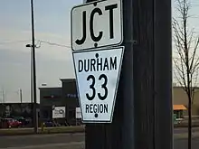
- NAVTEQ (2010). Durham Regional Road 33 (length and route) (Map). Cartography by NAVTEQ. Bing Maps. Retrieved 2010-01-10.
- Google (23 July 2020). "Durham Regional Road 34 (length and route of southern section)" (Map). Google Maps. Google. Retrieved 23 July 2020.
- Google (23 July 2020). "Durham Regional Road 34 (length and route of northern section)" (Map). Google Maps. Google. Retrieved 23 July 2020.
- NAVTEQ (2010). Durham Regional Road 35 (length and route) (Map). Cartography by NAVTEQ. Bing Maps. Retrieved 2010-01-10.
- NAVTEQ (2010). Durham Regional Road 36 (length and route) (Map). Cartography by NAVTEQ. Bing Maps. Retrieved 2010-01-10.
- Google (29 July 2020). "Durham Regional Road 37 (length and route)" (Map). Google Maps. Google. Retrieved 29 July 2020.
- NAVTEQ (2010). Durham Regional Road 38 (length and route) (Map). Cartography by NAVTEQ. Bing Maps. Retrieved 2010-01-10.
- NAVTEQ (2010). Durham Regional Road 39 (length and route) (Map). Cartography by NAVTEQ. Bing Maps. Retrieved 2010-01-10.
- Google (23 July 2020). "Durham Regional Road 41 (length and route)" (Map). Google Maps. Google. Retrieved 23 July 2020.
- NAVTEQ (2009). Durham Regional Road 42 (length and route) (Map). Cartography by NAVTEQ. Bing Maps. Retrieved 2009-12-17.
- NAVTEQ (2009). Durham Regional Road 43 (length and route) (Map). Cartography by NAVTEQ. Bing Maps. Retrieved 2009-12-17.
- NAVTEQ (2009). Durham Regional Road 44 (length and route) (Map). Cartography by NAVTEQ. Bing Maps. Retrieved 2009-12-17.
- NAVTEQ (2009). Durham Regional Road 45 (length and route) (Map). Cartography by NAVTEQ. Bing Maps. Retrieved 2009-12-17.
- NAVTEQ (2009). Durham Regional Road 46 (length and route) (Map). Cartography by NAVTEQ. Bing Maps. Retrieved 2009-12-17.
- NAVTEQ (2009). Durham Regional Road 47 (length and route) (Map). Cartography by NAVTEQ. Bing Maps.
- NAVTEQ (2009). Durham Regional Road 50 (length and route) (Map). Cartography by NAVTEQ. Bing Maps.
- Google (23 July 2020). "Durham Regional Road 51 (length and route)" (Map). Google Maps. Google. Retrieved 23 July 2020.
- Google (22 July 2020). "Durham Regional Road 52 (length and route of Phillip Murray Avenue section)" (Map). Google Maps. Google. Retrieved 22 July 2020.
- Google (22 July 2020). "Durham Regional Road 52 (length and route of Boundary Road section)" (Map). Google Maps. Google. Retrieved 22 July 2020.
- Google (22 July 2020). "Durham Regional Road 52 (length and route of Thornton Road section)" (Map). Google Maps. Google. Retrieved 22 July 2020.
- NAVTEQ (2009). Durham Regional Road 53 (length and route) (Map). Cartography by NAVTEQ. Bing Maps. Retrieved 2009-12-17.
- Google (23 July 2020). "Durham Regional Road 54 (length and route of southern section)" (Map). Google Maps. Google. Retrieved 23 July 2020.
- Google (23 July 2020). "Durham Regional Road 54 (length and route of northern section)" (Map). Google Maps. Google. Retrieved 23 July 2020.
- NAVTEQ (2009). Durham Regional Road 55 (length and route) (Map). Cartography by NAVTEQ. Bing Maps. Retrieved 2009-12-17.
- Google (29 July 2020). "Durham Regional Road 56 (length and route)" (Map). Google Maps. Google. Retrieved 29 July 2020.
- Google (23 July 2020). "Durham Regional Road 57 (length and route of Clarington - Blackstock section)" (Map). Google Maps. Google. Retrieved 23 July 2020.
- Google (23 July 2020). "Durham Regional Road 57 (length and route of Caesarea - Kawartha Lakes section)" (Map). Google Maps. Google. Retrieved 23 July 2020.
- Google (23 July 2020). "Durham Regional Road 58 (length and route of Manning Road section)" (Map). Google Maps. Google. Retrieved 23 July 2020.
- Google (23 July 2020). "Durham Regional Road 58 (length and route of Adelaide Avenue section)" (Map). Google Maps. Google. Retrieved 23 July 2020.
- Google (23 July 2020). "Durham Regional Road 59 (length and route of Gibb Street section)" (Map). Google Maps. Google. Retrieved 23 July 2020.
- Google (23 July 2020). "Durham Regional Road 59 (length and route of Olive Avenue section)" (Map). Google Maps. Google. Retrieved 23 July 2020.
- NAVTEQ (2009). Durham Regional Road 60 (length and route of eastern section) (Map). Cartography by NAVTEQ. Bing Maps. Retrieved 2009-12-11.
- NAVTEQ (2009). Durham Regional Road 60 (length and route of western section) (Map). Cartography by NAVTEQ. Bing Maps. Retrieved 2009-12-11.
| County roads | |
|---|---|
| Regional roads | |
| Municipal roads |
|
| See also | |