List of provincial highways in Ontario
Provincial highways in Ontario include all roads maintained by the Ministry of Transportation as part of the Ontario Provincial Highway Network. For sections of provincial highways that have been decommissioned, see List of former provincial highways in Ontario.
| Provincial Highway Network | |
|---|---|
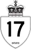 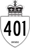  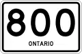 Highway markers for King's Highway 17, King's Highway 401, Secondary Highway 600, and Tertiary Highway 800 | |
| System information | |
| Maintained by MTO | |
| Length | 16,900 km[1] (10,500 mi) |
| Formed | February 26, 1920[2] |
| Highway names | |
| Types |
|
| System links | |
King's Highways
Although all roads in the provincial highway network are legally part of the King's Highway,[3] the term is primarily associated with the highways numbered 2 through 148, the 400-series highways and the Queen Elizabeth Way.
400-series highways
| Number | Length (km) | Length (mi) | Southern or western terminus | Northern or eastern terminus | Local names | Formed | Removed | Notes |
|---|---|---|---|---|---|---|---|---|
| 226.0 | 140.4 | Maple Leaf Drive in Toronto (continues as Black Creek Drive) | Highway 69 in Carling | Toronto–Barrie Highway | 1952[40] | current | Scheduled for extension to Sudbury.[40] | |
| 828.0 | 514.5 | Ojibway Parkway in Windsor | A-20 towards Montreal, QC | Macdonald–Cartier Freeway, Rt. Hon. Herb Gray Parkway, Highway of Heroes | 1952[40] | current | Backbone of the 400-series network; busiest highway in North America.[41] Scheduled for extension to Canada–United States border following completion of the Gordie Howe International Bridge, extended length will terminate at an interchange with I-75 on the bridge. | |
| 102.5 | 63.7 | I-69 / I-94 at Canada–United States border on Blue Water Bridge in Point Edward | Highway 401 in London | 1953[42] | current | |||
| 125.2 | 77.8 | Highway 401 near Woodstock | Highway 401 / Highway 410 in Mississauga | Chedoke Expressway, Alexander Graham Bell Parkway | 1963[43] | current | ||
| 50.1 | 31.1 | Highway 401 / DVP in Toronto | Woodbine Avenue in East Gwillimbury | 1977[44] | current | |||
| 8.7 | 5.4 | Queen Elizabeth Way – St. Catharines | I-190 at Canada–United States border on Queenston-Lewiston Bridge towards Lewiston, NY | General Brock Parkway | 1963[43] | current | ||
| 26.0 | 16.2 | East Main Street in Welland | Queen Elizabeth Way in St. Catharines | 1965[45] | current | |||
| 151.4 | 94.1 | Highway 403 / Queen Elizabeth Way in Burlington | Highway 35 / Highway 115 in Clarington | 1997[46] | current | Tollway divided into two sections; Highway 407E and 407 ETR, with the latter privately operated[47] | ||
| 5.6 | 3.5 | Pearson Airport in Mississauga | Highway 401 in Toronto | Belfield Expessway | 1978[48] | current | ||
| 20.3 | 12.6 | Highway 401 / Highway 403 in Mississauga | Highway 10 (Hurontario Street) in Caledon | 1978[49] | current | |||
| 10.0 | 6.2 | Highway 401 in Whitby | Highway 407 in Whitby | West Durham Link | 2016[50] | current | Tolled Highway. Route number assigned February 5, 2015[51] | |
| 76.4 | 47.5 | Highway 401 towards Brockville | Highway 417 in Ottawa | Veterans Memorial Highway | 1999[52] | current | ||
| 192.0 | 119.3 | Highway 17 in Arnprior | A-40 (TCH) towards Montreal, QC | Queensway, Trans-Canada Highway | 1971[53] | current | Unlike most freeways, kilometre posts are numbered east to west. | |
| 12.8 | 8.0 | Highway 401 in Clarington | Highway 407 in Clarington | East Durham Link | 2019[54] | current | Tolled highway. Route number assigned February 5, 2015.[51] Opened on December 9, 2019 | |
| 3.3 | 2.1 | Regional Road 98 (Montrose Road) | US 62 at Canada–United States border on Rainbow Bridge in Niagara Falls | Niagara Veterans Memorial Highway | 1941[55] | current | ||
| 19.9 | 12.4 | Queen Elizabeth Way/Gardiner Expressway in Toronto | Regional Road 7 in Vaughan | 1971[56] | current | 6.6 km (4.1 mi) extension under construction from Highway 7 north to York Regional Road 25 (Major Mackenzie Drive). | ||
| 139.1 | 86.4 | I-190 at Canada–United States border on Peace Bridge in Fort Erie | Highway 427 in Toronto | 1937[57] | current |
Secondary highways
 Highway 500 – Tory Hill
 Highway 501 – from Highway 103 north of Port Severn to Honey Harbour (decommissioned)
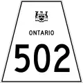 Highway 502 – from Highway 11 near Fort Frances to Highway 594 near Dryden. Formerly in Southern Ontario between Napanee and Marysville in Lennox and Addington County as an alternate route while a portion of Highway 401 was being constructed.
 Highway 503 – Highway 121 in Tory Hill to Highway 48 in Kirkfield (decommissioned)
 Highway 504 – Highway 28 in Apsley to Highway 620 in Glen Alda (decommissioned)
 Highway 505 – Highway 48 east of Kirkfield to Highway 503 in Uphill (decommissioned)
 Highway 506 – Highway 41 south of Cloyne to Highway 509 in Plevna (decommissioned)
 Highway 507 – Highway 28 southwest of Lakefield to Highway 503 in Gooderham (decommissioned)
 Highway 508 – Highway 17 west of Arnprior to Highway 511 in Calabogie (decommissioned)
 Highway 509 – Highway 506 in Plevna to Highway 7 west of Highway 38 near Sharbot Lake (decommissioned)
 Highway 510 – Highway 520 in Magnetawan to Highway 124
 Highway 511 – Highway 7 in Perth to Highway 508 in Calabogie (decommissioned)
 Highway 512 – Highway 60 outside Killaloe to Highway 41 outside Eganville (decommissioned)
 Highway 513 – Highway 132 in Dacre to township boundary east of Hyndford (decommissioned years before mass downloading)
 Highway 514 – Highway 28 in Hardwood Lake to Highway 515 east of Palmer Rapids (decommissioned)
 Highway 515 – Highway 62 in Combermere to Highway 512 west of Foymount (decommissioned)
 Highway 516 – Highway 72 in Sioux Lookout to Highway 599 near Savant Lake
 Highway 517 – Highway 62 in Combermere to Boulter Road 15 kilometres southwest (decommissioned)
 Highway 518 – Highway 69 near Parry Sound to Kearney
 Highway 519 – Highway 17 north of Wawa to Dubreuilville
 Highway 520 – Highway 11 in Burks Falls to Ardbeg; co-designated with Highway 124 from north of Magnetawan to east of Dunchurch
 Highway 522 – Highway 69 near Grundy Lake Provincial Park to Highway 11 in Trout Creek
- — Highway 522B – Highway 522 to Highway 11 in North Bay
 Highway 523 – Highway 60 in Madawaska to Hastings County boundary
 Highway 524 – Highway 522 near Commanda to Highway 534 near Restoule
 Highway 525 – Highway 596 near Minaki to Whitedog
 Highway 526 – Highway 69 to Britt
 Highway 527 – Highways 11 and 17 near Thunder Bay to Armstrong. Once Provincial Highway 800.
 Highway 528 – Highway 64 in French River to the community of Wolseley Bay
 Highway 528A – Highway 528 near the community of Wolseley Bay to the Wolseley Bay water body
 Highway 529 – Highway 69 near Pointe au Baril Station to Highway 69 near Byng Inlet and Britt
 Highway 529A – Highway 529 to Bayfield Inlet
 Highway 531 – Highway 17 west of Rutherglen to Bonfield
 Highway 532 – Highway 556 south of Searchmont northward for 15 kilometres
 Highway 533 – Highway 63 near Eldee to Highway 17 in Mattawa
 Highway 534 – Highway 11, near Powassan to Restoule Provincial Park
 Highway 535 – Highway 64 in Noelville to north of Highway 17 north of Hagar
 Highway 536 – Highway 17 near Lively to Creighton Mine (decommissioned)
 Highway 537 – Highway 69 south of Wanup to Highway 17 in Wahnapitae
 Highway 538 – Highway 17 in Algoma Mills to Highway 17 near Spragge. Old alignment of Highway 17.
 Highway 539 – Highway 17 in Warren to Highway 64 in Field
 Highway 539A – Highway 539 near River Valley to Highway 805 west of River Valley
 Highway 540 – Highway 6 in Little Current to Meldrum Bay, on Manitoulin Island
 Highway 540A – Highway 540 to Barrie Island
 Highway 540B – Highway 540 to Gore Bay
 Highway 541 – Highway 17 in Sudbury to Skead (decommissioned)
 Highway 541A – Highway 541 in Garson to Falconbridge mine entrance(decommissioned)
 Highway 542 – Highway 540 to Highway 6 near Tehkummah
 Highway 542A – Highway 542 to Tehkummah
 Highway 546 – Highway 17 in Iron Bridge to Mount Lake
 Highway 547 – Highway 101 east of Wawa to Hawk Junction
 Highway 548 – Highway 17 to St. Joseph Island
 Highway 550 – Highway 17 in Sault Ste. Marie to shore of Whitefish Bay at Gros Cap
 Highway 550A – Sault Ste. Marie
 Highway 550B – Sault Ste. Marie
 Highway 551 – Highway 540 in M'Chigeeng to south of Providence Bay
 Highway 552 – originally part of Highway 17, runs from Highway 556 to Goulais River.
 Highway 553 – Highway 17 in Massey, Ontario to Highway 810
 Highway 554 – Highway 129 north of Wharncliffe to Highway 546 north of Iron Bridge
 Highway 555 – Highway 557 north of Blind River northerly for a few kilometres. (decommissioned)
 Highway 556 – Highway 17 in Heyden to Highway 129
 Highway 557 – Highway 17 in Blind River to Martinenda Lake
 Highway 558 – Highway 11 near Haileybury to Mowat's Landing on the Montreal River
 Highway 559 – Highway 69 north of Nobel to Killbear Provincial Park
 Highway 560 – Highway 11 in Earlton to Highway 144 south of Gogama
 Highway 560A – Highway 560 to Westree
 Highway 562 – Highway 11 near Thornloe to Highway 65 at McCool
 Highway 563 – Highway 17 at Batchawana Bay southerly for five kilometres
 Highway 564 – Highway 112 near Tarzwell to Boston Creek
 Highway 565 – Highway 550 west of Sault Ste. Marie to Prince Township - Sault Ste. Marie boundary. Used to end at Sault Ste. Marie Airport road.
 Highway 566 – Highway 66 in Matachewan westerly for 23 kilometres
 Highway 567 – From North Cobalt southeast along Lake Timiskaming
 Highway 568 – Highway 11 at Kenogami Lake to Ontario Northland Railway
 Highway 569 – Highway 11 near Harley to Highway 11 near Englehart
 Highway 570 – Highway 11 to Sesekinika
 Highway 571 – Highway 11 in Earlton to Highway 562
 Highway 572 – Highway 101 east of Matheson to Highway 11 in Ramore
 Highway 573 – Highway 11 south of Highway 112 to Highway 560 in Charlton
 Highway 574 – Highway 652 east of Cochrane to Norembega
 Highway 575 – Highway 17 in Verner to Highway 64 in Field
 Highway 576 – Highway 101 west of Timmins northwesterly (decommissioned)
 Highway 577 – Highway 101 in Shillington to Highway 11 near Monteith. Used to continue north to Highway 67 in Iroquois Falls.
 Highway 578 – Highway 11 near Nellie Lake to Highway 67 in Iroquois Falls (decommissioned)
 Highway 579 – Highway 11 in Cochrane to Gardiner
 Highway 580 – Highway 11 near Beardmore to Lake Nipigon
 Highway 581 – Highway 11 in Moonbeam to Rene Brunelle Provincial Park
 Highway 582 – loops around Ontario Hwy 11/17 through Hurkett.
 Highway 583 – Cochrane District from Mead to Lac-Sainte-Thérèse
 Highway 584 – Highway 11 south of Geraldton to Nakina
 Highway 585 – Highway 11/17 near Nipigon to Pine Portage
 Highway 586 – Highway 11 near Shebandowan westerly for about five kilometres
 Highway 587 – Highway 11/17 northwest of Pass Lake to Sleeping Giant (Sibley).
 Highway 588 – Highway 11/17 west of Thunder Bay to west of Suomi
 Highway 589 – Highway 102 west of Thunder Bay to Dog Lake
 Highway 590 – Highway 11/17 in Kakabeka Falls to Highway 588 near Nolalu
 Highway 591 – Highway 589 north of Highway 102 northwest for 10 kilometres
 Highway 592 – Highway 11 in Novar to Highway 11 north of Emsdale. Northern terminus no longer connects with Highway 11. Original alignment of Highway 11.
 Highway 593 – Highway 588 southwest of Nolalu to Highway 61 north of international bridge. Southernmost portion originally part of Highway 61.
 Highway 594 – Highway 17 in Dryden to Highway 17 north of Eagle River
 Highway 595 – Highway 590 west of Kakabeka Falls to Highway 597
 Highway 596 – Highway 17A to Minaki. Used to start at Highway 17 in Keewatin.
 Highway 597 – Highway 608 west of Highway 61 to Pardee, south of Highway 595
 Highway 598 – Highway 604 to Highway 658 outside Kenora (decommissioned)
 Highway 599 – Highway 17 near Ignace to Central Patricia near Pickle Lake.
- Highway 600 – Highway 11 in Rainy river to Highway 71 east of Black Hawk
 Highway 601 – Highway 17 in Dryden to Highway 17 east of Dryden
 Highway 602 – Highway 11 west of Fort Frances to Highway 11 at Emo.
 Highway 603 – Highway 17 in Borups Corners to Dyment
 Highway 604 – Highway 17 in Kenora to Highway 17A at Highway 671 (decommissioned)
 Highway 605 – Highway 17 at Oxdrift to north of Eton-Rugby
 Highway 606 – Highway 17 at Sudbury to Markstay (decommissioned)
 Highway 607 – Highway 64 east of Alban to Highway 69 at Bigwood
 Highway 607A – Highway 607 east of Highway 69 to French River
 Highway 608 – from Highway 61 to South Gillies.
 Highway 609 – Highway 105 at Red Lake Road to Clay Lake
 Highway 610 – Highway 101 in Hoyle to Highway 67 at Barbers Bay (decommissioned)
 Highway 611 – Highway 602 southwest of Fort Frances to north of Highway 11
 Highway 612 – Highway 69 at Gordon Bay to Parry Sound-Muskoka boundary
 Highway 613 – Highway 602 to Government Landing.
- — Highway 614 – Highway 17 to Manitouwadge.
 Highway 615 – Highway 71 at Highway 600 to Burditt Lake
 Highway 617 – Highway 11 in Stratton to Highway 600 in North Branch
 Highway 618 – Highway 105 in Red Lake to Madsen.
 Highway 619 – Highway 11 in Pinewood to Highway 621 in Minahico
 Highway 620 – Highway 62 south of L'Amable to Highway 28 in Apsley (decommissioned)
 Highway 621 – Highway 11 in Sleeman to Lake of the Woods, north of Morson
 Highway 622 – Highway 11B in Atikokan to Highway 17 west of Ignace
 Highway 623 – Highway 11 east of Atikokan to Sapawe
 Highway 624 – Highway 569 just off Highway 11 near Englehart to Highway 66 in Larder Lake
 Highway 625 – Highway 11 east of Longlac to Caramat
 Highway 626 – Highway 17 west of Highway 627 to Marathon (decommissioned)
 Highway 627 – Highway 17 north of Heron Bay to Pic River.
 Highway 628 – Highway 11/17 to Red Rock.
- — Highway 629 – Highway 101 in Timmins to Timmins Airport (decommissioned)
 Highway 630 – Highway 17 west of Mattawa to Kiosk in Algonquin Provincial Park
 Highway 631 – Highway 17 at White River, through Hornepayne, to Highway 11 west of Hearst.
 Highway 632 – Highway 141 in Rosseau to Parry Sound-Muskoka boundary
 Highway 633 – Highway 11 east of Highway 623 to Kawene
 Highway 634 – Highway 11 in Smooth Rock Falls to Fraserdale, Ontario. Private road continues from end of highway to Otter Rapids.
- — Highway 635 – Highway 17 in Rolphton to interprovincial bridge across Ottawa River (decommissioned)
 Highway 636 – Highway 11 west of Cochrane to north of Frederick
 Highway 637 – Highway 69 south of Estaire to Killarney
 Highway 638 – Goes through the mountainous terrain of northern Ontario. It starts at Highway 17 in Bruce Mines and ends at Highway 17 in Echo Bay
 Highway 639 – Highway 108 north of Elliot Lake to Highway 546 near Mount Lake
 Highway 640 – Highway 571 in Earlton to Earlton Airport
 Highway 641 – Highway 17 east of Highway 17A west junction to Highway 596
 Highway 642 – Highway 516 in Sioux Lookout to Highway 599 at Silver Dollar
 Highway 643 – Highway 584 west of Nakina to Aroland
 Highway 644 – Highway 69 at Pointe au Baril Station westerly for 800 metres (the shortest highway in Ontario)
 Highway 645 – Highway 529 in Magnetawan First Nation to Byng Inlet
 Highway 646 – Highway 599 in Central Patricia to Pickle Crow Mine (decommissioned)
 Highway 647 – Highway 17 at Vermilion Bay to Blue Lake Provincial Park
- — Highway 648 – Highway 121 east of Tory Hill to Dyno Mine, five kilometres south of Highway 121 (decommissioned)
- — Highway 649 – Highway 121 south of Kinmount to Highway 36 in Bobcaygeon (decommissioned)
 Highway 650 – Highway 112 south of Swastika to Adams Mine site
 Highway 651 – Highway 101 west of Chapleau to Missanabie
 Highway 652 – Highway 11 in Cochrane to Kattawagami River Bridge. Private road continues from end of highway to Detour Lake Mine
 Highway 653 – Highway 17 in Haley Station to interprovincial bridge across Ottawa River (decommissioned). Now County Rd. 653.
 Highway 654 – Highway 11 in Callander to Highway 534 in Nipissing
 Highway 655 – Highway 11 in Driftwood to Highway 101 in Schumacher
 Highway 656 – Highway 533 northwest of Mattawa to hydroelectric dam on Ottawa River
 Highway 657 – Highway 105 in Ear Falls to Goldpines
 Highway 658 – Kenora, Ontario. Highway 17 north to Redditt. Formerly Highway 128, then Highway 666. Changed in 1985 after complaints from a Pentecostal church located on highway, and due to rampant highway sign theft, for obvious reasons. Original route went from Highway 17, west of Whitefish north to Fairbank Provincial Park; transferred to Sudbury in 1973.
- — Highway 659 – Highway 604 northeast of Kenora to Highway 658 south of Redditt (decommissioned)
 Highway 661 – Highway 144 north of Highway 560 to Gogama
 Highway 663 – Highway 11 west of Hearst to Calstock
 Highway 664 – Highway 72 southwest of Sioux Lookout to Hudson
 Highway 665 – Highway 17 north of Dryden to Richan
- — Highway 666 – see Highway 658
 Highway 667 – Highway 129 southeast of Chapleau to Sultan
 Highway 668 – Highway 11 west of Cochrane to Greenwater Provincial Park
 Highway 670 – Highway 638 near Ophir to Dunns Valley.
 Highway 671 – Highway 17A to Grassy Narrows
 Highway 672 – Highway 66 east of King Kirkland to Highway 101 west of Quebec border
 Highway 673 – Highway 17 east of Manitoba Border to Kejick First Nation boundary
Tertiary highways
| Number | Length (km)[4] | Length (mi) | Southern or western terminus | Northern or eastern terminus | Formed | Removed | Notes |
|---|---|---|---|---|---|---|---|
| 13.7 | 8.5 | Burchell Lake | Kashabowie railway crossing | — | — | ||
| 51.4 | 31.9 | Manitou Falls Dam | 1962 | current | |||
| 52.5 | 32.6 | Obabika Lake | 1962 | current | |||
| 42.6 | 26.5 | Richie Falls | 1974 | current | |||
| 59.0 | 36.7 | Weaver River Bridge, near Kashishibog Lake | 1976 | current |
7000-series highways
The following is a list of 7000-series highways as of October 2020. This list is compiled using the official MTO Provincial Highway Network and MTO Jurisdiction datasets.[4][58][59]
| Number | Road name | Length (km) | Length (mi) | Southern or western terminus | Northern or eastern terminus | District | Geographic township | Notes |
|---|---|---|---|---|---|---|---|---|
| Highway 7025 | Shrine Hill Drive | 0.8 | 0.5 | Hillcrest Avenue | Highway 60 | Renfrew | Killaloe, Hagarty and Richards | Original 60 route |
| Highway 7036 | Potter Road | 4.3 | 2.7 | 4.3 km west of Highway 11 | Highway 11 | Cochrane | Newmarket | Original 11 route |
| Highway 7037 | Hanna Road | 9.3 | 5.8 | Highway 11 | Highway 11 | Cochrane | Hanna, Lamarche | Original 11 route |
| Highway 7041 | Main Street | 1.3 | 0.8 | Highway 6 | Highway 6 | Sudbury | Curtin | |
| Highway 7042 | Old Wanup Road
Secord Road |
28.9 | 18.0 | Highway 7279 – Estaire | Highway 7279 | Sudbury | Dill, Secord | Original 69 route, later partially part of 537 |
| Highway 7044 | Old Cartier Road | 23 | 14.3 | Highway 144 – Windy Lake | Highway 144 – Cartier | Sudbury | Cartier, Cascadden, Hart | Original 544/144 route |
| Highway 7048 | 5 Mile Dock Road | 1 | 0.6 | Highway 11 | end of road | Rainy River | Couchiching 16A | Access to 5 Mile Dock |
| Highway 7049 | Lakeshore Road | 2.3 | 1.4 | Highway 17 | CPR railway | Thunder Bay | Killraine | Old 17 route? Not in AADT tables |
| Highway 7051 | Wolfe Island Ferry | 0 | 0.0 | Kingston | Wolfe Island | |||
| Highway 7057 | Willard Lake Road | 1.2 | 0.7 | Highway 17 | Willard Lake | Kenora | MacNicol | Portion of old 17 route, also access to Willard Lake |
| Highway 7059 | Longbow Lake Road | 4.2 | 2.6 | Highway 17 – Longbow Lake | Highway 17 | Kenora | Kirkup | Old 17 route |
| Highway 7087 | E.C. Row Expressway | 2.7 | 1.7 | Highway 7902 (Ojibway Pkwy) | east of Huron Church Road | Windsor | Windsor | Part of Herb Grey Parkway project |
| Highway 7088 | Havilland Shores Drive | 1.6 | 1.0 | 1.6 km west of Highway 17 | Highway 17 | Algoma | Havilland | MTO network only shows bridge over Stokely Creek, AADT lists 1.6km from Highway 17 |
| Highway 7090 | Harmony Beach Road | 1.6 | 1.0 | Highway 17 | Highway 17 | Algoma | Havilland | MTO network only shows bridge over Harmony River |
| Highway 7125 | Clearwater Bay Road | 0.5 | 0.3 | Dead end | Highway 17 | Kenora | Boys | Old 17 route |
| Highway 7146 | East Main Street | 1.6 | 1.0 | Wellington Street – Welland | Highway 140 | Niagara | Welland | East Main Tunnel |
| Highway 7148 | Beachwood Road | 7.9 | 4.9 | Highway 26 | Highway 26 – Collingwood | Simcoe | Clearview | Old 26 route |
| Highway 7149 | Mosley Street, Nottawasaga 33/34 Sideroad | 1.9 | 1.2 | Vancise Court | Highway 7148 | Simcoe | Clearview | Part of 26 bypass project |
| Highway 7150 | Mighton Court | 0.2 | 0.1 | Highway 26 | dead end | Simcoe | Clearview | Service road for Wasaga Beach bypass |
| Highway 7162 | Ontario Street | 0.8 | 0.5 | Highway 520 | Highway 7298 | Parry Sound | Armour | Old 11 route |
| Highway 7172 | Young Street | 0.6 | 0.4 | Highway 101 | Railway Avenue – Foleyet RR station | Sudbury | Foleyet | |
| Highway 7182 | Shebeshekong Road | 18.6 | 11.6 | Highway 559 | Highway 69 | Parry Sound | Shawanaga, Carling | Old 69 route |
| Highway 7186 | Thorold Stone Road | 0.8 | 0.5 | Highway 58 | Thorold Townline Road (Niagara 70) | Niagara | Thorold | Eastern approach to Thorold Tunnel |
| Highway 7188 | Katrine Road | 7.7 | 4.8 | Highway 592 | Highway 520 – Burk's Falls | Parry Sound | Armour | |
| Highway 7189 | Eastport Drive | 2 | 1.2 | QEW | Lakeshore Road | Hamilton, Halton | Hamilton, Burlington | Burlington Skyway detour |
| Highway 7191 | Caledonia Bridge | 0.2 | 0.1 | Haldimand | Caledonia | Former 6 route, bridge over Grand River | ||
| Highway 7195 | Centre Street | 0.6 | 0.4 | former Highway 7 | Dufferin Street (York 53) | York | Vaughan | Some involvement with 407? |
| Highway 7236 | Woodlawn Road | 0.6 | 0.4 | Brown Road | Highway 406 | Niagara | Welland | Built as part of 406 extension. Previously continued to Seaway Mall. |
| Highway 7237 | Main Street | 0.9 | 0.6 | Highway 48 | Mostar Street | York | Stouffville | Old 47, entrance to Stouffville |
| Highway 7242 | McKenzie Station Road, Lakeshore Drive | 8.6 | 5.3 | Highway 11/17 | Highway 11/17 | Thunder Bay | Shuniah | Old 11/17 route |
| Highway 7273 | Upper James Street | 0.2 | 0.1 | Highway 6 | 200 m north of Highway 6 | Hamilton | Mount Hope | approach to Hwy 6 bypass |
| Highway 7274 | Airport Road Connection | 0.6 | 0.4 | Highway 6 | Airport Road, John C. Munro Hamilton International | Hamilton | Connects 6 bypass to Hamilton Airport | |
| Highway 7277 | Arthur Street | 8.6 | 5.3 | Highway 130 | Highway 61 | Thunder Bay | Thunder Bay, Oliver-Paipoonge | AADT logs indicate not assumed. MTO network shows intersection with 61 still assumed |
| Highway 7279 | Estaire Road | 19.6 | 12.2 | just ends | Highway 69 | Sudbury | Dill, Burwash | Old 69 route |
| Highway 7287 | Shebeshekong Road | 2.3 | 1.4 | Highway 559 | Highway 7909 | Parry Sound | Carling | Old 559 route pre 1982 |
| Highway 7289 | Lake Joseph Road | 21.7 | 13.5 | Highway 400 IC 189 | Highway 141 – Brignall | Parry Sound | Seguin, Medora, Freeman | Old 69 route |
| Highway 7290 | Lake Joseph Road | 2.6 | 1.6 | Highway 141 – Hayes Corners | Highway 400 IC 213 | Parry Sound | Seguin | Old 69 route |
| Highway 7291 | Muskoka Road | 2.5 | 1.6 | Highway 11 overpass | Highway 124 | Parry Sound | Strong | Service road for west side of 11 |
| Highway 7292 | Sinclair Lane | 0.6 | 0.4 | Dead end | Highway 7291 | Parry Sound | Strong | Former 124 route |
| Highway 7293 | Green Road | 0.1 | 0.1 | Dead end | Highway 7294 | Parry Sound | Strong | Former 124 route |
| Highway 7294 | Sunny Ridge Road | 0.9 | 0.6 | just ends | Highway 124 | Parry Sound | Strong | Former 11 route |
| Highway 7295 | North Horn Lake Road | 1.1 | 0.7 | Sterling Creek Road | just ends, road continues | Parry Sound | Strong | Service road on west side of 11 |
| Highway 7296 | Valley View Road | 2.6 | 1.6 | Robins Road | just ends, road continues | Parry Sound | Strong | Service road on east side of 11 |
| Highway 7297 | South Service Road | 0.9 | 0.6 | Oke Drive | just ends, road continues | Parry Sound | Armour | Service road on west side of 11 |
| Highway 7298 | Pickerel & Jack Lake Road, Barriedale Road | 1.9 | 1.2 | Highway 7162 | just ends, road continues | Parry Sound | Armour | Service road on east side of 11 |
| Highway 7299 | Burwash Farm Road | 7.4 | 4.6 | Dead end | Burwash Road | Sudbury | Old 69 dead man's curve | |
| Highway 7300 | Indian Reserve Road | 5.5 | 3.4 | Sagamok territory boundary | Government Road (Massey) | Sudbury | Massey | Access to Sagamok Anishnawbek First Nation |
| Highway 7302 | Erin Mills Parkway | 1.2 | 0.7 | Folkway Drive | Credit Valley Road | Peel | Mississauga | Erin Mills at 403 interchange |
| Highway 7303 | Winston Churchill Road | 1.1 | 0.7 | Unity Drive | Credit Valley Road | Peel | Mississauga | Winston Churchill at 403 interchange |
| Highway 7304 | Flanders Road | 0 | 0.0 | Bridge | Rainy River | ? | ||
| Highway 7310 | Windy River bridge | 0.1 | 0.1 | Sudbury | Cascade | Old 144/544? | ||
| Highway 7311 | Renforth Drive | 1.6 | 1.0 | Eglinton Avenue West | Carlingview Drive | Toronto | Toronto | Renforth Drive over 401 |
| Highway 7902 | Ojibway Parkway | 0.3 | 0.2 | Intersection with E.C. Row Expressway | Windsor | Windsor | Part of Herb Grey Parkway project | |
| Highway 7908 | Howard Avenue Diversion | 0.9 | 0.6 | Laurier Parkway | Highway 3 | Windsor | Windsor | Part of Herb Grey Parkway project |
| Highway 7909 | Nobel Road | 6 | 3.7 | N/O Lake Forest Drive | Highway 7287 | Parry Sound | Carling
McDougall |
Old 69 route |
| Highway 7910 | Avro Arrow Road | 1.5 | 0.9 | Highway 7909 | Highway 400 | Parry Sound | McDougall | Built as part of Nobel Bypass |
References
- How we clear Ontario’s highways in winter
- Shragge, John; Bagnato, Sharon (1984). From Footpaths to Freeways. Toronto: Ontario Ministry of Transportation and Communications, Historical Committee. pp. 74–75. ISBN 978-0-7743-9388-1.
- "Public Transportation and Highway Improvement Act, R.S.O. 1990, c. P.50". July 21, 2020. Retrieved February 1, 2021.
- Ministry of Transportation of Ontario (2016). "Annual Average Daily Traffic (AADT) counts". Retrieved October 25, 2020.
- "III – The Provincial Highway". Annual Report (Report). Department of Public Highways. February 26, 1918. pp. 13–14. Retrieved February 2, 2021 – via Internet Archive.
- "Report on Provincial Highways". Annual Report (Report). Department of Public Highways. March 31, 1921. pp. 40–45. Retrieved February 2, 2021 – via Internet Archive.
- Shragge & Bagnato (1984), pp. 73–75, 84.
- "Appendix 4 - Schedule of Assumptions and Reversions". Annual Report (Report). Department of Highways. March 31, 1934. p. 37. Retrieved February 2, 2021 – via Internet Archives.
- "Appendix F – Provincial Highways". Annual Report (Report). Department of Public Highways. March 31, 1919. p. 51. Retrieved February 2, 2021 – via Internet Archive.
- "The Noden Causeway". Fort Frances Times. Retrieved December 1, 2018.
- "Provincial Highways Assumed in 1922". Annual Report (Report). Department of Public Highways. 1922. p. 31.
- "Highway 17A in Kenora". Hansard Transcripts (Report). Legislative Assembly of Ontario. November 21, 1990. Retrieved February 2, 2021.
- Ontario Road Map (Map). Cartography by C.P. Robins. Ontario Department of Highways. 1958. North Bay inset.
- Ontario Road Map (Map). Cartography by C.P. Robins. Ontario Department of Highways. 1959. North Bay inset.
- Ministry of Transportation of Ontario (2008). Annual Average Daily Traffic (AADT) counts.
- "Appendix No. 5 - Schedule of Assumptions and Reversions of Sections of the King's Highway System for the Years 1930 and 1931". Annual Report (Report). Department of Highways. March 31, 1932. pp. 76–78. Retrieved February 3, 2021 – via Internet Archive.
- "Appendix No. 6 - Schedule of Assumptions and Reversions of Sections of the Provincial Highway System for the Years 1926 and 1927". Annual Report (Report). Department of Highways. March 31, 1928. pp. 59–61. Retrieved February 3, 2021 – via Internet Archive.
- Ontario Road Map (Map). Cartography by D. Barclay. Ontario Department of Public Highways. 1928. Mileage Tables inset.
- "Appendix No. 4 - Schedule of Assumptions and Reversions of Sections of the King's Highway System for the Year 1932". Annual Report (Report). Department of Highways. March 31, 1933. p. 47. Retrieved February 3, 2021 – via Internet Archive.
- "Appendix No. 4 - Schedule of Assumptions and Reversions of Sections of the King's Highway System for the Year 1934". Annual Report (Report). Department of Highways. March 31, 1935. p. 119–120. Retrieved February 3, 2021 – via Internet Archive.
- "Appendix No. 4 - Schedule of Assumptions and Reversions of Sections of the King's Highway System for the Year 1935". Annual Report (Report). Department of Highways. March 31, 1935. p. 49. Retrieved February 3, 2021 – via Internet Archive.
- "Appendix No. 3 - Schedule of Assumptions and Reversions of Sections of the King's Highway System for the Year Ending March 31, 1938". Annual Report (Report). Department of Highways. March 31, 1938. pp. 80–81. Retrieved February 3, 2021 – via Internet Archive.
- A.A.D.T. Traffic Volumes 1955–1969 And Traffic Collision Data 1967–1969. Ontario Department of Highways. 1970.
- "Appendix No. 4 - Schedule of Assumptions and Reversions of Sections of the King's Highway System for the Year Ending March 31, 1937". Annual Report (Report). Department of Highways. March 31, 1937. p. 51. Retrieved February 3, 2021 – via Internet Archive.
- Ontario Road Map (Map). Cartography by C.P. Robins. Ontario Department of Highways. 1938–39. § J7–K8.
- "Appendix No. 3 - Schedule of Assumptions and Reversions of Sections of the King's Highway System for the Year Ending March 31, 1939". Annual Report (Report). Department of Highways. March 31, 1939. p. 84. Retrieved February 3, 2021 – via Internet Archive.
- "Appendix No. 3 - Schedule of Assumptions and Reversions of Sections of the King's Highway System for the Year Ending March 31, 1941". Annual Report (Report). Department of Highways. March 31, 1941. p. 92. Retrieved February 3, 2021 – via Internet Archive.
- Ontario Road Map (Map). Cartography by Photogrammetry Office. Ontario Department of Highways. 1971. § L6.
- Ontario Road Map (Map). Cartography by Photogrammetry Office. Department of Transportation and Communications. 1972. § L6.
- "By Road". Red Lake Regional Heritage Centre. Retrieved February 3, 2021.
- "Appendix 3B - Schedule of Designations of Sections". Annual Report (Report). Department of Highways. March 31, 1958. p. 241.
- Ontario Road Map (Map). Cartography by C.P. Robins. Ontario Department of Highways. 1953. §§ J32–K33.
- Ontario Road Map (Map). Cartography by C.P. Robins. Ontario Department of Highways. 1954. §§ J32–K33.
- Ontario Department of Highways (March 31, 1955). "Appendix No. 3C - Schedule of Plans Designating the King's Highways". Annual Report (Report). p. 164.
- Ontario Department of Highways (March 31, 1956). "Appendix No. 3 - Schedule of Assumptions of Sections of the King's Highway System for the Fiscal Year Ending March 31, 1957". Annual Report (Report). pp. 203–205.
- MacDonald-Cartier Freeway — Highway No. 401 (Map). Ontario Department of Highways. 1965.
- Canadian Press (October 6, 1972). "Highway 140 Opens". News. Globe and Mail. 129 (38, 324). Toronto. p. 5.
Highway 140, a new six-mile highway running along the east side of the Welland Canal between [Welland] and Port Colborne, was opened Yesterday.
- "Provincial Highways: Eastern Region". Annual Report (Report). Ministry of Transportation and Communications. March 31, 1983. p. 18.
- Doran, Carol (September 13, 1982). "Bypass Brings Toasts to 'Sounds of Silence'". Ottawa Citizen - Valley edition. p. 2. Retrieved January 11, 2021 – via Newspapers.com.
- Shragge & Bagnato (1984), pp. 89–92.
- Maier, Hanna (October 9, 2007). "Chapter 2". Long-Life Concrete Pavements in Europe and Canada (Report). Federal Highway Administration. Retrieved May 1, 2010.
The key high-volume highways in Ontario are the 400-series highways in the southern part of the province. The most important of these is the 401, the busiest highway in North America, with average annual daily traffic (AADT) of more than 425,000 vehicles in 2004 and daily traffic sometimes exceeding 500,000 vehicles.
- Ontario Department of Highways (1970), p. 11.
- Ontario Department of Highways (1970), p. 12.
- Mitchell, Bob (June 6, 1997). "At Last — Opening Bell Tolls for the 407". The Toronto Star. pp. A1, A6.
- "Map / Toll Calculator". 407 ETR. February 1, 2014. Retrieved December 17, 2015.
- "New Shortcut Will Let Some 'Fly' to Airport". Metro News. The Toronto Star. August 19, 1978. p. A6.
Highway 409, a new shortcut to Toronto International Airport, opens next Friday
- Public and Safety Information Section (November 9, 1978). "Highway 410 Opens November 15" (Press release). Ministry of Transportation and Communications.
- Pessian, Parvaneh (June 17, 2016). "UPDATE: Hwy. 407 From Pickering to Oshawa Opens June 20: Toll Free Until End of 2016". Whitby This Week. Retrieved June 17, 2016.
- "New Highway Numbers". Highway 407 East. Archived from the original on April 19, 2015. Retrieved February 10, 2015.
- "Ottawa Highway Link Opens". Ontario. Toronto Star. Canadian Press. September 24, 1999. p. A4.
- "Extension of Ontario Hwy. 407, new Hwy. 418 open east of Toronto". On-Site. Retrieved December 11, 2019.
An eastern extension of Ontario Hwy. 407 and a new toll road to connect the lengthened highway to nearby Hwy. 401 opened Dec. 9 on the outskirts of Toronto.
- Stamp (1987), pp. 124–127.
- "Highway 27 Interchange Fully in Service". The Globe and Mail. Toronto. December 4, 1971. p. 5.
- Shragge & Bagnato (1984), pp. 79–81.
- Ministry of Transportation of Ontario Geomatics Office; Land Information Ontario (December 10, 2020). "Ontario Road Network - Ontario Provincial Highways". ArcGIS.com. Retrieved February 1, 2021.
- Ministry of Transportation of Ontario Geomatics Office; Land Information Ontario (December 10, 2020). "Ontario Road Network - MTO Jurisdiction". ArcGIS.com. Retrieved February 1, 2021.
External links
- Ontario Highways - The History of the King's Highways and other Ontario Provincial Highways
- Ontario Highways - asphaltplanet.ca

|
This article is issued from Wikipedia. The text is licensed under Creative Commons - Attribution - Sharealike. Additional terms may apply for the media files.