Livingston, Kentucky
Livingston is a home rule-class city in Rockcastle County, Kentucky, in the United States. The population was 226 during the 2010 U.S. census. It is part of the Richmond-Berea micropolitan area.
Livingston, Kentucky | |
|---|---|
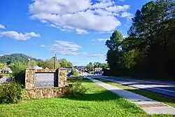 Welcome sign along US 25 | |
 Location of Livingston in Rockcastle County, Kentucky. | |
| Coordinates: 37°17′55″N 84°13′0″W | |
| Country | United States |
| State | Kentucky |
| County | Rockcastle |
| Incorporated | 1880 |
| Reïncorporated | 1943 |
| Named for | a local landowner |
| Area | |
| • Total | 0.32 sq mi (0.84 km2) |
| • Land | 0.31 sq mi (0.81 km2) |
| • Water | 0.01 sq mi (0.03 km2) |
| Elevation | 912 ft (278 m) |
| Population (2010) | |
| • Total | 226 |
| • Estimate (2019)[2] | 215 |
| • Density | 686.90/sq mi (265.40/km2) |
| Time zone | UTC-5 (Eastern (EST)) |
| • Summer (DST) | UTC-4 (EDT) |
| ZIP code | 40445 |
| Area code(s) | 606 |
| FIPS code | 21-47098 |
| GNIS feature ID | 513549[3] |
| Website | www |
History
The first post office at the site was known as Fish Point and opened in 1840. The L&N reached the settlement in 1870 and named its station after James Livingston, a local landowner. The post office was renamed Livingston Station in 1879 and, following the city's 1880 incorporation, Livingston in 1882.[4]
Geography
Livingston is located at 37°17′55″N 84°13′0″W (37.298551, -84.216661).[5] According to the United States Census Bureau, the city has a total area of 0.3 square miles (0.78 km2), all land. The city lies along U.S. Route 25 southeast of Mt. Vernon and northwest of London. The city's municipal area extends southward to the Rockcastle River. The Daniel Boone National Forest surrounds Livingston, and the Sheltowee Trace Trail passes through the city.
Demographics
| Historical population | |||
|---|---|---|---|
| Census | Pop. | %± | |
| 1900 | 605 | — | |
| 1910 | 685 | 13.2% | |
| 1920 | 703 | 2.6% | |
| 1930 | 912 | 29.7% | |
| 1940 | 669 | −26.6% | |
| 1950 | 378 | −43.5% | |
| 1960 | 419 | 10.8% | |
| 1970 | 338 | −19.3% | |
| 1980 | 334 | −1.2% | |
| 1990 | 241 | −27.8% | |
| 2000 | 228 | −5.4% | |
| 2010 | 226 | −0.9% | |
| 2019 (est.) | 215 | [2] | −4.9% |
| U.S. Decennial Census[6] | |||
As of the census[7] of 2000, there were 228 people, 104 households, and 63 families residing in the city. The population density was 704.4 people per square mile (275.1/km2). There were 122 housing units at an average density of 376.9 per square mile (147.2/km2). The racial makeup of the city was 96.05% White and 3.95% Native American. Hispanic or Latino of any race were 3.51% of the population.
There were 104 households, out of which 24.0% had children under the age of 18 living with them, 43.3% were married couples living together, 16.3% had a female householder with no husband present, and 38.5% were non-families. 35.6% of all households were made up of individuals, and 22.1% had someone living alone who was 65 years of age or older. The average household size was 2.19 and the average family size was 2.86.
In the city, the population was spread out, with 20.6% under the age of 18, 7.9% from 18 to 24, 28.1% from 25 to 44, 22.8% from 45 to 64, and 20.6% who were 65 years of age or older. The median age was 38 years. For every 100 females there were 93.2 males. For every 100 females age 18 and over, there were 88.5 males.
The median income for a household in the city was $17,500, and the median income for a family was $35,972. Males had a median income of $26,250 versus $20,313 for females. The per capita income for the city was $11,734. About 19.0% of families and 26.6% of the population were below the poverty line, including 14.7% of those under the age of eighteen and 48.7% of those sixty-five or over.
Current events
Livingston is a community steeped in a tradition of country, bluegrass and spiritual music. On weekends, area residents gather to events downtown that celebrate their music and heritage.
Climate
The climate in this area is characterized by hot, humid summers and generally mild to cool winters. According to the Köppen Climate Classification system, Livingston has a humid subtropical climate, abbreviated "Cfa" on climate maps.[8]
Notable people
- Private First Class David Monroe Smith (1926-1950), Medal of Honor recipient for his service during the Korean War
See also
References
- "2019 U.S. Gazetteer Files". United States Census Bureau. Retrieved July 24, 2020.
- "Population and Housing Unit Estimates". United States Census Bureau. May 24, 2020. Retrieved May 27, 2020.
- "Livingston". Geographic Names Information System. United States Geological Survey. Retrieved 2009-02-24.
- Rennick, Robert. Kentucky Place Names, p. 176. University Press of Kentucky (Lexington), 1987. Accessed 1 August 2013.
- "US Gazetteer files: 2010, 2000, and 1990". United States Census Bureau. 2011-02-12. Retrieved 2011-04-23.
- "Census of Population and Housing". Census.gov. Retrieved June 4, 2015.
- "U.S. Census website". United States Census Bureau. Retrieved 2008-01-31.
- Climate Summary for Livingston, Kentucky
External links
![]() Media related to Livingston, Kentucky at Wikimedia Commons
Media related to Livingston, Kentucky at Wikimedia Commons
Municipalities and communities of Rockcastle County, Kentucky, United States | ||
|---|---|---|
| Cities | 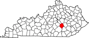 Location of Rockcastle County, Kentucky | |
| Unincorporated communities | ||
| ||
| Authority control |
|---|