Loka, Koper
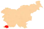
Loka (pronounced [ˈloːka]; Italian: Lonche)[2][3] is a small village in the City Municipality of Koper in the Littoral region of Slovenia.[4]
Loka | |
|---|---|
 Loka Location in Slovenia | |
| Coordinates: 45°32′8.23″N 13°53′20.75″E | |
| Country | |
| Traditional region | Littoral |
| Statistical region | Coastal–Karst |
| Municipality | Koper |
| Area | |
| • Total | 2.42 km2 (0.93 sq mi) |
| Elevation | 161.6 m (530.2 ft) |
| Population (2002) | |
| • Total | 76 |
| [1] | |
Name
The toponym Loka is relatively common in Slovenia. It is derived from the Slovene noun loka 'swampy meadow', from Proto-Slavic *lǫka 'swampy, flood-prone meadow', semantically derived from 'meander'. Toponyms of the same origin are also found in other Slavic countries (e.g., Polish Łąka, Serbian Luka, Bulgarian Shiroka Laka, etc.).[5] The Italian name Lonche reflects the early Slavic nasal vowel.[6]
History
During the Second World War, from March to September 1943 the first regional committee of the Liberation Front of the Slovene Nation was headquartered at the house of Ivan Žigante (a.k.a. Peter) in the hamlet of Žgani. Loka was burned by German forces on 12 October 1943.[7]
Church
The local church is dedicated to Saint Cecilia and belongs to the Parish of Predloka.[8] The medieval church was burned by German forces on 12 October 1943 and its ruins were registered as cultural heritage.[9] The parish archive, which had been transferred from Predloka to Loka for safekeeping, was also destroyed in the fire. The church was rebuilt by the villagers in 2005.[10]
Archaeology
The Loka area contains many karst caves. A 1911 archaeological dig in Loka Cave (Slovene: Ločka jama) yielded the bones of a cave bear and part of a human jaw.[7][11] A Neolithic left canine tooth from the jaw was found to contain a beeswax filling in 2012, leading to speculation that it may be the oldest example of a dental filling.[12][13] The Loka Cave site is part of the archaeological site known as Za gradom ('behind the castle'), named for the ruins of a fort that was part of 15th- and 16th-century fortifications along the Austrian-Venetian border.[11]
References
- Statistical Office of the Republic of Slovenia
- Žitko, Salvator. 1990. Kraški rob in Bržanija: zbornik v počastitev 500-letnice fresk v Hrastovljah. Koper: Pokrajinski muzej Koper, p. 49.
- Glonar, Joža. 1933. Poučni slovar, vol. 2. Ljubljana: Umetniška propaganda, p. 32.
- Koper municipal site
- Snoj, Marko (2009). Etimološki slovar slovenskih zemljepisnih imen. Ljubljana: Modrijan. p. 244.
- Levstik, Fran. 1862. "Imena slovenskih krajev." Novice gospodarske, obertniške in narodne 20(28) (9 July), p. 233.
- Savnik, Roman (1968). Krajevni leksikon Slovenije, vol. 1. Ljubljana: Državna založba Slovenije. p. 137.
- Roman Catholic Diocese of Koper List of Churches May 2008 Archived 2009-03-06 at the Wayback Machine
- Slovenian Ministry of Culture register of national heritage reference number ešd 3946
- Društvo Gugo Loka (in Slovene)
- Slovenian Ministry of Culture register of national heritage reference number ešd 1354
- Bernardini F, Tuniz C, Coppa A, Mancini L, Dreossi D, et al. 2012. "Beeswax as Dental Filling on a Neolithic Human Tooth." PLoS ONE 7(9): e44904. doi:10.1371/journal.pone.0044904.
- Barras, Colin. 2012. "Oldest dental filling is found in a Stone Age tooth" New Scientist

