Lumle
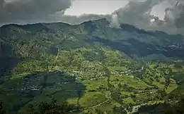
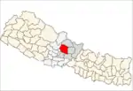
Lumle is a sub-urban and Village Development Committee in Kaski District in the Gandaki Zone of northern-central Nepal
- East side of this VDC is Paudhur Village,
- Sallyan village on south.
Lumle
लुम्ले | |
|---|---|
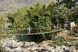
 Bridge over Dhoti Khola | |
 Lumle Location in Nepal | |
| Coordinates: 28.35°N 83.83°E | |
| Country | |
| Zone | Gandaki Zone |
| District | Kaski District |
| Population (1991) | |
| • Total | 4,685 |
| Time zone | UTC+5:45 (NST) |
| Area code(s) | 061 |


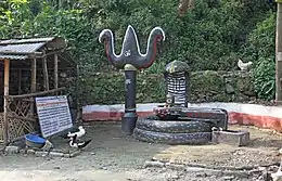
The river flowing down is called Dhoti Khola that meets Modi khola in Nayapool. This Village has many historical temples, Kali Mandir at Pokhari swara is very famous among lumleli. Kanchi Baraha Temple located in the middle of forest (north side of village) is a religious hotspot for the people around that region. Every year, they held big puja at this temple when hundreds of pilgrims visit from all around the country There are people of so many castes residing in this village. Brahmins, Gurungs, Pariyars and other minor castes. Education system is diverse and technical. There are few English Medium schools and many government schools. Balmandir community school, one of the best in country serves this region. Though its technically located in Dhikurpokhari VDC, it was originally started for Lumle Agricultural Research Center (LARC). As LARC was handed over to Nepal government (now known as, Regional Agricultural Research Station, Lumle), this school was automatically opened to general public. Shree Sangam High School is located in Chandrakot. Due to its poor performance, and ignorant school management, it hasn't been doing well in Government held SLC exams. Many Batches went NIL. The pass to fail ration is really low compared to National average. At the time of the 1991 Nepal census it had a population of 4,685 persons living in 955 individual households.[1]
Educational Institutions in Lumle
- Balmandir Community School ( Community)
- Future Star English Boarding School (Private)
- Shree Siddha lower secondary school (Government)
- Shree Sangam Secondary School (Government)
Important Religious Temple
- Shree Kalika Mandir
- Shree Kanchi Baraha Mandir
- Shree kyupche baraha temple
Income Source
Most villagers are farmers. But this is not the major source of household incomes. Although, the whole south side of village is Paddy field, it doesn't provide enough year long food. Most but not all depend on imported rice. Most youths of this village are working aboard largely in Gulf countries of Qatar, Saudi Arabia and Malaysia. Lately, some young folks have recently made their destination to very advanced countries of the world including Japan, Korea, European nations, and a few to United States of America.
Climate
Lumle has a Subtropical highland climate (Cwb) with mild, very wet summers and cold, fairly dry winters.
| Month | Jan | Feb | Mar | Apr | May | Jun | Jul | Aug | Sep | Oct | Nov | Dec | Year |
|---|---|---|---|---|---|---|---|---|---|---|---|---|---|
| Average high °C (°F) | 13 (55) |
14 (57) |
19 (66) |
22 (72) |
22 (72) |
23 (73) |
22 (72) |
23 (73) |
21 (70) |
20 (68) |
16 (61) |
13 (55) |
19 (66) |
| Average low °C (°F) | 5 (41) |
6 (43) |
10 (50) |
13 (55) |
14 (57) |
17 (63) |
17 (63) |
17 (63) |
16 (61) |
14 (57) |
9 (48) |
6 (43) |
12 (54) |
| Average rainfall mm (inches) | 28 (1.1) |
45 (1.8) |
52 (2.0) |
194 (7.6) |
318 (12.5) |
902 (35.5) |
1,522 (59.9) |
1,339 (52.7) |
932 (36.7) |
294 (11.6) |
23 (0.9) |
2 (0.1) |
5,651 (222.4) |
| Source: [2] | |||||||||||||
References
- "Nepal Census 2001". Nepal's Village Development Committees. Digital Himalaya. Archived from the original on 12 October 2008. Retrieved 30 September 2008.
- https://www.thamel.com/htms/climatological_Data.htm
External links
- UN map of the municipalities of Kaski District
- Regional Agricultural Research Station (RARS), Lumle, Kaski, Nepal
