Sarangkot
Sarangkot is Ward 18 of Pokhara, Kaski District, Nepal, after it was merged into the city in 2015. It is a popular tourist destination for those who arrive in Pokhara. At the 1991 Nepal census it had a total population of 5,060 with 1,010 individual households.[1]
Sarangkot
सराङकोट | |
|---|---|
Subdivision of Pokhara | |
 View from Sarangkot to Annapurna Conservation Area | |
 Sarangkot Location in Nepal | |
| Coordinates: 28°14′30″N 83°58′0″E | |
| Country | |
| Zone | Gandaki Zone |
| District | Kaski District |
| Area | Pokhara |
| Population (1991) | |
| • Total | 5,060 |
| Time zone | UTC+5:45 (NST) |
| Area code(s) | 061 |
The Ward is located on Sarangkot, a hill on the western side of Pokhara with an altitude of 1600m. Sarangkot is known for panoramic Himalayan views of Dhaulagiri, Annapurna and Manaslu. It also provides an expansive view of the city of Pokhara, from the extreme north to the south including the Phewa Lake. Tourists drive up the hill to watch the sunrise from the view tower at the top. In recent years, Sarangkot has been called one of the best paragliding locations in the world.[2][3] The hike up from Pokhara Baglung highway at Miruwa to Sarangkot takes 90 minutes to two hours.[4]
Sarangkot has one community FM radio station called Radio Sarangkot. It broadcasts at 104.6 MHz.
Gallery
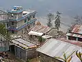
 Sarankot school
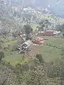
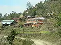
 Sarankot village
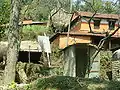
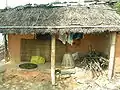 Traditional houses
References
- "Nepal Census 2001". Nepal's Village Development Committees. Digital Himalaya. Retrieved September 30, 2008.
- House, Media (2004-12-01). Columbus World Travel Guide, 2004-2005. Highbury Columbus Travel Pub. p. 514. ISBN 978-1-902221-84-7.
- Nepal. Lonely Planet Publications. 2009. p. 87.
- Wheeler, Tony; Everist, Richard (1990). Nepal, a travel survival kit. Lonely Planet Publications. p. 292. ISBN 978-0-86442-024-4.
External links
| Wikimedia Commons has media related to Sarankot. |
Headquarters: Pokhara | ||
| Metropolitan cities | 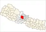 | |
| Rural municipalities | ||
| Former VDCs |
| |
| Villages | ||