Maçanet de la Selva
Maçanet de la Selva (Catalan pronunciation: [məsəˈnɛd də lə ˈsɛlβə]) is a Spanish municipality in the province of Girona, situated in the comarca of the Selva, Catalonia. It is an important communications junction, where the routes from the coast meet those from the Prelittoral Depression to form a single axis north towards Girona and the French border. RENFE railway lines run both south-east (with the N-II road) towards Blanes and the coasts of the Maresme and south-west (with the A-7 autopista and the C-251 road) towards Granollers: the station is shared with the neighbouring municipality of Massanes.
Maçanet de la Selva | |
|---|---|
 | |
 Coat of arms | |
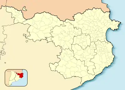 Maçanet de la Selva Location in Catalonia 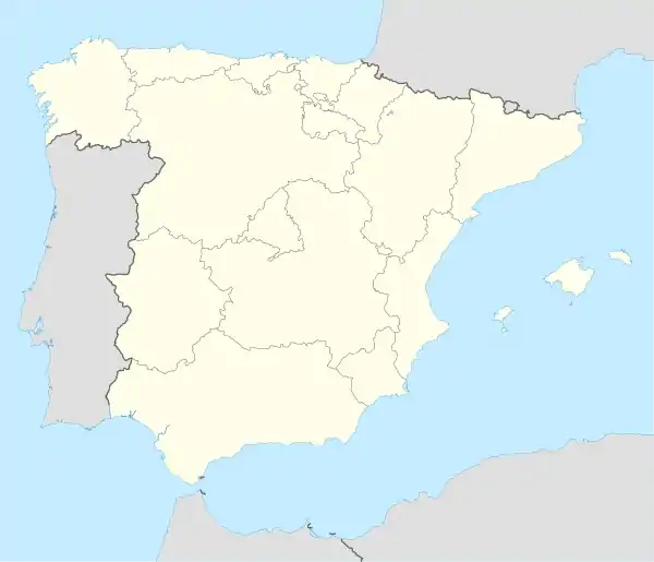 Maçanet de la Selva Maçanet de la Selva (Spain) | |
| Coordinates: 41°46′46″N 2°44′0″E | |
| Country | |
| Community | |
| Province | Girona |
| Comarca | Selva |
| Government | |
| • Mayor | Antoni Guinó Bou (2015)[1] |
| Area | |
| • Total | 45.6 km2 (17.6 sq mi) |
| Elevation | 94 m (308 ft) |
| Population (2018)[3] | |
| • Total | 6,919 |
| • Density | 150/km2 (390/sq mi) |
| Demonym(s) | Maçanetenc |
| Website | massanetdelaselva |
Main sights
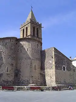
- Romanesque church of Sant Llorenç
- Church of Sant Pere de Martorell
- Torcafelló Castle
- Montbarbat Iberian settlement
References
- "Ajuntament de Maçanet de la Selva". Generalitat of Catalonia. Retrieved 2015-11-13.
- "El municipi en xifres: Maçanet de la Selva". Statistical Institute of Catalonia. Retrieved 2015-11-23.
- Municipal Register of Spain 2018. National Statistics Institute.
External links
| Wikimedia Commons has media related to Maçanet de la Selva. |
- Official website (in Catalan)
- Government data pages (in Catalan)
Places adjacent to Maçanet de la Selva | ||||||||||
|---|---|---|---|---|---|---|---|---|---|---|
| ||||||||||
This article is issued from Wikipedia. The text is licensed under Creative Commons - Attribution - Sharealike. Additional terms may apply for the media files.