Mairangi Bay
Mairangi Bay is a coastal suburb of North Shore, Auckland, located in the northern North Island of New Zealand, on the south-east-facing peninsula forming the northern side of the Waitematā Harbour. Mairangi Bay came under the local governance of the North Shore City Council until subsumed into the Auckland Council in 2010.
Mairangi Bay | |
|---|---|
Suburb | |
 Mairangi Bay 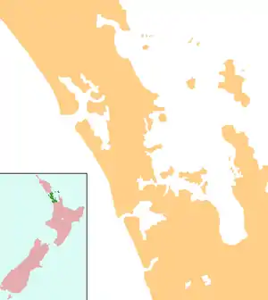 Mairangi Bay | |
| Coordinates: 36°44′19″S 174°44′54″E | |
| Country | New Zealand |
| Local authority | Auckland Council |
| Area | |
| • Land | 173.13 ha (427.81 acres) |
| Population (2018) | |
| • Total | 5,646 |
| Pinehill | Murrays Bay | (Hauraki Gulf) |
| Windsor Park |
|
(Hauraki Gulf) |
| Sunset North | Campbells Bay | Campbells Bay |
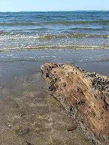
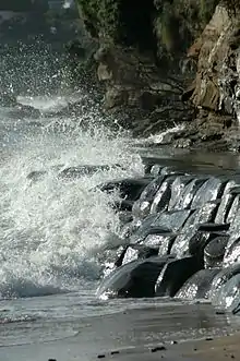
The Bay's beach itself has, along with adjacent Murrays and Campbells Bays, undergone civil works projects since 2004 to improve stormwater management.[1]
Demographics
| Year | Pop. | ±% p.a. |
|---|---|---|
| 2006 | 5,277 | — |
| 2013 | 5,346 | +0.19% |
| 2018 | 5,646 | +1.10% |
| Source: [2] | ||
Mairangi Bay, comprising the statistical areas of Mairangi Bay North and Mairangi Bay South, had a population of 5,646 at the 2018 New Zealand census, an increase of 300 people (5.6%) since the 2013 census, and an increase of 369 people (7.0%) since the 2006 census. There were 1,866 households. There were 2,721 males and 2,928 females, giving a sex ratio of 0.93 males per female, with 1,056 people (18.7%) aged under 15 years, 1,050 (18.6%) aged 15 to 29, 2,646 (46.9%) aged 30 to 64, and 900 (15.9%) aged 65 or older.
Ethnicities were 70.4% European/Pākehā, 5.0% Māori, 1.8% Pacific peoples, 27.3% Asian, and 2.3% other ethnicities (totals add to more than 100% since people could identify with multiple ethnicities).
The proportion of people born overseas was 43.9%, compared with 27.1% nationally.
Although some people objected to giving their religion, 53.6% had no religion, 37.1% were Christian, and 3.8% had other religions.
Of those at least 15 years old, 1,671 (36.4%) people had a bachelor or higher degree, and 342 (7.5%) people had no formal qualifications. The employment status of those at least 15 was that 2,235 (48.7%) people were employed full-time, 810 (17.6%) were part-time, and 108 (2.4%) were unemployed.[2]
Education
Mairangi Bay School and St John's School are coeducational contributing primary (years 1-6) schools with rolls of 445[3] and 297[4] respectively as at March 2020.[5] Mairangi Bay School was founded in 1967.[6] St John's is a state integrated Catholic School, which was founded in 1961.[7]
Rangitoto College is a large secondary school in Windsor Park, to the west of Mairangi Bay.
References
- Works & Environment Committee, North Shore City Council, 3 December 2002 Archived 28 September 2007 at the Wayback Machine
- "Statistical area 1 dataset for 2018 Census". Statistics New Zealand. March 2020. Mairangi Bay North (120500) and Mairangi Bay South (120800). 2018 Census place summary: Mairangi Bay North 2018 Census place summary: Mairangi Bay South
- Education Counts: Mairangi Bay School
- Education Counts: St Johns School
- "New Zealand Schools Directory". New Zealand Ministry of Education. Retrieved 26 April 2020.
- "Mairangi Bay Case Study 2" (PDF). Edtech Limited. Archived from the original (PDF) on 14 October 2008. Retrieved 24 January 2009.
- "A History of Development". St John's School. Archived from the original on 14 October 2008. Retrieved 24 January 2009.
External links
- Mairangi Bay School website
- St Johns School website
- Photographs of Mairangi Bay held in Auckland Libraries' heritage collections.