Mali Kal, Ivančna Gorica
Mali Kal (pronounced [ˈmaːli ˈkaːu̯]) is a small settlement in the hills north of Šentvid pri Stični in the Municipality of Ivančna Gorica in central Slovenia. The area is part of the historical region of Lower Carniola. The municipality is now included in the Central Slovenia Statistical Region.[2]
Mali Kal
Farški Kal (until 1953) | |
|---|---|
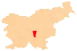
 Mali Kal Location in Slovenia | |
| Coordinates: 45°58′38.66″N 14°50′59.18″E | |
| Country | |
| Traditional region | Lower Carniola |
| Statistical region | Central Slovenia |
| Municipality | Ivančna Gorica |
| Area | |
| • Total | 0.88 km2 (0.34 sq mi) |
| Elevation | 453.2 m (1,486.9 ft) |
| Population (2002) | |
| • Total | 11 |
| [1] | |
Name
The name of the settlement was changed from Farški Kal (literally, 'parish pond') to Mali Kal (literally, 'little pond') in 1953. The name was changed on the basis of the 1948 Law on Names of Settlements and Designations of Squares, Streets, and Buildings as part of efforts by Slovenia's postwar communist government to remove religious elements from toponyms.[3][4][5] Prior to this, Mali Kal (German: Kleinkal) was the name of a hamlet of Farški Kal.[6]
References
- Statistical Office of the Republic of Slovenia
- Ivančna Gorica municipal site
- Spremembe naselij 1948–95. 1996. Database. Ljubljana: Geografski inštitut ZRC SAZU, DZS.
- Premk, F. 2004. Slovenska versko-krščanska terminologija v zemljepisnih imenih in spremembe za čas 1921–1967/68. Besedoslovne lastnosti slovenskega jezika: slovenska zemljepisna imena. Ljubljana: Slavistično društvo Slovenije, pp. 113–132.
- Urbanc, Mimi & Matej Gabrovec. 2005. Krajevna imena: poligon za dokazovanje moči in odraz lokalne identitete. Geografski vestnik 77(2): 25–43.
- Leksikon občin kraljestev in dežel zastopanih v državnem zboru, vol. 6: Kranjsko. 1906. Vienna: C. Kr. Dvorna in Državna Tiskarna, p. 99.
External links