Malta, Idaho
Malta is a city in Cassia County, Idaho, United States. The population was 193 at the 2010 census. It is part of the Burley, Idaho Micropolitan Statistical Area.
Malta, Idaho | |
|---|---|
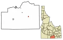 Location of Malta in Cassia County, Idaho. | |
 Malta, Idaho Location in the United States | |
| Coordinates: 42°18′33″N 113°22′14″W | |
| Country | United States |
| State | Idaho |
| County | Cassia |
| Area | |
| • Total | 1.38 sq mi (3.58 km2) |
| • Land | 1.38 sq mi (3.57 km2) |
| • Water | 0.00 sq mi (0.00 km2) |
| Elevation | 4,518 ft (1,377 m) |
| Population | |
| • Total | 193 |
| • Estimate (2019)[3] | 205 |
| • Density | 148.55/sq mi (57.37/km2) |
| Time zone | UTC-7 (Mountain (MST)) |
| • Summer (DST) | UTC-6 (MDT) |
| ZIP code | 83342 |
| Area code(s) | 208 |
| FIPS code | 16-50230 |
| GNIS feature ID | 0396845 |
History
The settlers in the Malta area in the early 1880s had no central location for mail delivery. The mail was delivered in open boxes. The Condit family secured a permit from the U.S. Post Office Department to open a post office and name the community. The post office was opened in 1883. Apparently it seemed like an island in a wide expanse of sea, so they named it Malta after the island of Malta in the Mediterranean.[4]
A website, created as an Eagle Scout project, includes a history on the majority of the people buried at the Valley Vu Cemetery in Malta. It also has histories and information from Raft River High School, including yearbooks.[5]
Geography
Malta is located at 42°18′33″N 113°22′14″W (42.309305, -113.370498).[6]
According to the United States Census Bureau, the city has a total area of 1.40 square miles (3.63 km2), all of it land.[7]
Demographics
| Historical population | |||
|---|---|---|---|
| Census | Pop. | %± | |
| 1970 | 196 | — | |
| 1980 | 196 | 0.0% | |
| 1990 | 171 | −12.8% | |
| 2000 | 177 | 3.5% | |
| 2010 | 193 | 9.0% | |
| 2019 (est.) | 205 | [3] | 6.2% |
| U.S. Decennial Census[8] | |||
2010 census
At the 2010 census there were 193 people in 66 households, including 46 families, in the city. The population density was 137.9 inhabitants per square mile (53.2/km2). There were 74 housing units at an average density of 52.9 per square mile (20.4/km2). The racial makup of the city was 91.2% White and 8.8% from other races. Hispanic or Latino of any race were 14.5%.[2]
Of the 66 households 37.9% had children under the age of 18 living with them, 62.1% were married couples living together, 6.1% had a female householder with no husband present, 1.5% had a male householder with no wife present, and 30.3% were non-families. 27.3% of households were one person and 15.1% were one person aged 65 or older. The average household size was 2.92 and the average family size was 3.70.
The median age was 33.2 years. 32.6% of residents were under the age of 18; 9.9% were between the ages of 18 and 24; 22.8% were from 25 to 44; 23.9% were from 45 to 64; and 10.9% were 65 or older. The gender makeup of the city was 49.7% male and 50.3% female.
2000 census
At the 2000 census there were 177 people in 62 households, including 49 families, in the city. The population density was 124.5 people per square mile (48.1/km2). There were 75 housing units with an average density of 52.7 per square mile (20.4/km2). The racial makup of the city was 98.31% White, 1.13% Native American, and 0.56% from two or more races.[9] Of the 62 households 38.7% had children under the age of 18 living with them, 74.2% were married couples living together, 4.8% had a female householder with no husband present, and 19.4% were non-families. 19.4% of households were one person and 12.9% were one person aged 65 or older. The average household size was 2.85 and the average family size was 3.30.
The age distribution was 33.3% under the age of 18, 8.5% from 18 to 24, 16.9% from 25 to 44, 18.6% from 45 to 64, and 22.6% 65 or older. The median age was 36 years. For every 100 females, there were 90.3 males. For every 100 females age 18 and over, there were 87.3 males.
The median household income was $32,292 and the median family income was $38,542. Males had a median income of $26,875 versus $43,125 for females. The per capita income for the city was $14,852. About 9.3% of families and 17.5% of the population were below the poverty line, including 26.8% of those under the age of eighteen and 11.8% of those sixty five or over.
Education
Malta is a part of the Cassia County School District.
Zoned schools include:
- Raft River Elementary School
- Raft River Junior/Senior High School
Climate
According to the Köppen Climate Classification system, Malta has a semi-arid climate, abbreviated "BSk" on climate maps.[10]
References
- "2019 U.S. Gazetteer Files". United States Census Bureau. Retrieved July 9, 2020.
- "U.S. Census website". United States Census Bureau. Retrieved 2012-12-18.
- "Population and Housing Unit Estimates". United States Census Bureau. May 24, 2020. Retrieved May 27, 2020.
- Bowen, V.K.; Cassia County Historical Society (2009). Images of America: Cassia County. Arcadia Publishing. pp. 79–80. ISBN 978-0-7385-6928-4. Retrieved July 24, 2016.
- "Malta, Idaho". Retrieved July 24, 2016.
- "US Gazetteer files: 2010, 2000, and 1990". United States Census Bureau. 2011-02-12. Retrieved 2011-04-23.
- "US Gazetteer files 2010". United States Census Bureau. Archived from the original on 2012-07-02. Retrieved 2012-12-18.
- "Census of Population and Housing". Census.gov. Retrieved June 4, 2015.
- "U.S. Census website". United States Census Bureau. Retrieved 2008-01-31.
- Climate Summary for Malta, Idaho
External links
![]() Media related to Malta, Idaho at Wikimedia Commons
Media related to Malta, Idaho at Wikimedia Commons
Municipalities and communities of Cassia County, Idaho, United States | ||
|---|---|---|
| Cities | Map of Idaho highlighting Cassia County | |
| Unincorporated communities | ||
| Footnotes | ‡This populated place also has portions in an adjacent county or counties | |
| ||