Manabo
Manabo, officially the Municipality of Manabo (Ilocano: Ili ti Manabo; Tagalog: Bayan ng Manabo), is a 5th class municipality in the province of Abra, Philippines. According to the 2015 census, it has a population of 10,761 people. [3]
Manabo | |
|---|---|
| Municipality of Manabo | |
 Seal | |
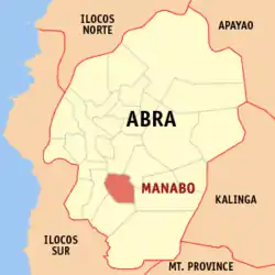 Map of Abra with Manabo highlighted | |
OpenStreetMap 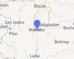
| |
.svg.png.webp) Manabo Location within the Philippines | |
| Coordinates: 17°26′N 120°42′E | |
| Country | |
| Region | Cordillera Administrative Region (CAR) |
| Province | Abra |
| District | Lone District |
| Barangays | 11 (see Barangays) |
| Government | |
| • Type | Sangguniang Bayan |
| • Mayor | Joanna Ruth G. Domasing |
| • Vice Mayor | Jerry B. Andres |
| • Representative | Joseph Santo Niño B. Bernos |
| • Electorate | 8,167 voters (2019) |
| Area | |
| • Total | 110.95 km2 (42.84 sq mi) |
| Elevation | 250 m (820 ft) |
| Population | |
| • Total | 10,761 |
| • Density | 97/km2 (250/sq mi) |
| • Households | 2,410 |
| Economy | |
| • Income class | 5th municipal income class |
| • Poverty incidence | 15.69% (2015)[4] |
| • Revenue | ₱55,382,153.91 (2016) |
| Time zone | UTC+8 (PST) |
| ZIP code | 2810 |
| PSGC | |
| IDD : area code | +63 (0)74 |
| Climate type | tropical rainforest climate |
| Native languages | Itneg Ilocano Tagalog |
Etymology
The name “Manabo” came from the word “Anabo”, a thorny herb used for making twines of rope, growing luxuriantly in the fields between San Jose Sur and Poblacion. One time during the Spanish regime, a group of Spaniards passed by the place and asked the name of the thorny herb. The people answered “Anabo”. From that time on, the Spaniards called the place Manabo.
The first inhabitants of Manabo were Tinguians who came from Mountain Province. They settled in the place before the arrival of the Spaniards and the Tinguians were known to be peace loving people.
Manabo is politically subdivided into 11 barangays, namely: Ayyeng, Catacdegan Nuevo, Catacdegan Viejo, Luzong, San Jose Norte, San Juan Norte, San Juan Sur, San Ramon East, San Ramon west and Santo Tomas.
Geography
Manabo is located at 17°26′N 120°42′E.
According to the Philippine Statistics Authority, the municipality has a land area of 110.95 square kilometres (42.84 sq mi) [2] constituting 2.66% of the 4,165.25-square-kilometre- (1,608.21 sq mi) total area of Abra.
Barangays
Manabo is politically subdivided into 11 barangays.[5]
| PSGC | Barangay | Population | ±% p.a. | |||
|---|---|---|---|---|---|---|
| 2015 [3] | 2010 [6] | |||||
| 140116004 | Ayyeng (Poblacion) | 14.9% | 1,602 | 1,567 | 0.42% | |
| 140116014 | Catacdegan Nuevo | 5.2% | 564 | 600 | −1.17% | |
| 140116002 | Catacdegan Viejo | 3.6% | 384 | 473 | −3.89% | |
| 140116003 | Luzong | 9.8% | 1,058 | 1,031 | 0.49% | |
| 140116005 | San Jose Norte | 5.2% | 556 | 604 | −1.56% | |
| 140116006 | San Jose Sur | 5.0% | 537 | 535 | 0.07% | |
| 140116007 | San Juan Norte | 5.6% | 601 | 632 | −0.95% | |
| 140116008 | San Juan Sur | 6.4% | 692 | 724 | −0.86% | |
| 140116011 | San Ramon East | 23.4% | 2,513 | 2,185 | 2.70% | |
| 140116012 | San Ramon West | 16.9% | 1,814 | 1,960 | −1.46% | |
| 140116013 | Santo Tomas | 4.1% | 440 | 445 | −0.21% | |
| Total | 10,761 | 10,756 | 0.01% | |||
Climate
| Climate data for Manabo, Abra | |||||||||||||
|---|---|---|---|---|---|---|---|---|---|---|---|---|---|
| Month | Jan | Feb | Mar | Apr | May | Jun | Jul | Aug | Sep | Oct | Nov | Dec | Year |
| Average high °C (°F) | 27 (81) |
28 (82) |
30 (86) |
32 (90) |
31 (88) |
31 (88) |
31 (88) |
30 (86) |
30 (86) |
30 (86) |
29 (84) |
27 (81) |
30 (86) |
| Average low °C (°F) | 20 (68) |
20 (68) |
21 (70) |
23 (73) |
24 (75) |
24 (75) |
25 (77) |
25 (77) |
25 (77) |
23 (73) |
22 (72) |
21 (70) |
23 (73) |
| Average precipitation mm (inches) | 23 (0.9) |
28 (1.1) |
33 (1.3) |
64 (2.5) |
232 (9.1) |
242 (9.5) |
258 (10.2) |
266 (10.5) |
245 (9.6) |
201 (7.9) |
87 (3.4) |
69 (2.7) |
1,748 (68.7) |
| Average rainy days | 8.3 | 8.0 | 10.8 | 15.2 | 23.7 | 26.1 | 27.0 | 25.8 | 23.5 | 17.3 | 13.7 | 12.1 | 211.5 |
| Source: Meteoblue [7] | |||||||||||||
Demographics
| Year | Pop. | ±% p.a. |
|---|---|---|
| 1918 | 2,318 | — |
| 1939 | 3,571 | +2.08% |
| 1948 | 3,658 | +0.27% |
| 1960 | 4,111 | +0.98% |
| 1970 | 6,009 | +3.86% |
| 1975 | 5,384 | −2.18% |
| 1980 | 6,590 | +4.12% |
| 1990 | 7,797 | +1.70% |
| 1995 | 8,633 | +1.93% |
| 2000 | 9,643 | +2.40% |
| 2007 | 10,538 | +1.23% |
| 2010 | 10,756 | +0.75% |
| 2015 | 10,761 | +0.01% |
| Source: Philippine Statistics Authority [3] [6] [8][9] | ||
In the 2015 census, Manabo had a population of 10,761. [3] The population density was 97 inhabitants per square kilometre (250/sq mi).
References
- Municipality of Manabo | (DILG)
- "Province: Abra". PSGC Interactive. Quezon City, Philippines: Philippine Statistics Authority. Retrieved 12 November 2016.
- Census of Population (2015). "Cordillera Administrative Region (CAR)". Total Population by Province, City, Municipality and Barangay. PSA. Retrieved 20 June 2016.
- "PSA releases the 2015 Municipal and City Level Poverty Estimates". Quezon City, Philippines. Retrieved 12 October 2019.
- "Municipal: Manabo". PSGC Interactive. Quezon City, Philippines: Philippine Statistics Authority. Retrieved 8 January 2016.
- Census of Population and Housing (2010). "Cordillera Administrative Region (CAR)". Total Population by Province, City, Municipality and Barangay. NSO. Retrieved 29 June 2016.
- "Manabo: Average Temperatures and Rainfall". Meteoblue. Retrieved 25 April 2020.
- Censuses of Population (1903–2007). "Cordillera Administrative Region (CAR)". Table 1. Population Enumerated in Various Censuses by Province/Highly Urbanized City: 1903 to 2007. NSO.
- "Province of Abra". Municipality Population Data. Local Water Utilities Administration Research Division. Retrieved 17 December 2016.
External links
| Wikimedia Commons has media related to Manabo, Abra. |
Places adjacent to Manabo | ||||||||||
|---|---|---|---|---|---|---|---|---|---|---|
| ||||||||||
Bangued (capital) | |
| Municipalities | |
| Barangays | |