Manaksas
Manaksas is a village situated in Jhunjhunu district, in the Indian state of Rajasthan surrounding by the great Aravali hills.
Manaksas | |
|---|---|
Village | |
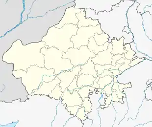 Manaksas Manaksas within the map of Rajasthan | |
| Coordinates: 26.92°N 75.8°E | |
| Country | India |
| State | Rajasthan |
| District | Jhunjhunu district |
| Time zone | UTC+5:30 (IST) |
History
This Village has a great history of Shekhawat rajputs. Manaksas has 06 panas, having a separate haveli of each. Brahmin and Baniya also have their individual haveli. Most of Baniya of this village shifted in other cites. The biggest one Haveli belongs to Thakur Sahab Bhanwar Singh Ji Sahab . In this village Thakur Bhanwar singh ji ruled about 32 years as Sarpanch of Gram Panchayat . There are many tample as-mansa mata,Dushasan bhernruji mandir , janki nath ji,Thakur ji ka Mandir, Narsingh ji, Todi wale balaji, Pipleshawar Mahadev, & Santoshi mata, Nirjhar dham etc. there are some old forts[Barkhandi fort,] this village catch to Arawli Parwat Sharnkhla. It`s part of jhunjhunu district these have best rate of education.These neighbour village is Gura ponkh, kho, bagoli,Sarai,papra,pachlangi,Mawta And some Village. This village is also providing regular water supply to nearby villages and Khetri (copper mines). There is a petrol pump in this village. Manaksas Panchayat is bigger Panchayat among all Panchayats nearby. There is a BRKGB bank in this village. Brahmin society also plays a important role in making this village. About 99% of citizens are educated in this village.
Population
This village has a population near about 5 to 6 thousand. The main castes living are Brahmins(BHARDWAJ), Rajputs (Shekhawats), and Gurjars and also some living other Cast. Manaksas is a Big village.it`s under to udaipurwati tehsil. There lives about 10000 villagers. It`s sequare on 4k.m. area.