Mandawa
Mandawa is a town in Jhunjhunu district of Rajasthan in India. It is part of Shekhawati region. Mandawa is situated 190 km off Jaipur in the north. The town lies between latitude 28° 06’ in the north and longitude 75° 20’ in the east. Mandawa is known for its fort and havelis. The fort town of Mandawa is well connected with the other places in region through a good network of roads.
Mandawa | |
|---|---|
Town | |
 A haveli in Mandawa | |
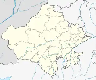 Mandawa Location in Rajasthan, India | |
| Coordinates: 28.05°N 75.15°E | |
| Country | India |
| State | Rajasthan |
| District | Jhunjhunun |
| Elevation | 316 m (1,037 ft) |
| Population (2011) | |
| • Total | 23,335 (Males−11,682 Females−11,653[1] |
| Languages | |
| • Official | Hindi |
| Time zone | UTC+5:30 (IST) |
| PIN | 333704 |
| Vehicle registration | RJ-18 |
In movies, Mandawa is popularised by Aamir Khan's film PK
History

The City of Mandawa[2] was made a thikana in the middle of the 18th century. There have been earlier references to Mandu Jat as the founder of the Mandawa village. He first established a Dhani (hamlet) and dug a well here, which was completed on savan badi 5 samvat 1797 (1740 AD) (source – Shekhawati Bodh, Mandawa special issue, July 2005). Initially, this place was known as ‘Mandu ki dhani’, ‘Mandu ka bas’ or ‘Manduwas’ which changed to ‘Manduwa’, ‘Mandwa’ and finally ‘Mandawa’.
A remote feudal principality in the centre of the Shekhawati region, Mandawa was a trading outpost for the ancient caravan routes that stopped here from China and the Middle East. Thakur Nawal Singh, the Rajput ruler of Nawalgarh and Mandawa, built a fort in 1755 to protect this outpost. The township that grew around the fort soon attracted a large community of traders, who settled here.
Geography
Mandawa is located at 28.05°N 75.15°E.[3] It has an average elevation of 316 metres (1036 ft). In the north side it has four villages named Bazisar, Kamalsar, Kuharu, and Godu ka bas and east side three villages named Tetara (Chandrpura), Syopura, and Hanumanpura (Dular ka bas), south sides villages names are Mithwas, Dinwa Ladhkhani and west side are Khalasi, Sadinsar, Tihawali, and Dabari.
Demographics
As of 2001 India census,[4] Mandawa had a population of 20,717. Males constitute 51% of the population and females 49%. Mandawa has an average literacy rate of 58%, lower than the national average of 59.5%: male literacy is 70%, and female literacy is 45%. In Mandawa, 18% of the population is under 6 years of age.
Mandawa Fort

The fort of Mandawa was founded in the 18th century. Thakur Nawal Singh, son of Shardul Singh, founded the fort in Vikram Samvat 1812 (1755 AD). The fort dominates the town with a painted arched gateway adorned with frescoes of Lord Krishna and his cows.
Situated in the middle of the town, the Mandawa Fort has been converted into a heritage hotel.
See also
References
- http://www.census2011.co.in/data/town/800475-mandawa-rajasthan.html
- Sharma, C. L. (1993). Ruling elites of Rajasthan: a changing profile. M.D. Publications Pvt. Ltd.
- Falling Rain Genomics, Inc - Mandawa
- "Census of India 2001: Data from the 2001 Census, including cities, villages and towns (Provisional)". Census Commission of India. Archived from the original on 16 June 2004. Retrieved 1 November 2008.
- Additional sources
- Shekhawati Bodh, A monthly magazine of Shekhawati region, Mandawa special issue, July 2005