Manderson-White Horse Creek, South Dakota
Manderson-White Horse Creek (Lakota: oyúȟpe;[3] the name of a band of the Oglala) is a census-designated place (CDP) in East Oglala Lakota Unorganized Territory (civil township equivalent) in Oglala Lakota County, South Dakota, United States. The population was 626 at the 2010 census. Oglala Lakota tribesman, Kicking Bear died here on May 28, 1904. He fought in several battles during the Black Hills War, including Battle of the Greasy Grass. His nephew, Felix Flying Hawk owned a ranch.
Manderson-White Horse Creek, South Dakota
Oyúȟpe | |
|---|---|
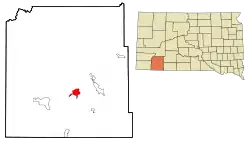 Location in Oglala Lakota County and the state of South Dakota | |
| Coordinates: 43°13′44″N 102°28′24″W | |
| Country | United States |
| State | South Dakota |
| County | Oglala Lakota |
| Civil township | East Oglala Lakota Unorganized Territory |
| Area | |
| • Total | 5.7 sq mi (14.8 km2) |
| • Land | 5.7 sq mi (14.8 km2) |
| • Water | 0 sq mi (0 km2) |
| Population | |
| • Total | 626 |
| • Density | 109.8/sq mi (42.3/km2) |
| Time zone | UTC-7 (Mountain (MST)) |
| • Summer (DST) | UTC-6 (MDT) |
| Area code(s) | 605 |
| FIPS code | 46-40550[2] |
According to the Federal Writers' Project, the origin of the name Manderson is obscure.[4]
Geography
Manderson- is located at 43°13′44″N 102°28′24″W (43.228781, -102.473216).[5]
According to the United States Census Bureau, the CDP has a total area of 5.7 square miles (14.8 km2), all land.
Manderson has been assigned the ZIP code 57756.
Demographics
| Historical population | |||
|---|---|---|---|
| Census | Pop. | %± | |
| 1990 | 243 | — | |
| 2000 | 626 | 157.6% | |
| 2010 | 626 | 0.0% | |
| U.S. Decennial Census | |||
As of the census[2] of 2000, there were 626 people, 109 households, and 97 families residing in the CDP. The population density was 109.9 people per square mile (42.4/km2). There were 116 housing units at an average density of 20.4/sq mi (7.9/km2). The racial makeup of the CDP was 1.12% White, 98.72% Native American, and 0.16% from two or more races. Hispanic or Latino of any race were 1.76% of the population.
There were 109 households, out of which 61.5% had children under the age of 18 living with them, 30.3% were married couples living together, 48.6% had a female householder with no husband present, and 10.1% were non-families. 9.2% of all households were made up of individuals, and 1.8% had someone living alone who was 65 years of age or older. The average household size was 5.70 and the average family size was 5.99.
In the CDP, the population was spread out, with 52.9% under the age of 18, 10.9% from 18 to 24, 22.0% from 25 to 44, 10.9% from 45 to 64, and 3.4% who were 65 years of age or older. The median age was 17 years. For every 100 females, there were 100.0 males. For every 100 females age 18 and over, there were 83.2 males.
The median income for a household in the CDP was $8,229, and the median income for a family was $8,229. Males had a median income of $13,750 versus $13,750 for females. The per capita income for the CDP was $4,440. About 75.9% of families and 74.6% of the population were below the poverty line, including 92.3% of those under age 18 and 57.9% of those age 65 or over.
References
- "2010 Census Redistricting Data (Public Law 94-171) Summary File". American FactFinder. United States Census Bureau. Retrieved 10 May 2012.
- "U.S. Census website". United States Census Bureau. Retrieved 2008-01-31.
- Ullrich, Jan F. (2014). New Lakota Dictionary (2nd ed.). Bloomington, IN: Lakota Language Consortium. ISBN 978-0-9761082-9-0. Archived from the original on 2016-10-18. Retrieved 2014-02-12.
- Federal Writers' Project (1940). South Dakota place-names, v.1-3. University of South Dakota. p. 49. Archived from the original on 2016-10-27.
- "US Gazetteer files: 2010, 2000, and 1990". United States Census Bureau. 2011-02-12. Retrieved 2011-04-23.
External links
| Wikimedia Commons has media related to Manderson-White Horse Creek, South Dakota. |
- Sustainable Homestead Designs a project to create sustainable housing on the Pine Ridge Indian Reservation
- House Alive Cob House Building Workshop in Manderson, SD
Municipalities and communities of Oglala Lakota County, South Dakota, United States | ||
|---|---|---|
| Town | 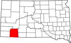 | |
| CDPs | ||
| Unincorporated communities | ||
| Indian reservation | ||
| Footnotes | ‡This populated place also has portions in an adjacent county or counties | |
| ||
