Mandoul Region
Mandoul is one of the 23 regions of Chad. Located in the south of the country, it comprises part of the former prefecture of Moyen-Chari. The regional capital is Koumra.
Mandoul | |
|---|---|
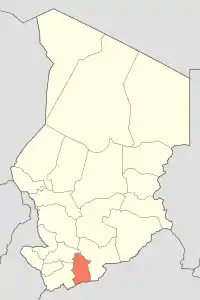 Map of Chad showing Mandoul. | |
| Country | Chad |
| Departments | 3 |
| Sub-prefectures | 15 |
| Regional capital | Koumra |
| Population (2009)[1] | |
| • Total | 628,065 |
Geography
The region borders Tandjilé Region to the north-west, Moyen-Chari Region to the east, the Central African Republic to the south, and Logone Oriental Region to the west.
Demography
The population of Mandoul is 628,065 inhabitants, as per the Chadian census of 2009.[1] The main ethnolinguistic groups are the Day, Doba peoples (speaking the closely related Bedjond, Mango and Gor languages), Gulay, Lutos, Mbay, Ndam, Sara and Tumak.[3]
Economy
The main products are subsistence agriculture and cotton.
Subdivisions
The region of Mandoul is divided into three departments:
| Department | Capital (chef-lieu) | Sub-prefectures |
|---|---|---|
| Mandoul Occidental | Bédjondo | Bédjondo, Bébopen, Békamba, Peni |
| Mandoul Oriental | Koumra | Koumra, Bessada, Bédaya, Goundi, Ngangara, Mouroum Goulaye |
| Barh Sara | Moïssala | Moïssala, Beboro, Bekourou, Bouna, Dembo |
References
- DEUXIEME RECENSEMENT GENERAL DE LA POPULATION ET DE L’HABITAT: RESULTATS GLOBAUX DEFINITIFS (PDF) (Report). INSEED. March 2012. p. 24. Archived from the original (PDF) on 24 September 2015. Retrieved 10 March 2017.
- "Tchad - Région de Mandoul, Carte de référence (07 septembre 2018)" (PDF). Reliefweb. Retrieved 30 September 2019.
- "Languages of Chad". Ethnologue. Retrieved 27 September 2019.
| ||
This article is issued from Wikipedia. The text is licensed under Creative Commons - Attribution - Sharealike. Additional terms may apply for the media files.
