Manilla, Iowa
Manilla is a city in Crawford County, Iowa, United States, along the West Branch of the West Nishnabotna River. The population was 776 at the 2010 census.
Manilla, Iowa | |
|---|---|
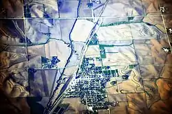 Aerial view of Manilla from roughly SSW | |
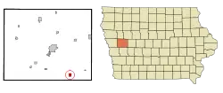 Location of Manilla, Iowa | |
| Coordinates: 41°53′18″N 95°13′58″W | |
| Country | |
| State | |
| County | Crawford |
| Area | |
| • Total | 1.03 sq mi (2.68 km2) |
| • Land | 1.03 sq mi (2.68 km2) |
| • Water | 0.00 sq mi (0.00 km2) |
| Elevation | 1,355 ft (413 m) |
| Population | |
| • Total | 776 |
| • Estimate (2019)[3] | 746 |
| • Density | 722.17/sq mi (278.81/km2) |
| Time zone | UTC-6 (Central (CST)) |
| • Summer (DST) | UTC-5 (CDT) |
| ZIP code | 51454 |
| Area code(s) | 712 |
| FIPS code | 19-48855 |
| GNIS feature ID | 0458757 |
History
Manilla is working to bolster its declining population by providing free land and property tax abatements to attract new residents.[4]
Geography
Manilla is located at 41°53′18″N 95°13′58″W (41.888202, -95.232809).[5] According to the United States Census Bureau, the city has a total area of 1.03 square miles (2.67 km2), all land.[6]
Demographics
| Year | Pop. | ±% |
|---|---|---|
| 1890 | 526 | — |
| 1900 | 773 | +47.0% |
| 1910 | 875 | +13.2% |
| 1920 | 1,142 | +30.5% |
| 1930 | 1,032 | −9.6% |
| 1940 | 1,040 | +0.8% |
| 1950 | 1,035 | −0.5% |
| 1960 | 939 | −9.3% |
| 1970 | 943 | +0.4% |
| 1980 | 1,020 | +8.2% |
| 1990 | 898 | −12.0% |
| 2000 | 839 | −6.6% |
| 2010 | 776 | −7.5% |
| 2019 | 746 | −3.9% |
| Source:"U.S. Census website". United States Census Bureau. Retrieved 2020-03-29. and Iowa Data Center Source: | ||
2010 census
As of the census[2] of 2010, there were 776 people, 337 households, and 214 families living in the city. The population density was 753.4 inhabitants per square mile (290.9/km2). There were 369 housing units at an average density of 358.3 per square mile (138.3/km2). The racial makeup of the city was 97.9% White, 0.1% Asian, 1.2% from other races, and 0.8% from two or more races. Hispanic or Latino of any race were 2.6% of the population.
There were 337 households, of which 27.0% had children under the age of 18 living with them, 49.9% were married couples living together, 8.9% had a female householder with no husband present, 4.7% had a male householder with no wife present, and 36.5% were non-families. 33.5% of all households were made up of individuals, and 18.1% had someone living alone who was 65 years of age or older. The average household size was 2.18 and the average family size was 2.74.
The median age in the city was 47.7 years. 20.9% of residents were under the age of 18; 5.4% were between the ages of 18 and 24; 19.5% were from 25 to 44; 27.4% were from 45 to 64; and 26.7% were 65 years of age or older. The gender makeup of the city was 47.6% male and 52.4% female.
2000 census
As of the census[8] of 2000, there were 839 people, 337 households, and 222 families living in the city. The population density was 1,059.2 people per square mile (410.1/km2). There were 369 housing units at an average density of 465.8 per square mile (180.3/km2). The racial makeup of the city was 97.74% White, 0.24% African American, 0.36% from other races, and 1.67% from two or more races. Hispanic or Latino of any race were 0.48% of the population.
There were 337 households, out of which 27.3% had children under the age of 18 living with them, 56.7% were married couples living together, 7.1% had a female householder with no husband present, and 34.1% were non-families. 30.3% of all households were made up of individuals, and 17.5% had someone living alone who was 65 years of age or older. The average household size was 2.31 and the average family size was 2.89.
In the city, the population was spread out, with 22.8% under the age of 18, 6.8% from 18 to 24, 21.8% from 25 to 44, 21.1% from 45 to 64, and 27.5% who were 65 years of age or older. The median age was 44 years. For every 100 females, there were 90.2 males. For every 100 females age 18 and over, there were 86.2 males.
The median income for a household was $31,146, and the median income for a family was $37,625. Males had a median income of $27,292 versus $16,875 for females. The per capita income for the city was $14,011. About 10.5% of families and 12.1% of the population were below the poverty line, including 17.2% of those under age 18 and 7.0% of those age 65 or over.
Education
Manilla is served by the IKM-Manning Community School District.[9] The district previously operated a middle school in Manilla but it closed in 2014; at the time the district continued to have its headquarters there.[10]
The Manilla Community School District was formed as a consolidation of various area school districts in 1889, and a four classroom building served as the first school in the city. A new school building funded by a $45,000 bond opened in 1915. In 1956 the school was renamed the Manilla Community School.[11] On July 1, 1992, the Manilla district merged into the IKM Community School District. That in turn, on July 1, 2011, merged into IKM-Manning.[12]
References
- "2019 U.S. Gazetteer Files". United States Census Bureau. Retrieved July 17, 2020.
- "U.S. Census website". United States Census Bureau. Retrieved 2012-05-11.
- "Population and Housing Unit Estimates". United States Census Bureau. May 24, 2020. Retrieved May 27, 2020.
- Kilen, Mike. "Free land the key to small towns' growth?" The Des Moines Register, November 15, 2009.
- "US Gazetteer files: 2010, 2000, and 1990". United States Census Bureau. 2011-02-12. Retrieved 2011-04-23.
- "US Gazetteer files 2010". United States Census Bureau. Archived from the original on 2012-01-25. Retrieved 2012-05-11.
- "Census of Population and Housing". Census.gov. Retrieved June 4, 2015.
- "U.S. Census website". United States Census Bureau. Retrieved 2008-01-31.
- "IKM-Manning." Iowa Department of Education. Retrieved on July 17, 2018.
- "When schools close". Carroll Daily Times Herald. 2014-03-28. Archived from the original on 2018-07-17. Retrieved 2018-07-17.
- "Chronology of Education." City of Manilla. Retrieved on July 17, 2018.
- "REORGANIZATION & DISSOLUTION ACTIONS SINCE 1965-66." Iowa Department of Education. Retrieved on July 20, 2018.
Municipalities and communities of Crawford County, Iowa, United States | ||
|---|---|---|
| Cities | Map of Iowa highlighting Crawford County | |
| Townships | ||
| Unincorporated communities | ||
| Footnotes | ‡This populated place also has portions in an adjacent county or counties | |
| ||