Manlius, New York
Manlius is a town in Onondaga County, east of the city of Syracuse, New York, in the United States. The population was 32,370 at the 2010 census, making it the third largest suburb in metropolitan Syracuse.[3][4] In 2005, the town was ranked 98th on CNN's list of Best Places to Live.[5]
Manlius | |
|---|---|
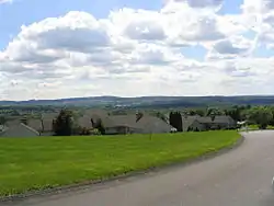 A neighborhood in the hills of the town of Manlius outside the village of Manlius | |
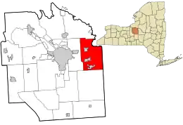 Location in Onondaga County and the state of New York. | |
| Coordinates: 43°02′53″N 075°58′58″W | |
| Country | United States |
| State | New York |
| County | Onondaga |
| Established | 1794 |
| Government | |
| • Type | Town Board |
| • Supervisor | Edmond J. Theobald (R) |
| • Councilors | |
| Area | |
| • Total | 49.95 sq mi (129.38 km2) |
| • Land | 49.22 sq mi (127.48 km2) |
| • Water | 0.73 sq mi (1.90 km2) |
| Elevation | 669 ft (204 m) |
| Population (2010) | |
| • Total | 32,370 |
| • Estimate (2016)[2] | 32,210 |
| • Density | 654.44/sq mi (252.68/km2) |
| Time zone | UTC-5 (Eastern (EST)) |
| • Summer (DST) | UTC-4 (EDT) |
| ZIP code | 13057, 13066, 13082, 13104, 13116 |
| Area code(s) | 315 |
| FIPS code | 36-45029 |
| GNIS feature ID | 0979192 |
| Website | www |
The town of Manlius includes a village also named Manlius, along with the villages of Fayetteville and Minoa. It is located on the eastern border of Onondaga County.
History
The town was a township of the former Central New York Military Tract. Manlius is the name of several important Romans, but exactly which one was being honored is no longer known. The current town was first settled around 1790.

The town of Manlius was created in 1813, along with Onondaga County, as a much larger entity, which was decreased by the formation, in part or in whole, of new towns (DeWitt, Onondaga, Salina) and part of Syracuse.
The economy related to trade generated by the Erie Canal contributed to the early development of the town.
The Christ Church and Manlius Village Cemeteries and Mycenae Schoolhouse are listed on the National Register of Historic Places.[6]
Geography
The east town line is the border of Madison County, New York, marked in part, by the Chittenango Creek. The town of DeWitt is to the west, the town of Pompey is to the south, and the town of Cicero is to the north.
According to the United States Census Bureau, the town has a total area of 50.0 square miles (129.4 km2), of which, 49.6 square miles (128.5 km2) of it is land and 0.3 square miles (0.9 km2) of it (0.68%) is water.
The New York State Thruway (Interstate 90) crosses the north part of Manlius. New York State Route 290 crosses the northwest corner of the town. New York State Route 5 (in part, Genesee Turnpike) and New York State Route 173 (Seneca Turnpike) are east-west highways. New York State Route 257 is a north-south state highway. New York State Route 92 (Cazenovia Rd) is a northwest-southeast highway.
Demographics
| Historical population | |||
|---|---|---|---|
| Census | Pop. | %± | |
| 1820 | 5,372 | — | |
| 1830 | 7,375 | 37.3% | |
| 1840 | 5,509 | −25.3% | |
| 1850 | 6,298 | 14.3% | |
| 1860 | 6,028 | −4.3% | |
| 1870 | 5,833 | −3.2% | |
| 1880 | 5,954 | 2.1% | |
| 1890 | 5,453 | −8.4% | |
| 1900 | 5,374 | −1.4% | |
| 1910 | 6,016 | 11.9% | |
| 1920 | 6,599 | 9.7% | |
| 1930 | 7,620 | 15.5% | |
| 1940 | 7,845 | 3.0% | |
| 1950 | 10,221 | 30.3% | |
| 1960 | 19,351 | 89.3% | |
| 1970 | 26,071 | 34.7% | |
| 1980 | 28,530 | 9.4% | |
| 1990 | 30,656 | 7.5% | |
| 2000 | 31,872 | 4.0% | |
| 2010 | 32,370 | 1.6% | |
| 2016 (est.) | 32,210 | [2] | −0.5% |
| U.S. Decennial Census[7] | |||
As of the census[8] of 2000, there were 31,872 people, 12,553 households, and 8,887 families residing in the town. The population density was 642.3 people per square mile (248.0/km2). There were 13,071 housing units at an average density of 263.4 per square mile (101.7/km2). The racial makeup of the town was 94.70% White, 0.87% Black or African American, 0.24% Native American, 2.94% Asian, 0.01% Pacific Islander, 0.17% from other races, and 1.07% from two or more races. Hispanic or Latino of any race were 0.97% of the population.
There were 12,553 households, out of which 34.5% had children under the age of 18 living with them, 60.2% were married couples living together, 8.0% had a female householder with no husband present, and 29.2% were non-families. 25.3% of all households were made up of individuals, and 10.9% had someone living alone who was 65 years of age or older. The average household size was 2.51 and the average family size was 3.04.
The population in the town was spread out, with 26.4% under the age of 18, 4.7% from 18 to 24, 26.7% from 25 to 44, 26.7% from 45 to 64, and 15.5% who were 65 years of age or older. The median age was 41 years. For every 100 females, there were 91.3 males. For every 100 females age 18 and over, there were 86.4 males.
The median income for a household in the town was $60,118, and the median income for a family was $70,655. As of the 2008 estimate, however, these figures had risen to $71,830 and $88,272, respectively.[9] Males had a median income of $52,065 versus $31,486 for females. The per capita income for the town was $31,825, but had risen to $39,688 in 2008.[9] About 2.0% of families and 3.3% of the population were below the poverty line, including 3.5% of those under age 18 and 4.7% of those age 65 or over.
Education
The Fayetteville-Manlius Central School District is a public school system, serving the majority of the Town of Manlius.
Some students residing in the Town of Manlius reside within the East Syracuse-Minoa Central School District, which also has its headquarters in the town.[10][11]
Before the school districts were formed, the historic Mycenae Schoolhouse was used.
The Fayetteville-Manlius Central School District has also been recognized by New York for having a great education system, and has won many awards.
Elementary schools
- Fayetteville Elementary School
- Mott Road Elementary School
- Enders Road Elementary School
Middle schools
- Wellwood Middle School (formerly Fayetteville High School)
- Eagle Hill Middle School
High school
Private secondary
The Manlius School, formerly St. John's Military School, merged with the Pebble Hill School in 1970, to become the Manlius Pebble Hill School. The school's Manlius campus was closed following the merger, in 1974.
Communities and locations in the Town of Manlius

- Eagle Village – A hamlet northeast of Manlius village on NY-173.
- Fayetteville – The Village of Fayetteville is by the west town line at the junction of NY-257 and NY-5.
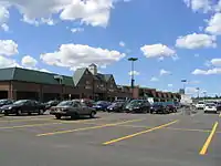
- Fayetteville Towne Center –that was formerly Fayetteville Mall.
- Fillmore Corners – A hamlet west of Manlius village on NY-173.
- Fremont Heights — A suburban hamlet near the west town line, south of Minoa.
- Fremont Hills — A suburban hamlet near the west town line, south of Minoa.
- Green Lake – A lake located northeast of Fayetteville.
- Green Lakes State Park – A state park southeast of Minoa containing two unique lakes.
- High Bridge — A hamlet at the west town line on NY-92.
- Kirkville — A hamlet east of Minoa.
- Limestone Creek
- Manlius – The Village of Manlius is near the south town line at the junction of NY-92 and NY-173.
- Manlius Center — A location south of Minoa and north of Fayetteville at the junction of NY-257 and NY-290.
- Minoa – The Village of Minoa is in the northern part of the town on NY-257.
- Mycenae – A hamlet near the east town line on NY-5.
- North Manlius — A hamlet by the north town line and Chittenango Creek.
- Old Erie Canal State Historic Park
- Peck Hill – A hamlet by the east town line, east of Manlius village.
- Polkville – A location northwest of Minoa.
- Pompey – A hamlet in the western part of the town at US 20 and NY 91 (part of which is considered to be in Manlius).
- Saintsville — A hamlet in the north part of the town, east of Minoa.
- Schepps Corner — A hamlet near the north town line on NY-298.
- Snyders Crossing — A location between Minoa and Kirkville.
The three libraries located in the Town of Manlius—Village of Manlius Library, Fayetteville Free Library, and Village of Minoa Library—are branches of the Onondaga County Public Library.
Notable people
The people below were born in or were residents of Manlius, New York
- Steve Altes, humorist, graphic novelist, co-recipient of the National Medal of Technology
- Laurie Halse Anderson, New York Times bestselling author, graduate of Fayetteville-Manlius High School
- Grover Cleveland, 22nd and 24th President of the United States and Governor of New York
- Larry Costello, American professional basketball player and coach, NBA Hall of Fame member and six-time All-Star, from Minoa
- William R. Gorsline, judge
- Matilda Joslyn Gage, abolitionist and suffragist
- Amos P. Granger, former U.S. Congressman
- Douglas Holtz-Eakin, former faculty member at Syracuse University, former Director of the Congressional Budget Office, and former chief economic policy adviser to U.S. Senator John McCain's 2008 presidential campaign.
- Thomas J. McIntyre, U.S. Senator from New Hampshire
- Steven Page, former member and co-founder of alternative rock band Barenaked Ladies
- Greg Paulus, former basketball player at Duke University, and former starting quarterback for the Syracuse Orange football team.
- John J. Peck, Civil War general
- Thomas S. Szasz, libertarian critic of psychiatry, author of The Myth of Mental Illness
- Christopher Woodrow, movie producer
 Manlius Swan Park
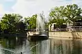 Manlius Swan Park Fountain
References
- "2016 U.S. Gazetteer Files". United States Census Bureau. Retrieved Jul 5, 2017.
- "Population and Housing Unit Estimates". Retrieved June 9, 2017.
- Annual population estimates for Manlius town, Onondaga County, New York . United States Census Bureau. Retrieved 2009-08-02.
- Datasets, Montana through Wyoming Archived 2011-11-27 at the Wayback Machine. United States Census Bureau. Retrieved 2010-07-12.
- "CNNMoney.com Best Places to Live 2005". CNN.
- "National Register Information System". National Register of Historic Places. National Park Service. March 13, 2009.
- "Census of Population and Housing". Census.gov. Retrieved June 4, 2015.
- "U.S. Census website". United States Census Bureau. Retrieved 2008-01-31.
- |04000US36&_street=&_county=manlius&_cityTown=manlius&_state=04000US36&_zip=&_lang=en&_sse=on&ActiveGeoDiv=geoSelect&_useEV=&pctxt=fph&pgsl=040&_submenuId=factsheet_1&ds_name=ACS_2008_3YR_SAFF&_ci_nbr=null&qr_name=null®=null%3Anull&_keyword=&_industry= 2006-2008 American Community Survey 3-Year Estimates for Manlius (town), Onondaga County, New York. United States Census Bureau. Retrieved 2010-08-11.
- "Town of Manlius GIS." Town of Manlius. Retrieved on September 23, 2012.
- "Home." East Syracuse-Minoa Central School District. Retrieved on September 23, 2012. "407 Fremont Road . East Syracuse, NY 13057"
External links
| Wikimedia Commons has media related to Manlius, New York. |
- Town of Manlius official website
- |04000US36|05000US36067|06000US3606745029&_street=&_county=manlius&_cityTown=manlius&_state=04000US36&_zip=&_lang=en&_sse=on&ActiveGeoDiv=&_useEV=&pctxt=fph&pgsl=060&_submenuId=business_1&ds_name=&_ci_nbr=&qr_name=®=null%3Anull&_keyword=&_industry= US Census Bureau Fact Sheet for the Town of Manlius
- USGS Feature Data for the Town of Manlius
- Manlius history/genealogy
- Manlius Historical Society
Municipalities and communities of Onondaga County, New York, United States | ||
|---|---|---|
| City | 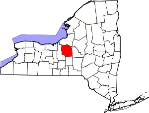 | |
| Towns | ||
| Villages | ||
| CDPs | ||
| Other hamlets |
| |
| Indian reservation | ||
| Footnotes | ‡This populated place also has portions in an adjacent county or counties | |
| ||